An easy road trip for anyone who enjoys driving and loves the wild sea - along the Baltic Sea, where you can reach most places by car and are usually completely alone in nature. You will see wild nature in all its glory with lots of wild animals and birds. If you are lucky, you will experience the sight of the fabulous Northern Lights. You can walk kilometers of sandy and rocky beaches where you will be alone! You will try the specialties of individual countries, which can sometimes be quite surprising! You will manage to experience the atmosphere of all three capitals and see the historical centers. And for lovers of military history - you will crawl through old military bunkers and batteries!
Arrive in Vilnius, the capital of Lithuania, and pick up your rental car (according to the instructions you will receive before departure). Please note that not all roads are asphalted and the roads are dusty with pebbles - therefore, do not choose the most beautiful and expensive car in the rental company. After arrival, depending on the time, go explore the city of Vilnius or go to your accommodation and go on an adventure tomorrow. You will use Euros to pay, but you can pay by card in most places.
At the airport, pick up your luggage and car (according to the instructions you will receive before departure) and head out for an adventure.


Vilnius Old Town (Lithuanian: Vilniaus senamiestis), one of the largest surviving medieval old towns in Northern Europe, a UNESCO World Heritage Site, covers an area of 3.59 km² (887 acres). It includes 74 quarters, 70 streets and alleys with 1487 buildings with a total floor area of 1,497,000 square meters. The administrative division of the Old Town (senamiesčio seniūnija) is a larger area and covers more than 4.5 km².


Part of the journey leads along the border of the Kaliningrad region, mostly through wild nature and dirt roads. Across the river, you can peek at life in the Russian enclave.
Along the way, you have the opportunity to stop at many beautiful places, walk along the river, and enjoy nature.


Kaliningrad Oblast is a Russian exclave, named after its center, Kaliningrad. It is separated from the rest of the Russian Federation by the territory of the European Union. In 2007, at the initiative of the Russian government, access to Sovetsk as a border town was restricted to foreigners and Russians not residing in the area. The Border Guard issued special permits to enter the area, which had to be applied for 30 days in advance. Restrictions on the movement of people significantly slowed the development of the city. Currently, the crossing is closed.


Ventė (Větrný hrad) is a village on the Ventė Peninsula on the coast of the Curonian Lagoon, a place known to tourists for the nearby Ventės Ragas cape (End of the World) with a lighthouse, ornithological station, museum and the Nemunas River delta nature park.

The Lankupiai Suspension Bridge is the longest bridge of its kind in Lithuania. It spans one of the widest sections of the Minija River. Just a few hundred meters away is the historic Wilhelm's Canal, whose lock is a protected Lithuanian technical monument. The bridge is 130 meters long, 1.4 meters wide, made of metal and covered with wooden planks. It connects the municipalities of Klaipėda and Šilutė in the village of Lankupiai. The bridge was built in 1900 and renovated in 2000 and 2014.


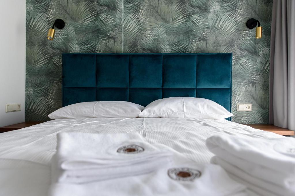
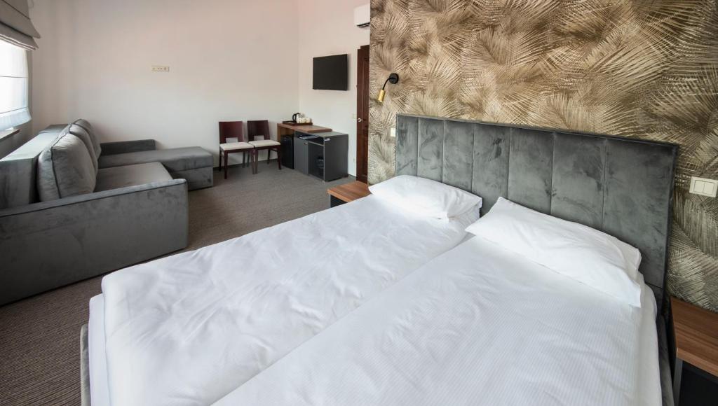
Romantic sunrise views over the river, long sandy beaches and bunker ruins on the beach.
The Old Town (lit. Senamiestis) is on the left bank of the Danė River. The most important streets are “Tilto” - Bridge Street, “Turgaus” and the traffic artery “Pilies”. There are several half-timbered houses in the Old Town. To take a trip to the dune fields, take the ferry to the Curonian Spit.

A popular ecotourism destination known for its nature, birdwatching (storks, shorebirds), and historic lighthouse on the Baltic Sea, offering nature reserves and farmhouses for accommodation.


The cathedral was built in the style of traditional 17th-century Russian churches, with a central dome representing Christ and four smaller domes representing the four evangelists, according to designs by Vasily Kosyakov. It was built as the cathedral of the Russian Navy stationed in Karosta. The foundation stone was laid in the presence of a number of important figures, including Russian Tsar Nicholas II. The cathedral was completed two years later, in 1903, and was solemnly consecrated and dedicated to the patron saint of sailors in the presence of the Tsar himself.

In Liepāja, there are several historical coastal artillery batteries that are part of the Liepāja Naval Fortress and served to defend the port; today, they are tourist attractions known for their unique views and partially submerged by the sea - offering a glimpse into the military history of coastal defense. Freely accessible.


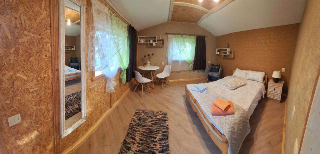


You can't miss the romantic lighthouse, sandy beaches, the ruins of the town of Irbene, a visit to the radio telescope, and the sunset at Cape Kolka along the way.

The entire lighthouse complex is listed in the State Register of Protected Cultural Monuments as an industrial cultural monument. The lighthouse is located in a remote location, standing on one of three high forested dunes - the so-called Tenirokan dune, 28 meters high, which is constantly threatened by erosion from the waves of the Baltic Sea. For this reason, the first coastal reinforcement structure was built in 1910, a thick wall of logs to ensure the stability of the lighthouse. In the 1930s, the first structure was supplemented with wicker baskets filled with gravel and large stones to absorb the energy of the waves. Since the 1970s, the base of the lighthouse has been protected by reinforced concrete blocks. In 1994, the lighthouse underwent extensive reconstruction.

In case of hot days, you can cool off in the water here.


Ventspils International Radio Astronomy Center is a former Soviet radio astronomy installation 30 km north of Ventspils, Latvia, on the Baltic Sea coast in Ance parish. The installation was secret until 1993, after Latvia regained independence. The Irbene radio antenna complex was founded on June 10, 1967 as a secret Soviet astronomical and communication center for spying on Western communications.
- Be sure to check the tour times here in advance, so you don't waste a lot of time waiting on site.


Mys Kolka (Cape Kolka) is a well-known headland on the Livonian coast in Latvia, marking the boundary between the open Baltic Sea and the Gulf of Riga; it is a unique place with sand dunes, historical significance for the Vikings, and also an important natural point in Slītere National Park.


Visit to Engure Nature Park with a viewing tower and overnight stay in the capital city of Riga.
In the protected area, 844 species of vascular plants were found, 40 of which are protected in Latvia as natural monuments, in addition to three other plant species protected by European Union directives. Habitat types according to the Habitats Directive include dune forests, western meadows, swampy deciduous forests, transitional swampy and peat bog forests, and floodplain forests. Low meadows, coastal meadows, and dry sandy pastures on calcareous soil with foxtail and red button. The lake itself is one of the moderately to poorly nutrient-rich bodies of water with benthic communities of quillworts.
186 species of birds nest on the lake, 44 of which are protected. There are also five species of protected fish. There are 14 species of amphibians and reptiles. Four species are listed in the Red Book of Latvia.
Freely accessible, forest paths, in places wet meadows, but the path can be managed without shoes :) the difficulty is therefore only in the kilometers traveled.

The historical center of Riga, a former Hanseatic city, is a UNESCO World Heritage Site; in addition to several medieval religious monuments, the city is characterized by its distinctive Art Nouveau architecture, which is comparable to cities such as Vienna, St. Petersburg, or Barcelona.
Don't miss shopping for local delicacies at the Riga market in the former zeppelin hangars.


Long sandy beaches, lighthouses, and wild nature, staying overnight in the picturesque town of Pärnu.


The Ainaži pier was built from a large number of erratic boulders brought from the surrounding area. The structure was 361 m long on the shore and 482 m in the bay. In 1911, the Valmieras šaursliežu pievadceļu sabiedrība railway company developed a project to connect the northern end of the harbor pier to the coast and use the narrow-gauge railway connection to Ainaži. Construction began in 1912 and was interrupted by the First World War in 1914. In 1915, the military authorities ordered the rails to be removed from the dam, and the structure was heavily damaged by the war. Today, only about 630 m of the structure remains. A valuable meadow and bird biotope extends around the pier and the beach.
It is advisable to have good shoes, the stones are loose towards the end of the pier.


Pärnu is a major holiday resort with many hotels, restaurants and long sandy beaches. The river of the same name flows through the city.
The history of the local spa began in 1837, when a group of local entrepreneurs transformed a lonely inn near the beach into a spa facility. This wooden building was first opened in 1838. It had 5–6 rooms where guests enjoyed a hot seawater bath in summer and a traditional Estonian sauna in winter. The original building was destroyed during the First World War. In 1927, the current mud bath building was built on its site.
Currently, the mud baths mainly treat joint problems, spinal cord disorders, peripheral and central nervous system disorders and gynecological diseases. Spa treatments include hydrotherapy, mud baths, treatment with earth wax, massages, laser therapy, electrotherapy, lymphatic and inhalation therapy and aromatherapy.


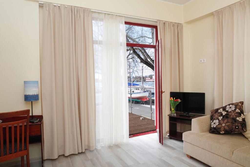

Dusty roads and forests will take you to unexpected places, perfect for a picnic or relaxation. Take a ferry with your car to Saaremaa Island, where you can walk to the site where a large meteorite struck, leaving a huge crater that appears in several mythologies.


Allikalahe is best known for the artwork Blesta kivi ('Blesta Stone'). The stone structure is dedicated to the mythical mother Blesta, the 'beautiful goddess of the north', from whom human civilization emerged 30,000 years ago. In the middle of the spiral stands a stone altar. The installation is a modern work of art by a local design studio.

The Kaali craters, or Kaali craters, are a group of nine impact craters in Kaali on the Estonian island of Saaremaa.
The largest of the craters is 110 meters in diameter and has a small lake, Kaali järv, in its center. The meteor broke up at an altitude of about 5 to 10 km. A group of meteors with a total weight of 20 to 80 tons (some sources say up to 1000 t) fell at a speed of 10 to 20 km/s at an angle of 35° from east-north-east. The largest of these created a crater 16 meters deep. Eight others landed within 1 km of the largest. They formed craters with diameters from 12 to 40 m and depths from one to four meters.
Finnish mythology contains stories that may describe the events at Kaali. The Kalevala tells of the evil sorcerer Louhi who steals the Sun and fire from the people, causing darkness. The sky god Ukko orders a new Sun to be made from a spark. But during its manufacture, the spark falls from the sky and hits the earth and Lake Alues, whose waters rise. The heroes describe the place of impact as somewhere beyond the Neva, which is the direction from Karelia in which Estonia lies. They set off in that direction and obtain fire from a forest fire.

Currently, Kuressaare is a popular spa town with a very pleasant atmosphere. The healing effects of the local sea mud have been known for more than 160 years. There are many sanatoriums providing professional care.
The most important monument is the bishop's castle, originally from the 13th century, later rebuilt several times. The central square building is surrounded by a large moat and a relatively well-preserved baroque fortification. Around the castle there is an extensive park, founded in the 19th century. Today the regional museum is located in the castle. Also worth mentioning are the baroque buildings of the town hall and the weights from the 17th century standing on the central square. The Church of St. Lawrence is also a cultural monument.


A rural flea market, abandoned bunkers, charming lighthouses, beautiful rocky beaches, and sunsets on the cliffs.
As part of the initial phase of the Moonzund landing operation (Моонзундская операция), a bloody battle was fought near the village between the Wehrmacht and the Red Army on the night of October 8-9, 1944. A twenty-one-meter concrete obelisk was erected on the site of the battle in 1966. In the autumn of 2025, the monument was stripped of its original ideological inscriptions as part of the de-Sovietization process.
The monuments near the parking lot were removed and the site plowed over after the outbreak of the war in Ukraine.

A small flea market where you can find practically everything.

Together with the Lõu lighthouse (number 931), located 3128 m away, it forms a pair of leading lights and guides ships in the Gulf of Riga.
The 31-meter high prismatic reinforced concrete tower is topped with a gallery. The light source is 2.6 m high. The lighthouse is white at the bottom and black at the top. In 1996 the lighthouse was repaired and a new power supply with solar panels and a wind turbine was installed. In 2007 the tower was raised by 8 m and LED lamps were installed.

Several bunkers are hidden in the forest, some more difficult to access, some easily accessible by footpath.

The lighthouse is the highest in Estonia and is among the sixty highest lighthouses in the world.
The residential building and sauna from the mid-19th century, the generator engine room, and warehouses from the second half of the 20th century have been preserved at the lighthouse.


Historical anti-tank line.


The highest coast of Saaremaa County, with a maximum height of 21.3 m, and also the highest rocky outcrop/cliff in western Estonia. It consists of at least three cliff terraces. In addition to the main cliff, there is also a smaller cliff inland and an underwater cliff. The cliff is not made of very solid material and is subject to erosion. From the cliff, there is a view to the neighboring island of Hiiumaa. The place is shrouded in myths and there was a sacrificial site at the top. There is a lookout tower and an artistically designed sundial on the cliff. There is also a nature reserve here. The cliffs can be easily reached at their ends, or you can climb down the permanently installed rope approximately in the middle of the cliff's length. The place is freely accessible all year round from the road or the nearby parking lot.
If the conditions are right and the aurora forecast is good, you may be able to see it here above the sea.


Take a ferry to the next island - Hiiumaa, where the most beautiful lighthouses are located, and with a bit of luck, you can experience the Northern Lights in the evening, which dance with all colors in these places.


Kõpu Lighthouse is one of the most famous symbols and tourist attractions of Hiiumaa Island. The lighthouse is one of the oldest lighthouses in the world, which has been in continuous use since its establishment in 1531.


As early as 1885, an Orthodox branch of the parish was founded on the Tahkuna peninsula, because the parish church in Puski was too far away for the members of the parish. However, they did not start building their own chapel until after the opening of the Malvaste cemetery in 1925. The prayer house dedicated to the prophet Elijah was built of wood from the former cooperative warehouse in Puski and consecrated in the same year. The construction was led by Peeter Holm. Later, a modest bell tower was added, and forester Peeter Leiger added an Orthodox pine cross.
The chapel, which stood empty for some time, was restored in 2008 by Juhan Kilumets and the company Rändmeister. The thatched roof was installed by roofer Siim Sooster and his workers. In the summer of 2011, the chapel was equipped with new furniture and an iconostasis. Relics of saints were placed in the altar table. In the same year, on the feast of the prophet Elijah on July 20, Metropolitan Stefanus of the Estonian Apostolic Orthodox Church re-explained the Malvaste chapel as a shrine. The chapel's bell tower was also renovated and received two new bells, which were blessed in November 2012. Since the Puski Christ Nativity parish is currently being restored from ruins, the Hiiumaa Orthodox parish operates in Malvaste today.

Freely accessible bunker.

Tahkuna Lighthouse is the highest cast iron lighthouse in Estonia. The lighthouse area includes a residential building, outbuildings and farm buildings from the second half of the 19th century, which are part of the cultural monument.


The Northern Lights (Aurora) are an amazing light phenomenon in the sky that occurs when energetic particles from the Sun (solar wind) interact with atoms in the Earth's atmosphere, most often at an altitude of around 100 km, and release energy in the form of colored light. It is mainly visible in the polar regions (Aurora Borealis in the north, Aurora Australis in the south), but in strong solar activity it can also be visible in lower latitudes. The colors (green, red, blue, purple) depend on which atoms (oxygen, nitrogen) and at what altitude the collision occurs.


You will enjoy the last corners of the island and then take a ferry back to the mainland to enjoy life in Tallinn.


The lighthouse is located two kilometers from the port of Rohuküla (Ruke-Rag), helping to guide ships passing through the Voosi and Hari straits to the ports of Heltermaa, Rohuküllaa and Haapsalu and away from the shallows around the island.


Kiltsi Ungru Manor (Ungru Mõis) is an impressive, partially ruined Neo-Baroque castle ruin near Kiltsi, Estonia, known for its sad love story and similarity to the German Merseburg Castle. The castle was never completed due to the tragic death of the Count's fiancée and has become a popular spot for photography due to the mystical ruins and beautiful surroundings.

The construction of the wooden station began in May 1904, and limited train operations began in December 1904. The railway station consists of several buildings: a passenger terminal, a train control pavilion, a covered terrace, and a covered platform 216 meters long.
The single-story terminal is finished with wooden lace. The two-story stone waiting room has a clock tower on the northeast facade. The interior of the building has stucco ceilings and floors of small ceramic tiles; in the 1950s, scenes with views of the sea were painted.

Padise Monastery (Padise klooster) is a significant Cistercian monastery in Estonia, known as the best-preserved medieval fortified monastery in Livonia. After recent revitalization, it is once again open to visitors and also serves as a concert hall due to its excellent acoustics. The monastery, founded in the 14th century on the site of the original fortress, offers tours of the ruins, permanent exhibitions, and is a valuable example of Gothic sacred and defensive architecture.

Murru Prison was closed in 2014, but today it is open as a museum, offering visitors the opportunity to explore the fascinating history of this historic site. The prison museum offers tours that include the prison's interior, cells, punishment areas, work and technical rooms, as well as the surrounding landscape, which attracts with its unique and mysterious atmosphere.
The Murru Prison Museum is a great place for history and adventure lovers who want to learn more about the history of the former prison system in Estonia. Visit this fascinating place and experience not only historical and industrial aspects, but also the breathtaking surroundings.
In addition to the flooded quarry, where there is an entrance fee, there is also the prison complex a little further away, where there is a separate entrance fee.

The most historically and architecturally valuable part of Tallinn is Vanalinn (Old Town), a largely preserved medieval Hanseatic town. It is said that within the boundaries of the Old Town, approximately two-thirds of the buildings have retained their appearance, created in the 13th to 17th centuries. More than half of the city's fortifications with towers and gates, and later built advanced bastions, have also been preserved. The oldest preserved parts of the walls date from the 13th century, most of the towers from the 14th and 16th centuries, and the gates preserved today from the 15th century. The most famous are the towers called Kiek in de Kök ("Peek into the Kitchen", 1475 and then rebuilt at the beginning of the 16th century) and Paks Margareeta ("Fat Margaret", 1510–1529).


Waterfalls, red water, the northernmost point of Estonia, and the most popular (and ugliest) Estonian city - all this awaits you on today's route!
The Jägala Waterfall (Estonian: Jägala juga) is one of the largest waterfalls in Estonia. It has a height of 8.1 m, making it the second highest waterfall in Estonia after the Valaste Waterfall. However, because the Valaste Waterfall was partly created by human activity, the Jägala Waterfall is the highest naturally formed waterfall among Estonian waterfalls.

Pärispea is the northernmost settlement on mainland Estonia and in neighboring European Union countries, with the northernmost point being Cape Purekkari, which is located one kilometer north of the village.
Reaching the promontory requires some fitness and, above all, suitable shoes. In places, you wade through very slippery stones covered in algae.


Toolse Castle (German: Tolsburg) was a crusader castle belonging to the Teutonic Order. It was completed in 1471. For a time, it was reputedly the northernmost outpost of the Holy Roman Empire. Today, only ruins remain. Since 2006, conservation and archaeological research has been carried out on the site. Freely accessible.

The small town of Kunda (English: Pussy) drew attention in the Czech media in August 2024, when the airline airBaltic launched a vote on naming the aircraft in its fleet after cities in the Baltic States. People from all over the world were able to vote, and citizens of the Czech Republic also participated in the voting, significantly influencing the results, and Kunda won by a landslide. The towns of Püssi and Lihula also came to the fore among Czech voters.

Valaste Waterfall (Estonian: Valaste juga) is the highest waterfall in Estonia. The stream water falls over the edge of the Baltic Klint to a depth of 30.5 meters. The place is a frequent tourist destination. The waterfall is easily accessible from the road, and there is a viewing platform under its edge, from which you can see the entire waterfall.


Today's goal is the border area, where you can look at the territory of Russia from the other bank of the city of Narva, visit the fortress, and then it's time to head back to the city.
The Narva-Jõesuu Lighthouse (Estonian: Narva-Jõesuu tuletorn) is a coastal lighthouse located on the western bank of the Narva River's mouth. It is situated on the border between Estonia and Russia.

Approximately 15,000 German soldiers who fell during the Second World War are buried in the Narva war cemetery. The cemetery was officially opened on August 29, 1999. In 1943, the German Wehrmacht established a cemetery near Narva where more than 4,000 fallen soldiers were buried. After 1945, the cemetery was razed to the ground. Volksbund Deutsche Kriegsgräberfürsorge e. V. (German War Graves Commission) transformed this area into a central resting place for the fallen from the Narva front.

The territory of present-day Narva was already settled in the early Middle Ages, when one of the most important trade routes connecting the Baltic States with the Mediterranean passed through here. The city's importance began to rise in the 13th century, when the road connecting Tallinn with Novgorod led across local fords. The industrial revolution in the 19th and 20th centuries hardly touched the historical core, and it might have been preserved to this day if it had not been for the unfortunate events of March 6 and 7, 1944, when Narva was the victim of carpet bombing by the Red Army and was practically razed to the ground.
After the carpet bombings in 1944, Narva was rebuilt in the gloomy style of socialist realism. Only the baroque town hall, a few houses, and the Orthodox Church of the Resurrection of Jesus Christ have been preserved from the original center. However, the most important monument is the newly reconstructed Hermann's Castle with its massive tower called Long Hermann (Pikk Hermann) and a system of fortifications. Also worth mentioning is the extensive Kreenholm factory, built in a typical English industrial style at the end of the 19th century, once one of the largest in Europe.
Near the factory, just a few decades ago, there was a waterfall that was the largest in volume on the entire continent. However, after the construction of the dam in 1956, the water flows through a new channel, and the waterfall steps remain dry most of the time. Only during times of higher water levels, when the water rushes over the overflows of the water structure, does the waterfall come to life in its former glory. After the end of World War II, the Soviet occupiers did not allow refugees of Estonian nationality to return to the city and, on the contrary, actively supported immigration from Russian-speaking parts of the Soviet Union. As a result, the ethnic structure of the population changed, and as a result, Russians overwhelmingly prevail in the city today. The university was founded in the city in 1999.

Narva Venice, where you can peek into a slightly different world.

Enjoy your last day in Tallinn before departure, or take one last trip to the sea. Remember to be at the airport at least 2/3 hours before departure, return the car, and head to your gate. I wish you a pleasant journey home and many beautiful memories from your Baltic road trip.
Remember to plan your last day's stops so you get to the airport in time and return the car. Have a pleasant flight!
An easy road trip for anyone who enjoys driving and loves the wild sea - along the Baltic Sea, where you can reach most places by car and are usually completely alone in nature. You will see wild nature in all its glory with lots of wild animals and birds. If you are lucky, you will experience the sight of the fabulous Northern Lights. You can walk kilometers of sandy and rocky beaches where you will be alone! You will try the specialties of individual countries, which can sometimes be quite surprising! You will manage to experience the atmosphere of all three capitals and see the historical centers. And for lovers of military history - you will crawl through old military bunkers and batteries!
Arrive in Vilnius, the capital of Lithuania, and pick up your rental car (according to the instructions you will receive before departure). Please note that not all roads are asphalted and the roads are dusty with pebbles - therefore, do not choose the most beautiful and expensive car in the rental company. After arrival, depending on the time, go explore the city of Vilnius or go to your accommodation and go on an adventure tomorrow. You will use Euros to pay, but you can pay by card in most places.
At the airport, pick up your luggage and car (according to the instructions you will receive before departure) and head out for an adventure.
Vilnius Old Town (Lithuanian: Vilniaus senamiestis), one of the largest surviving medieval old towns in Northern Europe, a UNESCO World Heritage Site, covers an area of 3.59 km² (887 acres). It includes 74 quarters, 70 streets and alleys with 1487 buildings with a total floor area of 1,497,000 square meters. The administrative division of the Old Town (senamiesčio seniūnija) is a larger area and covers more than 4.5 km².
Part of the journey leads along the border of the Kaliningrad region, mostly through wild nature and dirt roads. Across the river, you can peek at life in the Russian enclave.
Along the way, you have the opportunity to stop at many beautiful places, walk along the river, and enjoy nature.
Kaliningrad Oblast is a Russian exclave, named after its center, Kaliningrad. It is separated from the rest of the Russian Federation by the territory of the European Union. In 2007, at the initiative of the Russian government, access to Sovetsk as a border town was restricted to foreigners and Russians not residing in the area. The Border Guard issued special permits to enter the area, which had to be applied for 30 days in advance. Restrictions on the movement of people significantly slowed the development of the city. Currently, the crossing is closed.
Ventė (Větrný hrad) is a village on the Ventė Peninsula on the coast of the Curonian Lagoon, a place known to tourists for the nearby Ventės Ragas cape (End of the World) with a lighthouse, ornithological station, museum and the Nemunas River delta nature park.
The Lankupiai Suspension Bridge is the longest bridge of its kind in Lithuania. It spans one of the widest sections of the Minija River. Just a few hundred meters away is the historic Wilhelm's Canal, whose lock is a protected Lithuanian technical monument. The bridge is 130 meters long, 1.4 meters wide, made of metal and covered with wooden planks. It connects the municipalities of Klaipėda and Šilutė in the village of Lankupiai. The bridge was built in 1900 and renovated in 2000 and 2014.
Romantic sunrise views over the river, long sandy beaches and bunker ruins on the beach.
The Old Town (lit. Senamiestis) is on the left bank of the Danė River. The most important streets are “Tilto” - Bridge Street, “Turgaus” and the traffic artery “Pilies”. There are several half-timbered houses in the Old Town. To take a trip to the dune fields, take the ferry to the Curonian Spit.
A popular ecotourism destination known for its nature, birdwatching (storks, shorebirds), and historic lighthouse on the Baltic Sea, offering nature reserves and farmhouses for accommodation.
The cathedral was built in the style of traditional 17th-century Russian churches, with a central dome representing Christ and four smaller domes representing the four evangelists, according to designs by Vasily Kosyakov. It was built as the cathedral of the Russian Navy stationed in Karosta. The foundation stone was laid in the presence of a number of important figures, including Russian Tsar Nicholas II. The cathedral was completed two years later, in 1903, and was solemnly consecrated and dedicated to the patron saint of sailors in the presence of the Tsar himself.
In Liepāja, there are several historical coastal artillery batteries that are part of the Liepāja Naval Fortress and served to defend the port; today, they are tourist attractions known for their unique views and partially submerged by the sea - offering a glimpse into the military history of coastal defense. Freely accessible.
You can't miss the romantic lighthouse, sandy beaches, the ruins of the town of Irbene, a visit to the radio telescope, and the sunset at Cape Kolka along the way.
The entire lighthouse complex is listed in the State Register of Protected Cultural Monuments as an industrial cultural monument. The lighthouse is located in a remote location, standing on one of three high forested dunes - the so-called Tenirokan dune, 28 meters high, which is constantly threatened by erosion from the waves of the Baltic Sea. For this reason, the first coastal reinforcement structure was built in 1910, a thick wall of logs to ensure the stability of the lighthouse. In the 1930s, the first structure was supplemented with wicker baskets filled with gravel and large stones to absorb the energy of the waves. Since the 1970s, the base of the lighthouse has been protected by reinforced concrete blocks. In 1994, the lighthouse underwent extensive reconstruction.
In case of hot days, you can cool off in the water here.
Ventspils International Radio Astronomy Center is a former Soviet radio astronomy installation 30 km north of Ventspils, Latvia, on the Baltic Sea coast in Ance parish. The installation was secret until 1993, after Latvia regained independence. The Irbene radio antenna complex was founded on June 10, 1967 as a secret Soviet astronomical and communication center for spying on Western communications.
- Be sure to check the tour times here in advance, so you don't waste a lot of time waiting on site.
Mys Kolka (Cape Kolka) is a well-known headland on the Livonian coast in Latvia, marking the boundary between the open Baltic Sea and the Gulf of Riga; it is a unique place with sand dunes, historical significance for the Vikings, and also an important natural point in Slītere National Park.
Visit to Engure Nature Park with a viewing tower and overnight stay in the capital city of Riga.
In the protected area, 844 species of vascular plants were found, 40 of which are protected in Latvia as natural monuments, in addition to three other plant species protected by European Union directives. Habitat types according to the Habitats Directive include dune forests, western meadows, swampy deciduous forests, transitional swampy and peat bog forests, and floodplain forests. Low meadows, coastal meadows, and dry sandy pastures on calcareous soil with foxtail and red button. The lake itself is one of the moderately to poorly nutrient-rich bodies of water with benthic communities of quillworts.
186 species of birds nest on the lake, 44 of which are protected. There are also five species of protected fish. There are 14 species of amphibians and reptiles. Four species are listed in the Red Book of Latvia.
Freely accessible, forest paths, in places wet meadows, but the path can be managed without shoes :) the difficulty is therefore only in the kilometers traveled.
The historical center of Riga, a former Hanseatic city, is a UNESCO World Heritage Site; in addition to several medieval religious monuments, the city is characterized by its distinctive Art Nouveau architecture, which is comparable to cities such as Vienna, St. Petersburg, or Barcelona.
Don't miss shopping for local delicacies at the Riga market in the former zeppelin hangars.
Long sandy beaches, lighthouses, and wild nature, staying overnight in the picturesque town of Pärnu.
The Ainaži pier was built from a large number of erratic boulders brought from the surrounding area. The structure was 361 m long on the shore and 482 m in the bay. In 1911, the Valmieras šaursliežu pievadceļu sabiedrība railway company developed a project to connect the northern end of the harbor pier to the coast and use the narrow-gauge railway connection to Ainaži. Construction began in 1912 and was interrupted by the First World War in 1914. In 1915, the military authorities ordered the rails to be removed from the dam, and the structure was heavily damaged by the war. Today, only about 630 m of the structure remains. A valuable meadow and bird biotope extends around the pier and the beach.
It is advisable to have good shoes, the stones are loose towards the end of the pier.
Pärnu is a major holiday resort with many hotels, restaurants and long sandy beaches. The river of the same name flows through the city.
The history of the local spa began in 1837, when a group of local entrepreneurs transformed a lonely inn near the beach into a spa facility. This wooden building was first opened in 1838. It had 5–6 rooms where guests enjoyed a hot seawater bath in summer and a traditional Estonian sauna in winter. The original building was destroyed during the First World War. In 1927, the current mud bath building was built on its site.
Currently, the mud baths mainly treat joint problems, spinal cord disorders, peripheral and central nervous system disorders and gynecological diseases. Spa treatments include hydrotherapy, mud baths, treatment with earth wax, massages, laser therapy, electrotherapy, lymphatic and inhalation therapy and aromatherapy.
Dusty roads and forests will take you to unexpected places, perfect for a picnic or relaxation. Take a ferry with your car to Saaremaa Island, where you can walk to the site where a large meteorite struck, leaving a huge crater that appears in several mythologies.
Allikalahe is best known for the artwork Blesta kivi ('Blesta Stone'). The stone structure is dedicated to the mythical mother Blesta, the 'beautiful goddess of the north', from whom human civilization emerged 30,000 years ago. In the middle of the spiral stands a stone altar. The installation is a modern work of art by a local design studio.
The Kaali craters, or Kaali craters, are a group of nine impact craters in Kaali on the Estonian island of Saaremaa.
The largest of the craters is 110 meters in diameter and has a small lake, Kaali järv, in its center. The meteor broke up at an altitude of about 5 to 10 km. A group of meteors with a total weight of 20 to 80 tons (some sources say up to 1000 t) fell at a speed of 10 to 20 km/s at an angle of 35° from east-north-east. The largest of these created a crater 16 meters deep. Eight others landed within 1 km of the largest. They formed craters with diameters from 12 to 40 m and depths from one to four meters.
Finnish mythology contains stories that may describe the events at Kaali. The Kalevala tells of the evil sorcerer Louhi who steals the Sun and fire from the people, causing darkness. The sky god Ukko orders a new Sun to be made from a spark. But during its manufacture, the spark falls from the sky and hits the earth and Lake Alues, whose waters rise. The heroes describe the place of impact as somewhere beyond the Neva, which is the direction from Karelia in which Estonia lies. They set off in that direction and obtain fire from a forest fire.
Currently, Kuressaare is a popular spa town with a very pleasant atmosphere. The healing effects of the local sea mud have been known for more than 160 years. There are many sanatoriums providing professional care.
The most important monument is the bishop's castle, originally from the 13th century, later rebuilt several times. The central square building is surrounded by a large moat and a relatively well-preserved baroque fortification. Around the castle there is an extensive park, founded in the 19th century. Today the regional museum is located in the castle. Also worth mentioning are the baroque buildings of the town hall and the weights from the 17th century standing on the central square. The Church of St. Lawrence is also a cultural monument.
A rural flea market, abandoned bunkers, charming lighthouses, beautiful rocky beaches, and sunsets on the cliffs.
As part of the initial phase of the Moonzund landing operation (Моонзундская операция), a bloody battle was fought near the village between the Wehrmacht and the Red Army on the night of October 8-9, 1944. A twenty-one-meter concrete obelisk was erected on the site of the battle in 1966. In the autumn of 2025, the monument was stripped of its original ideological inscriptions as part of the de-Sovietization process.
The monuments near the parking lot were removed and the site plowed over after the outbreak of the war in Ukraine.
A small flea market where you can find practically everything.
Together with the Lõu lighthouse (number 931), located 3128 m away, it forms a pair of leading lights and guides ships in the Gulf of Riga.
The 31-meter high prismatic reinforced concrete tower is topped with a gallery. The light source is 2.6 m high. The lighthouse is white at the bottom and black at the top. In 1996 the lighthouse was repaired and a new power supply with solar panels and a wind turbine was installed. In 2007 the tower was raised by 8 m and LED lamps were installed.
Several bunkers are hidden in the forest, some more difficult to access, some easily accessible by footpath.
The lighthouse is the highest in Estonia and is among the sixty highest lighthouses in the world.
The residential building and sauna from the mid-19th century, the generator engine room, and warehouses from the second half of the 20th century have been preserved at the lighthouse.
Historical anti-tank line.
The highest coast of Saaremaa County, with a maximum height of 21.3 m, and also the highest rocky outcrop/cliff in western Estonia. It consists of at least three cliff terraces. In addition to the main cliff, there is also a smaller cliff inland and an underwater cliff. The cliff is not made of very solid material and is subject to erosion. From the cliff, there is a view to the neighboring island of Hiiumaa. The place is shrouded in myths and there was a sacrificial site at the top. There is a lookout tower and an artistically designed sundial on the cliff. There is also a nature reserve here. The cliffs can be easily reached at their ends, or you can climb down the permanently installed rope approximately in the middle of the cliff's length. The place is freely accessible all year round from the road or the nearby parking lot.
If the conditions are right and the aurora forecast is good, you may be able to see it here above the sea.
Take a ferry to the next island - Hiiumaa, where the most beautiful lighthouses are located, and with a bit of luck, you can experience the Northern Lights in the evening, which dance with all colors in these places.
Kõpu Lighthouse is one of the most famous symbols and tourist attractions of Hiiumaa Island. The lighthouse is one of the oldest lighthouses in the world, which has been in continuous use since its establishment in 1531.
As early as 1885, an Orthodox branch of the parish was founded on the Tahkuna peninsula, because the parish church in Puski was too far away for the members of the parish. However, they did not start building their own chapel until after the opening of the Malvaste cemetery in 1925. The prayer house dedicated to the prophet Elijah was built of wood from the former cooperative warehouse in Puski and consecrated in the same year. The construction was led by Peeter Holm. Later, a modest bell tower was added, and forester Peeter Leiger added an Orthodox pine cross.
The chapel, which stood empty for some time, was restored in 2008 by Juhan Kilumets and the company Rändmeister. The thatched roof was installed by roofer Siim Sooster and his workers. In the summer of 2011, the chapel was equipped with new furniture and an iconostasis. Relics of saints were placed in the altar table. In the same year, on the feast of the prophet Elijah on July 20, Metropolitan Stefanus of the Estonian Apostolic Orthodox Church re-explained the Malvaste chapel as a shrine. The chapel's bell tower was also renovated and received two new bells, which were blessed in November 2012. Since the Puski Christ Nativity parish is currently being restored from ruins, the Hiiumaa Orthodox parish operates in Malvaste today.
Freely accessible bunker.
Tahkuna Lighthouse is the highest cast iron lighthouse in Estonia. The lighthouse area includes a residential building, outbuildings and farm buildings from the second half of the 19th century, which are part of the cultural monument.
The Northern Lights (Aurora) are an amazing light phenomenon in the sky that occurs when energetic particles from the Sun (solar wind) interact with atoms in the Earth's atmosphere, most often at an altitude of around 100 km, and release energy in the form of colored light. It is mainly visible in the polar regions (Aurora Borealis in the north, Aurora Australis in the south), but in strong solar activity it can also be visible in lower latitudes. The colors (green, red, blue, purple) depend on which atoms (oxygen, nitrogen) and at what altitude the collision occurs.
You will enjoy the last corners of the island and then take a ferry back to the mainland to enjoy life in Tallinn.
The lighthouse is located two kilometers from the port of Rohuküla (Ruke-Rag), helping to guide ships passing through the Voosi and Hari straits to the ports of Heltermaa, Rohuküllaa and Haapsalu and away from the shallows around the island.
Kiltsi Ungru Manor (Ungru Mõis) is an impressive, partially ruined Neo-Baroque castle ruin near Kiltsi, Estonia, known for its sad love story and similarity to the German Merseburg Castle. The castle was never completed due to the tragic death of the Count's fiancée and has become a popular spot for photography due to the mystical ruins and beautiful surroundings.
The construction of the wooden station began in May 1904, and limited train operations began in December 1904. The railway station consists of several buildings: a passenger terminal, a train control pavilion, a covered terrace, and a covered platform 216 meters long.
The single-story terminal is finished with wooden lace. The two-story stone waiting room has a clock tower on the northeast facade. The interior of the building has stucco ceilings and floors of small ceramic tiles; in the 1950s, scenes with views of the sea were painted.
Padise Monastery (Padise klooster) is a significant Cistercian monastery in Estonia, known as the best-preserved medieval fortified monastery in Livonia. After recent revitalization, it is once again open to visitors and also serves as a concert hall due to its excellent acoustics. The monastery, founded in the 14th century on the site of the original fortress, offers tours of the ruins, permanent exhibitions, and is a valuable example of Gothic sacred and defensive architecture.
Murru Prison was closed in 2014, but today it is open as a museum, offering visitors the opportunity to explore the fascinating history of this historic site. The prison museum offers tours that include the prison's interior, cells, punishment areas, work and technical rooms, as well as the surrounding landscape, which attracts with its unique and mysterious atmosphere.
The Murru Prison Museum is a great place for history and adventure lovers who want to learn more about the history of the former prison system in Estonia. Visit this fascinating place and experience not only historical and industrial aspects, but also the breathtaking surroundings.
In addition to the flooded quarry, where there is an entrance fee, there is also the prison complex a little further away, where there is a separate entrance fee.
The most historically and architecturally valuable part of Tallinn is Vanalinn (Old Town), a largely preserved medieval Hanseatic town. It is said that within the boundaries of the Old Town, approximately two-thirds of the buildings have retained their appearance, created in the 13th to 17th centuries. More than half of the city's fortifications with towers and gates, and later built advanced bastions, have also been preserved. The oldest preserved parts of the walls date from the 13th century, most of the towers from the 14th and 16th centuries, and the gates preserved today from the 15th century. The most famous are the towers called Kiek in de Kök ("Peek into the Kitchen", 1475 and then rebuilt at the beginning of the 16th century) and Paks Margareeta ("Fat Margaret", 1510–1529).
Waterfalls, red water, the northernmost point of Estonia, and the most popular (and ugliest) Estonian city - all this awaits you on today's route!
The Jägala Waterfall (Estonian: Jägala juga) is one of the largest waterfalls in Estonia. It has a height of 8.1 m, making it the second highest waterfall in Estonia after the Valaste Waterfall. However, because the Valaste Waterfall was partly created by human activity, the Jägala Waterfall is the highest naturally formed waterfall among Estonian waterfalls.
Pärispea is the northernmost settlement on mainland Estonia and in neighboring European Union countries, with the northernmost point being Cape Purekkari, which is located one kilometer north of the village.
Reaching the promontory requires some fitness and, above all, suitable shoes. In places, you wade through very slippery stones covered in algae.
Toolse Castle (German: Tolsburg) was a crusader castle belonging to the Teutonic Order. It was completed in 1471. For a time, it was reputedly the northernmost outpost of the Holy Roman Empire. Today, only ruins remain. Since 2006, conservation and archaeological research has been carried out on the site. Freely accessible.
The small town of Kunda (English: Pussy) drew attention in the Czech media in August 2024, when the airline airBaltic launched a vote on naming the aircraft in its fleet after cities in the Baltic States. People from all over the world were able to vote, and citizens of the Czech Republic also participated in the voting, significantly influencing the results, and Kunda won by a landslide. The towns of Püssi and Lihula also came to the fore among Czech voters.
Valaste Waterfall (Estonian: Valaste juga) is the highest waterfall in Estonia. The stream water falls over the edge of the Baltic Klint to a depth of 30.5 meters. The place is a frequent tourist destination. The waterfall is easily accessible from the road, and there is a viewing platform under its edge, from which you can see the entire waterfall.
Today's goal is the border area, where you can look at the territory of Russia from the other bank of the city of Narva, visit the fortress, and then it's time to head back to the city.
The Narva-Jõesuu Lighthouse (Estonian: Narva-Jõesuu tuletorn) is a coastal lighthouse located on the western bank of the Narva River's mouth. It is situated on the border between Estonia and Russia.
Approximately 15,000 German soldiers who fell during the Second World War are buried in the Narva war cemetery. The cemetery was officially opened on August 29, 1999. In 1943, the German Wehrmacht established a cemetery near Narva where more than 4,000 fallen soldiers were buried. After 1945, the cemetery was razed to the ground. Volksbund Deutsche Kriegsgräberfürsorge e. V. (German War Graves Commission) transformed this area into a central resting place for the fallen from the Narva front.
The territory of present-day Narva was already settled in the early Middle Ages, when one of the most important trade routes connecting the Baltic States with the Mediterranean passed through here. The city's importance began to rise in the 13th century, when the road connecting Tallinn with Novgorod led across local fords. The industrial revolution in the 19th and 20th centuries hardly touched the historical core, and it might have been preserved to this day if it had not been for the unfortunate events of March 6 and 7, 1944, when Narva was the victim of carpet bombing by the Red Army and was practically razed to the ground.
After the carpet bombings in 1944, Narva was rebuilt in the gloomy style of socialist realism. Only the baroque town hall, a few houses, and the Orthodox Church of the Resurrection of Jesus Christ have been preserved from the original center. However, the most important monument is the newly reconstructed Hermann's Castle with its massive tower called Long Hermann (Pikk Hermann) and a system of fortifications. Also worth mentioning is the extensive Kreenholm factory, built in a typical English industrial style at the end of the 19th century, once one of the largest in Europe.
Near the factory, just a few decades ago, there was a waterfall that was the largest in volume on the entire continent. However, after the construction of the dam in 1956, the water flows through a new channel, and the waterfall steps remain dry most of the time. Only during times of higher water levels, when the water rushes over the overflows of the water structure, does the waterfall come to life in its former glory. After the end of World War II, the Soviet occupiers did not allow refugees of Estonian nationality to return to the city and, on the contrary, actively supported immigration from Russian-speaking parts of the Soviet Union. As a result, the ethnic structure of the population changed, and as a result, Russians overwhelmingly prevail in the city today. The university was founded in the city in 1999.
Narva Venice, where you can peek into a slightly different world.
Enjoy your last day in Tallinn before departure, or take one last trip to the sea. Remember to be at the airport at least 2/3 hours before departure, return the car, and head to your gate. I wish you a pleasant journey home and many beautiful memories from your Baltic road trip.
Remember to plan your last day's stops so you get to the airport in time and return the car. Have a pleasant flight!



itinerary by Marketa Novakova
An easy road trip for anyone who enjoys driving and loves the wild sea - along the Baltic Sea, where you can reach most places by car and are usually completely alone in nature. You will see wild nature in all its glory with lots of wild animals and birds. If you are lucky, you will experience the sight of the fabulous Northern Lights. You can walk kilometers of sandy and rocky beaches where you will be alone! You will try the specialties of individual countries, which can sometimes be quite surprising! You will manage to experience the atmosphere of all three capitals and see the historical centers. And for lovers of military history - you will crawl through old military bunkers and batteries!
Arrive in Vilnius, the capital of Lithuania, and pick up your rental car (according to the instructions you will receive before departure). Please note that not all roads are asphalted and the roads are dusty with pebbles - therefore, do not choose the most beautiful and expensive car in the rental company. After arrival, depending on the time, go explore the city of Vilnius or go to your accommodation and go on an adventure tomorrow. You will use Euros to pay, but you can pay by card in most places.
At the airport, pick up your luggage and car (according to the instructions you will receive before departure) and head out for an adventure.
Vilnius Old Town (Lithuanian: Vilniaus senamiestis), one of the largest surviving medieval old towns in Northern Europe, a UNESCO World Heritage Site, covers an area of 3.59 km² (887 acres). It includes 74 quarters, 70 streets and alleys with 1487 buildings with a total floor area of 1,497,000 square meters. The administrative division of the Old Town (senamiesčio seniūnija) is a larger area and covers more than 4.5 km².
Part of the journey leads along the border of the Kaliningrad region, mostly through wild nature and dirt roads. Across the river, you can peek at life in the Russian enclave.
Along the way, you have the opportunity to stop at many beautiful places, walk along the river, and enjoy nature.
Kaliningrad Oblast is a Russian exclave, named after its center, Kaliningrad. It is separated from the rest of the Russian Federation by the territory of the European Union. In 2007, at the initiative of the Russian government, access to Sovetsk as a border town was restricted to foreigners and Russians not residing in the area. The Border Guard issued special permits to enter the area, which had to be applied for 30 days in advance. Restrictions on the movement of people significantly slowed the development of the city. Currently, the crossing is closed.
Ventė (Větrný hrad) is a village on the Ventė Peninsula on the coast of the Curonian Lagoon, a place known to tourists for the nearby Ventės Ragas cape (End of the World) with a lighthouse, ornithological station, museum and the Nemunas River delta nature park.
The Lankupiai Suspension Bridge is the longest bridge of its kind in Lithuania. It spans one of the widest sections of the Minija River. Just a few hundred meters away is the historic Wilhelm's Canal, whose lock is a protected Lithuanian technical monument. The bridge is 130 meters long, 1.4 meters wide, made of metal and covered with wooden planks. It connects the municipalities of Klaipėda and Šilutė in the village of Lankupiai. The bridge was built in 1900 and renovated in 2000 and 2014.
Romantic sunrise views over the river, long sandy beaches and bunker ruins on the beach.
The Old Town (lit. Senamiestis) is on the left bank of the Danė River. The most important streets are “Tilto” - Bridge Street, “Turgaus” and the traffic artery “Pilies”. There are several half-timbered houses in the Old Town. To take a trip to the dune fields, take the ferry to the Curonian Spit.
A popular ecotourism destination known for its nature, birdwatching (storks, shorebirds), and historic lighthouse on the Baltic Sea, offering nature reserves and farmhouses for accommodation.
The cathedral was built in the style of traditional 17th-century Russian churches, with a central dome representing Christ and four smaller domes representing the four evangelists, according to designs by Vasily Kosyakov. It was built as the cathedral of the Russian Navy stationed in Karosta. The foundation stone was laid in the presence of a number of important figures, including Russian Tsar Nicholas II. The cathedral was completed two years later, in 1903, and was solemnly consecrated and dedicated to the patron saint of sailors in the presence of the Tsar himself.
In Liepāja, there are several historical coastal artillery batteries that are part of the Liepāja Naval Fortress and served to defend the port; today, they are tourist attractions known for their unique views and partially submerged by the sea - offering a glimpse into the military history of coastal defense. Freely accessible.
You can't miss the romantic lighthouse, sandy beaches, the ruins of the town of Irbene, a visit to the radio telescope, and the sunset at Cape Kolka along the way.
The entire lighthouse complex is listed in the State Register of Protected Cultural Monuments as an industrial cultural monument. The lighthouse is located in a remote location, standing on one of three high forested dunes - the so-called Tenirokan dune, 28 meters high, which is constantly threatened by erosion from the waves of the Baltic Sea. For this reason, the first coastal reinforcement structure was built in 1910, a thick wall of logs to ensure the stability of the lighthouse. In the 1930s, the first structure was supplemented with wicker baskets filled with gravel and large stones to absorb the energy of the waves. Since the 1970s, the base of the lighthouse has been protected by reinforced concrete blocks. In 1994, the lighthouse underwent extensive reconstruction.
In case of hot days, you can cool off in the water here.
Ventspils International Radio Astronomy Center is a former Soviet radio astronomy installation 30 km north of Ventspils, Latvia, on the Baltic Sea coast in Ance parish. The installation was secret until 1993, after Latvia regained independence. The Irbene radio antenna complex was founded on June 10, 1967 as a secret Soviet astronomical and communication center for spying on Western communications.
- Be sure to check the tour times here in advance, so you don't waste a lot of time waiting on site.
Mys Kolka (Cape Kolka) is a well-known headland on the Livonian coast in Latvia, marking the boundary between the open Baltic Sea and the Gulf of Riga; it is a unique place with sand dunes, historical significance for the Vikings, and also an important natural point in Slītere National Park.
Visit to Engure Nature Park with a viewing tower and overnight stay in the capital city of Riga.
In the protected area, 844 species of vascular plants were found, 40 of which are protected in Latvia as natural monuments, in addition to three other plant species protected by European Union directives. Habitat types according to the Habitats Directive include dune forests, western meadows, swampy deciduous forests, transitional swampy and peat bog forests, and floodplain forests. Low meadows, coastal meadows, and dry sandy pastures on calcareous soil with foxtail and red button. The lake itself is one of the moderately to poorly nutrient-rich bodies of water with benthic communities of quillworts.
186 species of birds nest on the lake, 44 of which are protected. There are also five species of protected fish. There are 14 species of amphibians and reptiles. Four species are listed in the Red Book of Latvia.
Freely accessible, forest paths, in places wet meadows, but the path can be managed without shoes :) the difficulty is therefore only in the kilometers traveled.
The historical center of Riga, a former Hanseatic city, is a UNESCO World Heritage Site; in addition to several medieval religious monuments, the city is characterized by its distinctive Art Nouveau architecture, which is comparable to cities such as Vienna, St. Petersburg, or Barcelona.
Don't miss shopping for local delicacies at the Riga market in the former zeppelin hangars.
Long sandy beaches, lighthouses, and wild nature, staying overnight in the picturesque town of Pärnu.
The Ainaži pier was built from a large number of erratic boulders brought from the surrounding area. The structure was 361 m long on the shore and 482 m in the bay. In 1911, the Valmieras šaursliežu pievadceļu sabiedrība railway company developed a project to connect the northern end of the harbor pier to the coast and use the narrow-gauge railway connection to Ainaži. Construction began in 1912 and was interrupted by the First World War in 1914. In 1915, the military authorities ordered the rails to be removed from the dam, and the structure was heavily damaged by the war. Today, only about 630 m of the structure remains. A valuable meadow and bird biotope extends around the pier and the beach.
It is advisable to have good shoes, the stones are loose towards the end of the pier.
Pärnu is a major holiday resort with many hotels, restaurants and long sandy beaches. The river of the same name flows through the city.
The history of the local spa began in 1837, when a group of local entrepreneurs transformed a lonely inn near the beach into a spa facility. This wooden building was first opened in 1838. It had 5–6 rooms where guests enjoyed a hot seawater bath in summer and a traditional Estonian sauna in winter. The original building was destroyed during the First World War. In 1927, the current mud bath building was built on its site.
Currently, the mud baths mainly treat joint problems, spinal cord disorders, peripheral and central nervous system disorders and gynecological diseases. Spa treatments include hydrotherapy, mud baths, treatment with earth wax, massages, laser therapy, electrotherapy, lymphatic and inhalation therapy and aromatherapy.
Dusty roads and forests will take you to unexpected places, perfect for a picnic or relaxation. Take a ferry with your car to Saaremaa Island, where you can walk to the site where a large meteorite struck, leaving a huge crater that appears in several mythologies.
Allikalahe is best known for the artwork Blesta kivi ('Blesta Stone'). The stone structure is dedicated to the mythical mother Blesta, the 'beautiful goddess of the north', from whom human civilization emerged 30,000 years ago. In the middle of the spiral stands a stone altar. The installation is a modern work of art by a local design studio.
The Kaali craters, or Kaali craters, are a group of nine impact craters in Kaali on the Estonian island of Saaremaa.
The largest of the craters is 110 meters in diameter and has a small lake, Kaali järv, in its center. The meteor broke up at an altitude of about 5 to 10 km. A group of meteors with a total weight of 20 to 80 tons (some sources say up to 1000 t) fell at a speed of 10 to 20 km/s at an angle of 35° from east-north-east. The largest of these created a crater 16 meters deep. Eight others landed within 1 km of the largest. They formed craters with diameters from 12 to 40 m and depths from one to four meters.
Finnish mythology contains stories that may describe the events at Kaali. The Kalevala tells of the evil sorcerer Louhi who steals the Sun and fire from the people, causing darkness. The sky god Ukko orders a new Sun to be made from a spark. But during its manufacture, the spark falls from the sky and hits the earth and Lake Alues, whose waters rise. The heroes describe the place of impact as somewhere beyond the Neva, which is the direction from Karelia in which Estonia lies. They set off in that direction and obtain fire from a forest fire.
Currently, Kuressaare is a popular spa town with a very pleasant atmosphere. The healing effects of the local sea mud have been known for more than 160 years. There are many sanatoriums providing professional care.
The most important monument is the bishop's castle, originally from the 13th century, later rebuilt several times. The central square building is surrounded by a large moat and a relatively well-preserved baroque fortification. Around the castle there is an extensive park, founded in the 19th century. Today the regional museum is located in the castle. Also worth mentioning are the baroque buildings of the town hall and the weights from the 17th century standing on the central square. The Church of St. Lawrence is also a cultural monument.
A rural flea market, abandoned bunkers, charming lighthouses, beautiful rocky beaches, and sunsets on the cliffs.
As part of the initial phase of the Moonzund landing operation (Моонзундская операция), a bloody battle was fought near the village between the Wehrmacht and the Red Army on the night of October 8-9, 1944. A twenty-one-meter concrete obelisk was erected on the site of the battle in 1966. In the autumn of 2025, the monument was stripped of its original ideological inscriptions as part of the de-Sovietization process.
The monuments near the parking lot were removed and the site plowed over after the outbreak of the war in Ukraine.
A small flea market where you can find practically everything.
Together with the Lõu lighthouse (number 931), located 3128 m away, it forms a pair of leading lights and guides ships in the Gulf of Riga.
The 31-meter high prismatic reinforced concrete tower is topped with a gallery. The light source is 2.6 m high. The lighthouse is white at the bottom and black at the top. In 1996 the lighthouse was repaired and a new power supply with solar panels and a wind turbine was installed. In 2007 the tower was raised by 8 m and LED lamps were installed.
Several bunkers are hidden in the forest, some more difficult to access, some easily accessible by footpath.
The lighthouse is the highest in Estonia and is among the sixty highest lighthouses in the world.
The residential building and sauna from the mid-19th century, the generator engine room, and warehouses from the second half of the 20th century have been preserved at the lighthouse.
Historical anti-tank line.
The highest coast of Saaremaa County, with a maximum height of 21.3 m, and also the highest rocky outcrop/cliff in western Estonia. It consists of at least three cliff terraces. In addition to the main cliff, there is also a smaller cliff inland and an underwater cliff. The cliff is not made of very solid material and is subject to erosion. From the cliff, there is a view to the neighboring island of Hiiumaa. The place is shrouded in myths and there was a sacrificial site at the top. There is a lookout tower and an artistically designed sundial on the cliff. There is also a nature reserve here. The cliffs can be easily reached at their ends, or you can climb down the permanently installed rope approximately in the middle of the cliff's length. The place is freely accessible all year round from the road or the nearby parking lot.
If the conditions are right and the aurora forecast is good, you may be able to see it here above the sea.
Take a ferry to the next island - Hiiumaa, where the most beautiful lighthouses are located, and with a bit of luck, you can experience the Northern Lights in the evening, which dance with all colors in these places.
Kõpu Lighthouse is one of the most famous symbols and tourist attractions of Hiiumaa Island. The lighthouse is one of the oldest lighthouses in the world, which has been in continuous use since its establishment in 1531.
As early as 1885, an Orthodox branch of the parish was founded on the Tahkuna peninsula, because the parish church in Puski was too far away for the members of the parish. However, they did not start building their own chapel until after the opening of the Malvaste cemetery in 1925. The prayer house dedicated to the prophet Elijah was built of wood from the former cooperative warehouse in Puski and consecrated in the same year. The construction was led by Peeter Holm. Later, a modest bell tower was added, and forester Peeter Leiger added an Orthodox pine cross.
The chapel, which stood empty for some time, was restored in 2008 by Juhan Kilumets and the company Rändmeister. The thatched roof was installed by roofer Siim Sooster and his workers. In the summer of 2011, the chapel was equipped with new furniture and an iconostasis. Relics of saints were placed in the altar table. In the same year, on the feast of the prophet Elijah on July 20, Metropolitan Stefanus of the Estonian Apostolic Orthodox Church re-explained the Malvaste chapel as a shrine. The chapel's bell tower was also renovated and received two new bells, which were blessed in November 2012. Since the Puski Christ Nativity parish is currently being restored from ruins, the Hiiumaa Orthodox parish operates in Malvaste today.
Freely accessible bunker.
Tahkuna Lighthouse is the highest cast iron lighthouse in Estonia. The lighthouse area includes a residential building, outbuildings and farm buildings from the second half of the 19th century, which are part of the cultural monument.
The Northern Lights (Aurora) are an amazing light phenomenon in the sky that occurs when energetic particles from the Sun (solar wind) interact with atoms in the Earth's atmosphere, most often at an altitude of around 100 km, and release energy in the form of colored light. It is mainly visible in the polar regions (Aurora Borealis in the north, Aurora Australis in the south), but in strong solar activity it can also be visible in lower latitudes. The colors (green, red, blue, purple) depend on which atoms (oxygen, nitrogen) and at what altitude the collision occurs.
You will enjoy the last corners of the island and then take a ferry back to the mainland to enjoy life in Tallinn.
The lighthouse is located two kilometers from the port of Rohuküla (Ruke-Rag), helping to guide ships passing through the Voosi and Hari straits to the ports of Heltermaa, Rohuküllaa and Haapsalu and away from the shallows around the island.
Kiltsi Ungru Manor (Ungru Mõis) is an impressive, partially ruined Neo-Baroque castle ruin near Kiltsi, Estonia, known for its sad love story and similarity to the German Merseburg Castle. The castle was never completed due to the tragic death of the Count's fiancée and has become a popular spot for photography due to the mystical ruins and beautiful surroundings.
The construction of the wooden station began in May 1904, and limited train operations began in December 1904. The railway station consists of several buildings: a passenger terminal, a train control pavilion, a covered terrace, and a covered platform 216 meters long.
The single-story terminal is finished with wooden lace. The two-story stone waiting room has a clock tower on the northeast facade. The interior of the building has stucco ceilings and floors of small ceramic tiles; in the 1950s, scenes with views of the sea were painted.
Padise Monastery (Padise klooster) is a significant Cistercian monastery in Estonia, known as the best-preserved medieval fortified monastery in Livonia. After recent revitalization, it is once again open to visitors and also serves as a concert hall due to its excellent acoustics. The monastery, founded in the 14th century on the site of the original fortress, offers tours of the ruins, permanent exhibitions, and is a valuable example of Gothic sacred and defensive architecture.
Murru Prison was closed in 2014, but today it is open as a museum, offering visitors the opportunity to explore the fascinating history of this historic site. The prison museum offers tours that include the prison's interior, cells, punishment areas, work and technical rooms, as well as the surrounding landscape, which attracts with its unique and mysterious atmosphere.
The Murru Prison Museum is a great place for history and adventure lovers who want to learn more about the history of the former prison system in Estonia. Visit this fascinating place and experience not only historical and industrial aspects, but also the breathtaking surroundings.
In addition to the flooded quarry, where there is an entrance fee, there is also the prison complex a little further away, where there is a separate entrance fee.
The most historically and architecturally valuable part of Tallinn is Vanalinn (Old Town), a largely preserved medieval Hanseatic town. It is said that within the boundaries of the Old Town, approximately two-thirds of the buildings have retained their appearance, created in the 13th to 17th centuries. More than half of the city's fortifications with towers and gates, and later built advanced bastions, have also been preserved. The oldest preserved parts of the walls date from the 13th century, most of the towers from the 14th and 16th centuries, and the gates preserved today from the 15th century. The most famous are the towers called Kiek in de Kök ("Peek into the Kitchen", 1475 and then rebuilt at the beginning of the 16th century) and Paks Margareeta ("Fat Margaret", 1510–1529).
Waterfalls, red water, the northernmost point of Estonia, and the most popular (and ugliest) Estonian city - all this awaits you on today's route!
The Jägala Waterfall (Estonian: Jägala juga) is one of the largest waterfalls in Estonia. It has a height of 8.1 m, making it the second highest waterfall in Estonia after the Valaste Waterfall. However, because the Valaste Waterfall was partly created by human activity, the Jägala Waterfall is the highest naturally formed waterfall among Estonian waterfalls.
Pärispea is the northernmost settlement on mainland Estonia and in neighboring European Union countries, with the northernmost point being Cape Purekkari, which is located one kilometer north of the village.
Reaching the promontory requires some fitness and, above all, suitable shoes. In places, you wade through very slippery stones covered in algae.
Toolse Castle (German: Tolsburg) was a crusader castle belonging to the Teutonic Order. It was completed in 1471. For a time, it was reputedly the northernmost outpost of the Holy Roman Empire. Today, only ruins remain. Since 2006, conservation and archaeological research has been carried out on the site. Freely accessible.
The small town of Kunda (English: Pussy) drew attention in the Czech media in August 2024, when the airline airBaltic launched a vote on naming the aircraft in its fleet after cities in the Baltic States. People from all over the world were able to vote, and citizens of the Czech Republic also participated in the voting, significantly influencing the results, and Kunda won by a landslide. The towns of Püssi and Lihula also came to the fore among Czech voters.
Valaste Waterfall (Estonian: Valaste juga) is the highest waterfall in Estonia. The stream water falls over the edge of the Baltic Klint to a depth of 30.5 meters. The place is a frequent tourist destination. The waterfall is easily accessible from the road, and there is a viewing platform under its edge, from which you can see the entire waterfall.
Today's goal is the border area, where you can look at the territory of Russia from the other bank of the city of Narva, visit the fortress, and then it's time to head back to the city.
The Narva-Jõesuu Lighthouse (Estonian: Narva-Jõesuu tuletorn) is a coastal lighthouse located on the western bank of the Narva River's mouth. It is situated on the border between Estonia and Russia.
Approximately 15,000 German soldiers who fell during the Second World War are buried in the Narva war cemetery. The cemetery was officially opened on August 29, 1999. In 1943, the German Wehrmacht established a cemetery near Narva where more than 4,000 fallen soldiers were buried. After 1945, the cemetery was razed to the ground. Volksbund Deutsche Kriegsgräberfürsorge e. V. (German War Graves Commission) transformed this area into a central resting place for the fallen from the Narva front.
The territory of present-day Narva was already settled in the early Middle Ages, when one of the most important trade routes connecting the Baltic States with the Mediterranean passed through here. The city's importance began to rise in the 13th century, when the road connecting Tallinn with Novgorod led across local fords. The industrial revolution in the 19th and 20th centuries hardly touched the historical core, and it might have been preserved to this day if it had not been for the unfortunate events of March 6 and 7, 1944, when Narva was the victim of carpet bombing by the Red Army and was practically razed to the ground.
After the carpet bombings in 1944, Narva was rebuilt in the gloomy style of socialist realism. Only the baroque town hall, a few houses, and the Orthodox Church of the Resurrection of Jesus Christ have been preserved from the original center. However, the most important monument is the newly reconstructed Hermann's Castle with its massive tower called Long Hermann (Pikk Hermann) and a system of fortifications. Also worth mentioning is the extensive Kreenholm factory, built in a typical English industrial style at the end of the 19th century, once one of the largest in Europe.
Near the factory, just a few decades ago, there was a waterfall that was the largest in volume on the entire continent. However, after the construction of the dam in 1956, the water flows through a new channel, and the waterfall steps remain dry most of the time. Only during times of higher water levels, when the water rushes over the overflows of the water structure, does the waterfall come to life in its former glory. After the end of World War II, the Soviet occupiers did not allow refugees of Estonian nationality to return to the city and, on the contrary, actively supported immigration from Russian-speaking parts of the Soviet Union. As a result, the ethnic structure of the population changed, and as a result, Russians overwhelmingly prevail in the city today. The university was founded in the city in 1999.
Narva Venice, where you can peek into a slightly different world.
Enjoy your last day in Tallinn before departure, or take one last trip to the sea. Remember to be at the airport at least 2/3 hours before departure, return the car, and head to your gate. I wish you a pleasant journey home and many beautiful memories from your Baltic road trip.
Remember to plan your last day's stops so you get to the airport in time and return the car. Have a pleasant flight!
An easy road trip for anyone who enjoys driving and loves the wild sea - along the Baltic Sea, where you can reach most places by car and are usually completely alone in nature. You will see wild nature in all its glory with lots of wild animals and birds. If you are lucky, you will experience the sight of the fabulous Northern Lights. You can walk kilometers of sandy and rocky beaches where you will be alone! You will try the specialties of individual countries, which can sometimes be quite surprising! You will manage to experience the atmosphere of all three capitals and see the historical centers. And for lovers of military history - you will crawl through old military bunkers and batteries!
Arrive in Vilnius, the capital of Lithuania, and pick up your rental car (according to the instructions you will receive before departure). Please note that not all roads are asphalted and the roads are dusty with pebbles - therefore, do not choose the most beautiful and expensive car in the rental company. After arrival, depending on the time, go explore the city of Vilnius or go to your accommodation and go on an adventure tomorrow. You will use Euros to pay, but you can pay by card in most places.
At the airport, pick up your luggage and car (according to the instructions you will receive before departure) and head out for an adventure.
Vilnius Old Town (Lithuanian: Vilniaus senamiestis), one of the largest surviving medieval old towns in Northern Europe, a UNESCO World Heritage Site, covers an area of 3.59 km² (887 acres). It includes 74 quarters, 70 streets and alleys with 1487 buildings with a total floor area of 1,497,000 square meters. The administrative division of the Old Town (senamiesčio seniūnija) is a larger area and covers more than 4.5 km².
Part of the journey leads along the border of the Kaliningrad region, mostly through wild nature and dirt roads. Across the river, you can peek at life in the Russian enclave.
Along the way, you have the opportunity to stop at many beautiful places, walk along the river, and enjoy nature.
Kaliningrad Oblast is a Russian exclave, named after its center, Kaliningrad. It is separated from the rest of the Russian Federation by the territory of the European Union. In 2007, at the initiative of the Russian government, access to Sovetsk as a border town was restricted to foreigners and Russians not residing in the area. The Border Guard issued special permits to enter the area, which had to be applied for 30 days in advance. Restrictions on the movement of people significantly slowed the development of the city. Currently, the crossing is closed.
Ventė (Větrný hrad) is a village on the Ventė Peninsula on the coast of the Curonian Lagoon, a place known to tourists for the nearby Ventės Ragas cape (End of the World) with a lighthouse, ornithological station, museum and the Nemunas River delta nature park.
The Lankupiai Suspension Bridge is the longest bridge of its kind in Lithuania. It spans one of the widest sections of the Minija River. Just a few hundred meters away is the historic Wilhelm's Canal, whose lock is a protected Lithuanian technical monument. The bridge is 130 meters long, 1.4 meters wide, made of metal and covered with wooden planks. It connects the municipalities of Klaipėda and Šilutė in the village of Lankupiai. The bridge was built in 1900 and renovated in 2000 and 2014.
Romantic sunrise views over the river, long sandy beaches and bunker ruins on the beach.
The Old Town (lit. Senamiestis) is on the left bank of the Danė River. The most important streets are “Tilto” - Bridge Street, “Turgaus” and the traffic artery “Pilies”. There are several half-timbered houses in the Old Town. To take a trip to the dune fields, take the ferry to the Curonian Spit.
A popular ecotourism destination known for its nature, birdwatching (storks, shorebirds), and historic lighthouse on the Baltic Sea, offering nature reserves and farmhouses for accommodation.
The cathedral was built in the style of traditional 17th-century Russian churches, with a central dome representing Christ and four smaller domes representing the four evangelists, according to designs by Vasily Kosyakov. It was built as the cathedral of the Russian Navy stationed in Karosta. The foundation stone was laid in the presence of a number of important figures, including Russian Tsar Nicholas II. The cathedral was completed two years later, in 1903, and was solemnly consecrated and dedicated to the patron saint of sailors in the presence of the Tsar himself.
In Liepāja, there are several historical coastal artillery batteries that are part of the Liepāja Naval Fortress and served to defend the port; today, they are tourist attractions known for their unique views and partially submerged by the sea - offering a glimpse into the military history of coastal defense. Freely accessible.
You can't miss the romantic lighthouse, sandy beaches, the ruins of the town of Irbene, a visit to the radio telescope, and the sunset at Cape Kolka along the way.
The entire lighthouse complex is listed in the State Register of Protected Cultural Monuments as an industrial cultural monument. The lighthouse is located in a remote location, standing on one of three high forested dunes - the so-called Tenirokan dune, 28 meters high, which is constantly threatened by erosion from the waves of the Baltic Sea. For this reason, the first coastal reinforcement structure was built in 1910, a thick wall of logs to ensure the stability of the lighthouse. In the 1930s, the first structure was supplemented with wicker baskets filled with gravel and large stones to absorb the energy of the waves. Since the 1970s, the base of the lighthouse has been protected by reinforced concrete blocks. In 1994, the lighthouse underwent extensive reconstruction.
In case of hot days, you can cool off in the water here.
Ventspils International Radio Astronomy Center is a former Soviet radio astronomy installation 30 km north of Ventspils, Latvia, on the Baltic Sea coast in Ance parish. The installation was secret until 1993, after Latvia regained independence. The Irbene radio antenna complex was founded on June 10, 1967 as a secret Soviet astronomical and communication center for spying on Western communications.
- Be sure to check the tour times here in advance, so you don't waste a lot of time waiting on site.
Mys Kolka (Cape Kolka) is a well-known headland on the Livonian coast in Latvia, marking the boundary between the open Baltic Sea and the Gulf of Riga; it is a unique place with sand dunes, historical significance for the Vikings, and also an important natural point in Slītere National Park.
Visit to Engure Nature Park with a viewing tower and overnight stay in the capital city of Riga.
In the protected area, 844 species of vascular plants were found, 40 of which are protected in Latvia as natural monuments, in addition to three other plant species protected by European Union directives. Habitat types according to the Habitats Directive include dune forests, western meadows, swampy deciduous forests, transitional swampy and peat bog forests, and floodplain forests. Low meadows, coastal meadows, and dry sandy pastures on calcareous soil with foxtail and red button. The lake itself is one of the moderately to poorly nutrient-rich bodies of water with benthic communities of quillworts.
186 species of birds nest on the lake, 44 of which are protected. There are also five species of protected fish. There are 14 species of amphibians and reptiles. Four species are listed in the Red Book of Latvia.
Freely accessible, forest paths, in places wet meadows, but the path can be managed without shoes :) the difficulty is therefore only in the kilometers traveled.
The historical center of Riga, a former Hanseatic city, is a UNESCO World Heritage Site; in addition to several medieval religious monuments, the city is characterized by its distinctive Art Nouveau architecture, which is comparable to cities such as Vienna, St. Petersburg, or Barcelona.
Don't miss shopping for local delicacies at the Riga market in the former zeppelin hangars.
Long sandy beaches, lighthouses, and wild nature, staying overnight in the picturesque town of Pärnu.
The Ainaži pier was built from a large number of erratic boulders brought from the surrounding area. The structure was 361 m long on the shore and 482 m in the bay. In 1911, the Valmieras šaursliežu pievadceļu sabiedrība railway company developed a project to connect the northern end of the harbor pier to the coast and use the narrow-gauge railway connection to Ainaži. Construction began in 1912 and was interrupted by the First World War in 1914. In 1915, the military authorities ordered the rails to be removed from the dam, and the structure was heavily damaged by the war. Today, only about 630 m of the structure remains. A valuable meadow and bird biotope extends around the pier and the beach.
It is advisable to have good shoes, the stones are loose towards the end of the pier.
Pärnu is a major holiday resort with many hotels, restaurants and long sandy beaches. The river of the same name flows through the city.
The history of the local spa began in 1837, when a group of local entrepreneurs transformed a lonely inn near the beach into a spa facility. This wooden building was first opened in 1838. It had 5–6 rooms where guests enjoyed a hot seawater bath in summer and a traditional Estonian sauna in winter. The original building was destroyed during the First World War. In 1927, the current mud bath building was built on its site.
Currently, the mud baths mainly treat joint problems, spinal cord disorders, peripheral and central nervous system disorders and gynecological diseases. Spa treatments include hydrotherapy, mud baths, treatment with earth wax, massages, laser therapy, electrotherapy, lymphatic and inhalation therapy and aromatherapy.
Dusty roads and forests will take you to unexpected places, perfect for a picnic or relaxation. Take a ferry with your car to Saaremaa Island, where you can walk to the site where a large meteorite struck, leaving a huge crater that appears in several mythologies.
Allikalahe is best known for the artwork Blesta kivi ('Blesta Stone'). The stone structure is dedicated to the mythical mother Blesta, the 'beautiful goddess of the north', from whom human civilization emerged 30,000 years ago. In the middle of the spiral stands a stone altar. The installation is a modern work of art by a local design studio.
The Kaali craters, or Kaali craters, are a group of nine impact craters in Kaali on the Estonian island of Saaremaa.
The largest of the craters is 110 meters in diameter and has a small lake, Kaali järv, in its center. The meteor broke up at an altitude of about 5 to 10 km. A group of meteors with a total weight of 20 to 80 tons (some sources say up to 1000 t) fell at a speed of 10 to 20 km/s at an angle of 35° from east-north-east. The largest of these created a crater 16 meters deep. Eight others landed within 1 km of the largest. They formed craters with diameters from 12 to 40 m and depths from one to four meters.
Finnish mythology contains stories that may describe the events at Kaali. The Kalevala tells of the evil sorcerer Louhi who steals the Sun and fire from the people, causing darkness. The sky god Ukko orders a new Sun to be made from a spark. But during its manufacture, the spark falls from the sky and hits the earth and Lake Alues, whose waters rise. The heroes describe the place of impact as somewhere beyond the Neva, which is the direction from Karelia in which Estonia lies. They set off in that direction and obtain fire from a forest fire.
Currently, Kuressaare is a popular spa town with a very pleasant atmosphere. The healing effects of the local sea mud have been known for more than 160 years. There are many sanatoriums providing professional care.
The most important monument is the bishop's castle, originally from the 13th century, later rebuilt several times. The central square building is surrounded by a large moat and a relatively well-preserved baroque fortification. Around the castle there is an extensive park, founded in the 19th century. Today the regional museum is located in the castle. Also worth mentioning are the baroque buildings of the town hall and the weights from the 17th century standing on the central square. The Church of St. Lawrence is also a cultural monument.
A rural flea market, abandoned bunkers, charming lighthouses, beautiful rocky beaches, and sunsets on the cliffs.
As part of the initial phase of the Moonzund landing operation (Моонзундская операция), a bloody battle was fought near the village between the Wehrmacht and the Red Army on the night of October 8-9, 1944. A twenty-one-meter concrete obelisk was erected on the site of the battle in 1966. In the autumn of 2025, the monument was stripped of its original ideological inscriptions as part of the de-Sovietization process.
The monuments near the parking lot were removed and the site plowed over after the outbreak of the war in Ukraine.
A small flea market where you can find practically everything.
Together with the Lõu lighthouse (number 931), located 3128 m away, it forms a pair of leading lights and guides ships in the Gulf of Riga.
The 31-meter high prismatic reinforced concrete tower is topped with a gallery. The light source is 2.6 m high. The lighthouse is white at the bottom and black at the top. In 1996 the lighthouse was repaired and a new power supply with solar panels and a wind turbine was installed. In 2007 the tower was raised by 8 m and LED lamps were installed.
Several bunkers are hidden in the forest, some more difficult to access, some easily accessible by footpath.
The lighthouse is the highest in Estonia and is among the sixty highest lighthouses in the world.
The residential building and sauna from the mid-19th century, the generator engine room, and warehouses from the second half of the 20th century have been preserved at the lighthouse.
Historical anti-tank line.
The highest coast of Saaremaa County, with a maximum height of 21.3 m, and also the highest rocky outcrop/cliff in western Estonia. It consists of at least three cliff terraces. In addition to the main cliff, there is also a smaller cliff inland and an underwater cliff. The cliff is not made of very solid material and is subject to erosion. From the cliff, there is a view to the neighboring island of Hiiumaa. The place is shrouded in myths and there was a sacrificial site at the top. There is a lookout tower and an artistically designed sundial on the cliff. There is also a nature reserve here. The cliffs can be easily reached at their ends, or you can climb down the permanently installed rope approximately in the middle of the cliff's length. The place is freely accessible all year round from the road or the nearby parking lot.
If the conditions are right and the aurora forecast is good, you may be able to see it here above the sea.
Take a ferry to the next island - Hiiumaa, where the most beautiful lighthouses are located, and with a bit of luck, you can experience the Northern Lights in the evening, which dance with all colors in these places.
Kõpu Lighthouse is one of the most famous symbols and tourist attractions of Hiiumaa Island. The lighthouse is one of the oldest lighthouses in the world, which has been in continuous use since its establishment in 1531.
As early as 1885, an Orthodox branch of the parish was founded on the Tahkuna peninsula, because the parish church in Puski was too far away for the members of the parish. However, they did not start building their own chapel until after the opening of the Malvaste cemetery in 1925. The prayer house dedicated to the prophet Elijah was built of wood from the former cooperative warehouse in Puski and consecrated in the same year. The construction was led by Peeter Holm. Later, a modest bell tower was added, and forester Peeter Leiger added an Orthodox pine cross.
The chapel, which stood empty for some time, was restored in 2008 by Juhan Kilumets and the company Rändmeister. The thatched roof was installed by roofer Siim Sooster and his workers. In the summer of 2011, the chapel was equipped with new furniture and an iconostasis. Relics of saints were placed in the altar table. In the same year, on the feast of the prophet Elijah on July 20, Metropolitan Stefanus of the Estonian Apostolic Orthodox Church re-explained the Malvaste chapel as a shrine. The chapel's bell tower was also renovated and received two new bells, which were blessed in November 2012. Since the Puski Christ Nativity parish is currently being restored from ruins, the Hiiumaa Orthodox parish operates in Malvaste today.
Freely accessible bunker.
Tahkuna Lighthouse is the highest cast iron lighthouse in Estonia. The lighthouse area includes a residential building, outbuildings and farm buildings from the second half of the 19th century, which are part of the cultural monument.
The Northern Lights (Aurora) are an amazing light phenomenon in the sky that occurs when energetic particles from the Sun (solar wind) interact with atoms in the Earth's atmosphere, most often at an altitude of around 100 km, and release energy in the form of colored light. It is mainly visible in the polar regions (Aurora Borealis in the north, Aurora Australis in the south), but in strong solar activity it can also be visible in lower latitudes. The colors (green, red, blue, purple) depend on which atoms (oxygen, nitrogen) and at what altitude the collision occurs.
You will enjoy the last corners of the island and then take a ferry back to the mainland to enjoy life in Tallinn.
The lighthouse is located two kilometers from the port of Rohuküla (Ruke-Rag), helping to guide ships passing through the Voosi and Hari straits to the ports of Heltermaa, Rohuküllaa and Haapsalu and away from the shallows around the island.
Kiltsi Ungru Manor (Ungru Mõis) is an impressive, partially ruined Neo-Baroque castle ruin near Kiltsi, Estonia, known for its sad love story and similarity to the German Merseburg Castle. The castle was never completed due to the tragic death of the Count's fiancée and has become a popular spot for photography due to the mystical ruins and beautiful surroundings.
The construction of the wooden station began in May 1904, and limited train operations began in December 1904. The railway station consists of several buildings: a passenger terminal, a train control pavilion, a covered terrace, and a covered platform 216 meters long.
The single-story terminal is finished with wooden lace. The two-story stone waiting room has a clock tower on the northeast facade. The interior of the building has stucco ceilings and floors of small ceramic tiles; in the 1950s, scenes with views of the sea were painted.
Padise Monastery (Padise klooster) is a significant Cistercian monastery in Estonia, known as the best-preserved medieval fortified monastery in Livonia. After recent revitalization, it is once again open to visitors and also serves as a concert hall due to its excellent acoustics. The monastery, founded in the 14th century on the site of the original fortress, offers tours of the ruins, permanent exhibitions, and is a valuable example of Gothic sacred and defensive architecture.
Murru Prison was closed in 2014, but today it is open as a museum, offering visitors the opportunity to explore the fascinating history of this historic site. The prison museum offers tours that include the prison's interior, cells, punishment areas, work and technical rooms, as well as the surrounding landscape, which attracts with its unique and mysterious atmosphere.
The Murru Prison Museum is a great place for history and adventure lovers who want to learn more about the history of the former prison system in Estonia. Visit this fascinating place and experience not only historical and industrial aspects, but also the breathtaking surroundings.
In addition to the flooded quarry, where there is an entrance fee, there is also the prison complex a little further away, where there is a separate entrance fee.
The most historically and architecturally valuable part of Tallinn is Vanalinn (Old Town), a largely preserved medieval Hanseatic town. It is said that within the boundaries of the Old Town, approximately two-thirds of the buildings have retained their appearance, created in the 13th to 17th centuries. More than half of the city's fortifications with towers and gates, and later built advanced bastions, have also been preserved. The oldest preserved parts of the walls date from the 13th century, most of the towers from the 14th and 16th centuries, and the gates preserved today from the 15th century. The most famous are the towers called Kiek in de Kök ("Peek into the Kitchen", 1475 and then rebuilt at the beginning of the 16th century) and Paks Margareeta ("Fat Margaret", 1510–1529).
Waterfalls, red water, the northernmost point of Estonia, and the most popular (and ugliest) Estonian city - all this awaits you on today's route!
The Jägala Waterfall (Estonian: Jägala juga) is one of the largest waterfalls in Estonia. It has a height of 8.1 m, making it the second highest waterfall in Estonia after the Valaste Waterfall. However, because the Valaste Waterfall was partly created by human activity, the Jägala Waterfall is the highest naturally formed waterfall among Estonian waterfalls.
Pärispea is the northernmost settlement on mainland Estonia and in neighboring European Union countries, with the northernmost point being Cape Purekkari, which is located one kilometer north of the village.
Reaching the promontory requires some fitness and, above all, suitable shoes. In places, you wade through very slippery stones covered in algae.
Toolse Castle (German: Tolsburg) was a crusader castle belonging to the Teutonic Order. It was completed in 1471. For a time, it was reputedly the northernmost outpost of the Holy Roman Empire. Today, only ruins remain. Since 2006, conservation and archaeological research has been carried out on the site. Freely accessible.
The small town of Kunda (English: Pussy) drew attention in the Czech media in August 2024, when the airline airBaltic launched a vote on naming the aircraft in its fleet after cities in the Baltic States. People from all over the world were able to vote, and citizens of the Czech Republic also participated in the voting, significantly influencing the results, and Kunda won by a landslide. The towns of Püssi and Lihula also came to the fore among Czech voters.
Valaste Waterfall (Estonian: Valaste juga) is the highest waterfall in Estonia. The stream water falls over the edge of the Baltic Klint to a depth of 30.5 meters. The place is a frequent tourist destination. The waterfall is easily accessible from the road, and there is a viewing platform under its edge, from which you can see the entire waterfall.
Today's goal is the border area, where you can look at the territory of Russia from the other bank of the city of Narva, visit the fortress, and then it's time to head back to the city.
The Narva-Jõesuu Lighthouse (Estonian: Narva-Jõesuu tuletorn) is a coastal lighthouse located on the western bank of the Narva River's mouth. It is situated on the border between Estonia and Russia.
Approximately 15,000 German soldiers who fell during the Second World War are buried in the Narva war cemetery. The cemetery was officially opened on August 29, 1999. In 1943, the German Wehrmacht established a cemetery near Narva where more than 4,000 fallen soldiers were buried. After 1945, the cemetery was razed to the ground. Volksbund Deutsche Kriegsgräberfürsorge e. V. (German War Graves Commission) transformed this area into a central resting place for the fallen from the Narva front.
The territory of present-day Narva was already settled in the early Middle Ages, when one of the most important trade routes connecting the Baltic States with the Mediterranean passed through here. The city's importance began to rise in the 13th century, when the road connecting Tallinn with Novgorod led across local fords. The industrial revolution in the 19th and 20th centuries hardly touched the historical core, and it might have been preserved to this day if it had not been for the unfortunate events of March 6 and 7, 1944, when Narva was the victim of carpet bombing by the Red Army and was practically razed to the ground.
After the carpet bombings in 1944, Narva was rebuilt in the gloomy style of socialist realism. Only the baroque town hall, a few houses, and the Orthodox Church of the Resurrection of Jesus Christ have been preserved from the original center. However, the most important monument is the newly reconstructed Hermann's Castle with its massive tower called Long Hermann (Pikk Hermann) and a system of fortifications. Also worth mentioning is the extensive Kreenholm factory, built in a typical English industrial style at the end of the 19th century, once one of the largest in Europe.
Near the factory, just a few decades ago, there was a waterfall that was the largest in volume on the entire continent. However, after the construction of the dam in 1956, the water flows through a new channel, and the waterfall steps remain dry most of the time. Only during times of higher water levels, when the water rushes over the overflows of the water structure, does the waterfall come to life in its former glory. After the end of World War II, the Soviet occupiers did not allow refugees of Estonian nationality to return to the city and, on the contrary, actively supported immigration from Russian-speaking parts of the Soviet Union. As a result, the ethnic structure of the population changed, and as a result, Russians overwhelmingly prevail in the city today. The university was founded in the city in 1999.
Narva Venice, where you can peek into a slightly different world.
Enjoy your last day in Tallinn before departure, or take one last trip to the sea. Remember to be at the airport at least 2/3 hours before departure, return the car, and head to your gate. I wish you a pleasant journey home and many beautiful memories from your Baltic road trip.
Remember to plan your last day's stops so you get to the airport in time and return the car. Have a pleasant flight!