Canada - the land of the maple leaf, the cradle of hockey, and endless natural scenery, is one of the most attractive destinations in the world. It offers everything from modern and clean cities to the famous Niagara Falls and wild landscapes full of mountains, lakes, and forests. Every traveler will find something for themselves here, whether they are looking for adventure, nature, or the unique atmosphere of this vast country.
In this itinerary, you will explore one of the most beautiful regions of Canada, the province of British Columbia, between the Pacific Ocean and the mountain ranges. Your base will be Vancouver, a modern city surrounded by nature, from where you can quickly reach breathtaking wilderness. Mountain scenery, glaciers, turquoise lakes, and encounters with wild animals await you, making this landscape so unique and unforgettable.
Practical information about Canada and traveling in it can be found here.
Your arrival day is mainly for rest and acclimatization. You need to get used to the different time zone, climate, and culture. Depending on your arrival time, you can then explore the city. However, be careful not to forget - due to its location by the ocean, the city is sometimes nicknamed "Raincouver" in reference to the frequent rains.
The places listed for today are a suggestion of options for how to spend not only your arrival day but also any time on your departure day. If you have the time and desire, head to Queen Elizabeth Park, located almost in the geographical center of the city, which is full of pleasant trails with rich greenery and a greenhouse with exotic plants and animals at its peak. Another stop could be Granville Island, which is a popular shopping and entertainment district in the city center. From there, you can take a pleasant stroll along the coast to the popular Kitsilano Beach - a center for relaxation and sports.
The listed places and brief information about them are provided below, it depends on your time whether you visit them.
Hello, welcome to Canada! Welcome to British Columbia - a beautiful province made up of the rugged coastline of the endless Pacific and high, glaciated mountains. Today will be more about organization (immigration control) and relaxation after a tiring flight, however, depending on your arrival time, it is possible to use this day meaningfully.
After arrival, you will move to your accommodation (depending on the time of your arrival and check-in), where you can rest and refresh yourself after a tiring flight. On the way from the airport or later after stopping at the hotel, you can replenish energy after a tiring flight in one of the many more or less known fast foods offering cuisines from all over the world and tune in to the local food culture. You can also try the Canadian national dish - fries topped with brown meat sauce sprinkled with cheese, so-called poutine. You can improve it a bit, for example, by adding bacon or pulled meat. Then you can go to the city, to explore which you will use very well-organized public transport.


Queen Elizabeth Park is accessible by the automated SkyTrain light blue Canada Line:
Target stop: 61372 King Edward station
Frequency of connections: 4 - 8 min
Travel time from the center/airport area: approx. 10 min
You can find information about public transport in Vancouver in the practical information about the country (link in the introduction of the itinerary).
TIP: If you live far from a metro stop, a dense network of bus lines will get you closer; you can find a list of their lines and timetables again in the practical information about the country.
On Little Mountain (which is the highest point of the flat metropolis), almost in the center of the city, lies this extensive park and city arboretum, which is a welcome green oasis in the middle of the concrete jungle. You can walk along the many paths leading through the flowering gardens or relax on one of the green plains. Among other things, you will also find a rock garden with a waterfall and, at the very top, the Bloedel Conservatory - a dome-shaped greenhouse that houses several hundred exotic plants as well as various species of birds, amphibians and fish thematically divided according to landscapes (deserts, subtropics, etc.). Admission to the park is NON-STOP and free, but there is a charge for admission to the greenhouse. The Hillcrest Centre sports center, built for the purpose of holding the Olympics, is adjacent to the park.
Information about the Bloedel Conservatory (opening hours, admission, etc.) can be found here.
Bloedel Conservatory opening hours: vary depending on the season, you can find them here

You can get to the island from the park by a combination of subway and bus.
1) SkyTrain light blue line Canada line:
Entrance: stop 61372 King Edward station, direction Waterfront station
Exit: 61368 Olympic Village station, transfer to bus No. 50
2) bus No. 50:
Entrance: stop 61040 Olympic Village station, bay 1, direction Waterfront station
Exit: 52061 WB W 2 AVE FS ANDERSON ST, then walk across the bridge to the island
Originally a fishing district with a harbor located on the peninsula under the Granville Bridge leading to Downtown, it has now been transformed into a shopping and entertainment center with a popular market (even among locals) offering local products from local vendors. You can also find tasting breweries, art studios, galleries and theaters. The place is also a center for street artists and various festivals and performances. You can walk around the local marina. There is also a beautiful view of the Downtown skyscrapers from the coast. More information can be found here.
Public market opening hours: 9:00 - 18:00

Take a pleasant walk through the park along the coast.
The seaside park offers greenery, beaches, and promenades with views of downtown and the surrounding mountains, as well as many opportunities for cultural activities:
1) Museum of Vancouver - here you can learn about the history and culture of the city, website here
2) Space Centre - ideal for science, space, and observation enthusiasts, including a planetarium, website here
3) Bard on the Beach - summer Shakespeare festival in the open air (June - September), website here
4) Maritime Museum - the maritime museum is actually part of the adjacent Hadden Park, where you can learn about naval history and sea exploration, website here

Continue along the park promenade along the beaches to the most famous one.
A favorite spot for relaxation and sports activities for locals and tourists alike (especially in the summer) is this pleasant beach with an adjacent park. In addition to lounging on the beach with a view of the Downtown skyline and the opposite peninsula with Stanley Park, you can also play sports here. For this purpose, there are tennis and beach volleyball courts, a table tennis table, a basketball court, and more. There are also facilities such as toilets, showers, drinking water, and refreshments. More here
You can spend pleasant moments over a glass of wine on the terrace overlooking the beach at The Boathouse restaurant.
From the park, you can take a bus to downtown, and from there you can continue by metro.
Bus #2:
Boarding: Walk to the bus stop 50069 EB CORNWALL AVE FS YEW ST, direction MACDONALD/TO BURRARD STN
Alighting: 50031 BURRARD STN BAY 7, then walk to the metro stops:
61363 VANCOUVER CITY CENTRE STATION - light blue line Canada line
60826 BURRARD STATION - dark blue line Expo Line


Today, you'll explore downtown Vancouver. You'll start in the heart of the city at the center of major events - Canada Place, where you can take a quick virtual flight across the country thanks to a local virtual attraction. Via the square with the Olympic cauldron, where you can reminisce about the 2010 Winter Olympics, which the city hosted, you'll gradually reach two of the most important sports venues - multi-purpose arenas that are home to major sports clubs, led by the hockey Canucks. In nearby Chinatown, you can taste some of the delicacies of the Far East and stroll through the Zen garden. With a full stomach, you'll then head to the historic part of the city, where not only you but also the local iconic steam clock will "let off steam." Finally, you'll see the city and its picturesque surroundings from the observation tower.
Waterfront station is a transfer hub located in the heart of the city. Subway and ferry lines intersect here:
Light blue Canada Line: from the airport, the city of Richmond, and the southern periphery
Dark blue Expo Line: from the eastern periphery and the city of Surrey
SeaBus ferry: travels across the bay between Downtown and North Vancouver
Frequency: 4 - 8 min
Travel time from peripheral areas: approx. 20 - 30 min
The center of activity in the city is this pier with the iconic building with a roof structure resembling ship sails. It is a multifunctional center built for the EXPO exhibition. In addition to walking along the pier with views of the bay with boats and seaplanes, you will find a congress center, a terminal for cruise ships sailing to Alaska, and also the main attraction - the Canada "FlyOver Canada" flight simulator, where you can experience a flight across the country in about eight minutes using advanced technologies of curved projection screens, moving seats, wind or fog. The place is also the center of celebrations of the most important national holiday - Canada Day. First, visit the Canada Place Welcome Centre, where you can get the necessary information, or study the website here.
Canada Place opening hours: 7:00 AM - 10:00 PM
FlyOver Canada: information on the website here
Opening hours: 10:00 AM - 8:30 PM
NOTE: I recommend booking tickets in advance during the summer season

The main square located right next to Canada Place and the convention center by the sea, offering a beautiful view. The main attraction is the Olympic Cauldron, which was lit during the Winter Olympics that the city hosted in 2010. In winter, the square hosts Christmas markets.

Another of the city's everyday hubs is an architecturally interesting square built in a cascading style with water features and staircases with ramps connecting the individual levels. Around the square you will find court buildings or the Vancouver Art Gallery. In the summer, the square becomes the venue for cultural events, and in the winter it is a popular ice rink. The busy shopping street Robson Street emerges from the square.

From the square, continue along the bustling Robson Street - the city's main shopping and cultural artery that runs through the entire Downtown area. Along this boulevard, you will find a myriad of boutiques and restaurants offering food from all over the world, and you will fully experience the city's multicultural character. This street is an ideal place for a lunch break - the choice is really great here.
The city is known for its extensive areas on the shores of the bays that form its character. One such place is this sprawling square offering views of False Creek Bay. The area was created for the EXPO exhibition, but today it is a quieter area with opportunities for walks along the coast. In its vicinity are two major sports arenas (described as sub-locations).

You definitely won't miss this multi-purpose stadium with its modern retractable roof. It's home to the local Whitecaps (European football) and BC Lions (American football) teams. It also hosts major sporting and cultural events (e.g. concerts, world championships, etc.). During the city's Olympics, it was the main venue for medal ceremonies. More here https://www.bcplace.com/

Another pair of popular city sports clubs – the Warriors lacrosse team and, above all, the local darlings, the Canucks hockey players, are based in this multifunctional hall. Like BC Place, it was also the venue for the Olympic Games (then still called Canada Hockey Place). More here

A distinctive building in the shape of a glass sphere standing on the shore of the bay offers interactive exhibitions mediating scientific knowledge from natural science fields such as biology, physics, and mathematics. It is not a classic museum with a passive tour of exhibits; here, you can touch everything and playfully explore various phenomena and objects.
Information about the museum, including opening hours and admission fees, can be found here.

Every major city in North America has its own Chinatown, inhabited by a Chinese community, where you can find traditional architecture, bistros offering excellent local cuisine, and souvenir shops. In Vancouver, it's the area around Sun Yat-Sen Plaza with the adjacent beautiful Dr. Sun Yat-Sen Classical Chinese Garden. You can view the public part of the park for free, and there is an entrance fee for the garden. The entrance to Chinatown is usually guarded by monumental entrance gates. In Vancouver, it's the Chinatown Millennium Gate.
!!WARNING!! The northern part of Chinatown adjoins East Hastings Street, which is the dark side of an otherwise clean city. Homeless people and drug addicts roam the street and its immediate surroundings, under the influence of drugs at any time of the day. It is better to avoid the street and its surroundings if you do not want to witness images that you probably would not expect in the otherwise pleasant Vancouver and Canada in general. Unfortunately, the problem of fentanyl and other drugs has also spread from the USA to this country.
Information about Sun Yat-Sen Plaza, including opening hours and admission fees, can be found here.

The birthplace of today's modern Vancouver is this neighborhood named after “Gassy” Jack Deighton. This historic area, full of shops, restaurants, and galleries, offers an interesting combination of old Victorian architecture against the backdrop of a modern city with glass skyscrapers. If you want to take a souvenir from Vancouver, this area is a good choice. You will find many tourist shops here.
The main symbol of Gastown is this historic steam clock with four faces, which 'whistles' every 15 minutes thanks to a steam-powered mechanism. Every hour it plays a melody and releases steam.

At the top of the Harbour Centre building is an enclosed glass observation deck offering 360° views of the city, Stanley Park with the Lions Gate Bridge, and the surrounding panorama of ocean and mountains, including labels of prominent peaks. A glass elevator will take you to the lookout.
Information about the lookout, including opening hours and admission fees, can be found here.
TIP: Plan your visit to the lookout in the early evening to see the city and surrounding nature during the day and at night in the glow of lights.

Waterfront station is a transfer hub located in the heart of the city. Subway and ferry lines intersect here:
light blue Canada line: from the airport, the city of Richmond and the southern periphery
dark blue Expo Line: from the eastern periphery and the city of Surrey
SeaBus ferry: runs across the bay between Downtown and North Vancouver
frequency of connections: 4 - 8 min
travel time to peripheral areas: approx. 20 - 30 min
Today you can do some sports, because the most suitable means of transport for exploring the vast Stanley Park is a bicycle. This will give you the freedom and opportunity to go around the park, which you should definitely do! You will be rewarded with beautiful views of the bay and the city skyline with mountains in the background, which are offered by the rocky tips of the peninsula with picturesque white lighthouses. Don't forget to take a look at the culture of the local natives and experience a little spirituality under their sacred totems. The local aquarium will then allow you to see representatives of not only the underwater world from all corners of the Earth. You can absorb the kilometers you have traveled while relaxing on the local beautiful beaches with fine sand. When you give your body enough regeneration and gain strength, head to the bustle of the big city in the local lively district, which is a famous center of the LGBTQ+ community. Here you can have fun until the morning.
Waterfront station is a transport hub located in the heart of the city. It intersects with metro and ferry lines:
light blue Canada Line: from the airport, the city of Richmond and the southern periphery
dark blue Expo Line: from the eastern periphery and the city of Surrey
SeaBus ferry: runs across the bay between Downtown and North Vancouver
frequency of connections: 4 - 8 min
travel time from peripheral areas: approx. 20 - 30 min
Today is a perfect day to use a shared bike. Take advantage of the many bike racks with parked bikes of the city network MOBI by Rogers, located around Waterfront, and subscribe to a day pass via the app. You can find information about this type of transport in the practical information about the country (link in the introduction of the itinerary).
TIP: You can still take a pleasant walk to Devonian Harbor Park, but I recommend getting on a bike here at the latest, as the distances in Stanley Park are too long for a walking trip.
Use the app to unlock some of the bikes parked in the racks near the metro station. When you purchase a day pass, you can use the dense network of bike racks throughout the day. The only thing to watch out for is the 30-minute riding interval between individual bikes. Therefore, always check the map of stands in the app for the nearest stands to your target stop so you don't unnecessarily pay extra for exceeding the 30-minute limit of using one bike.
NOTE: You can easily walk to the park
Whether on foot or by bike, take the coastal promenade and cycle path aptly named "Seawall" that follows the bay's coastline. Along the way, stop at one of the pleasant parks right in Downtown, in the seaside district of Coal Harbour. In addition to views of the bay and the mountains rising in the distance, you can watch seaplanes during takeoff/landing.
Continue along the Seawall promenade along the coast past the marina towards Stanley Park.
NOTE: The park is easily accessible on foot
Another of the coastal parks is the last stop in the Coal Harbour port district before entering the peninsula with Stanley Park. If you haven't used a bicycle yet, I recommend getting on it here and getting around by bike for the rest of the day (or at least while visiting Stanley Park). It is a very pleasant and efficient way to get around the park.
The best way to get around Stanley Park is by bike on the Stanley Park Seawall Bike Path, which follows the coastline along the entire length of the park.
The most remote tip of the peninsula offers a beautiful view of the bay, Downtown, and the opposite district of North Vancouver with mountains rising behind the city skyline. The dominant feature of this cape is the white and red lighthouse, standing here as a landmark for ships sailing through Vancouver Bay.

One of the most interesting places in Stanley Park and the entire city is the park with totem poles carved by the original indigenous tribes (properly called "First Nations" in Canada), which inhabited the area in ancient times. Each of the totems has its own symbolism, and the place offers an amazing genius loci thanks to the historical and cultural significance against the backdrop of a modern metropolis.

While traveling along the coastal bike path between Brockton Point and the turnoff to the aquarium, take note of the bronze statue of Girl in a Wetsuit depicting a girl in a wetsuit sitting on a rock in the sea.
The largest aquarium in the country offers several pavilions thematically divided by landscape. Here you can observe polar penguins, seals and sea lions, dolphins, sea otters, or, conversely, colorful tropical species of fish. However, it is not just an exhibition of animals - the aquarium is focused on marine research, nature protection and rehabilitation of injured animals.
Information about the aquarium, including opening hours and admission fees, can be found here.

The northernmost part of Stanley Park is an ideal place to view the Lions Gate Bridge spanning the bay and connecting Downtown with North and West Vancouver. There is also a lighthouse here that navigates ships sailing across the bay to the local port, which you can easily observe from here.

Near the park's westernmost point, the rocky outcrop of Ferguson Point, you can relax after cycling many kilometers on a pleasant beach with fine sand. Return your bike to the nearby rack and enjoy walks on the beach and the surrounding rugged coastline with beautiful views of the bay. Compared to the nearby Second Beach, this one is more natural and quieter.
NOTE: Due to its location, the beach is a popular spot for watching the sunset. However, that may be far off. If you want to enjoy this experience, simply rearrange the order of places in the itinerary and plan a visit to this beach at the end of the day.
Another popular beach located on the border of Stanley Park and the West End is sought after not only for its views of the sea and classic beach activities but also for its outdoor heated pool, which is right on the beach.
Thirdly, a beach, this time located outside Stanley Park in the West End district. The beach is adjacent to the pleasant and tranquil English Bay and is a popular spot for sunbathing, swimming and watching breathtaking sunsets. Around the beach runs a pleasant Seaside English Bay trail seamlessly connecting to Stanley Park Seawall. The place is also the venue for various cultural events and shows, led by the famous Celebration of Light fireworks competition held every summer.

Part of Morton Park adjacent to the beach is a likeable group of 14 bronze little men depicted in various positions, but with one thing in common - spontaneous and very lively laughter.

One of the liveliest streets crossing the entire West End district offers an ideal end to the day and also the opportunity to soak up the evening atmosphere of the pulsating center. This distinctive avenue is a renowned center of the local LGBTQ+ community and hosts various parades and happenings, led by the Vancouver Pride Parade. You can experience the open queer atmosphere with rainbow flags and crossings, LGBTQ+ bars, clubs and businesses, especially in the center of the street - the Davie Village area.

At the eastern end of Davie Street is the Yaletown station on the SkyTrain light blue Canada Line.
SkyTrain Canada Line (light blue line):
Frequency: 4-8 minutes
Travel time to downtown (Waterfront): 5 minutes
Travel time to the periphery: approx. 20 minutes
The magic of Vancouver lies especially in its beautiful surroundings. You don't even have to leave the city to get into the beautiful nature of forested mountains, canyons of wild rivers, and deep sea bays. Today will be dedicated to exploring the beauty of Vancouver's peripheral areas. You will start the day in style with a visit to one of the city's most popular natural attractions - the Capilano Suspension Bridge, swaying 70 meters above the wild river, and the connecting path leading through the treetops of the local rainforest. Later, you will head towards one of the highest peaks lying on the very edge of the city, where a luxury cable car will take you. At its top, you can see a grizzly bear and, of course, the panorama of the nearby center of Vancouver. You will spend the end of the day in a quiet bay with a beach with the possibility of kayaking through a narrow fjord.
The airport is accessible by the automatic SkyTrain light blue Canada Line:
Destination stop: YVR–Airport station
Frequency: 4 - 8 min
Travel time from downtown: approx. 25 min
!!ATTENTION!! Some connections from Bridgeport station do not continue to the airport, but go to Richmond–Brighouse station. Look for connections with the final stop Airport station
Pick up your car (according to the instructions sent before the trip), which will give you the freedom to explore the natural beauty around Vancouver and more remote areas of the province.

Parking:
During summer weekends, the parking lot at the entrance is often full. In this case, staff will redirect you to alternative parking in the area. The price of the official parking lot at the entrance is (March 2026) 9 CAD for 3 hours; alternative parking lots in the area are usually free, often with a shuttle bus connection.
TIP: You can leave your car at the hotel and get to the park by shuttle bus from Downtown. If you have a ticket, this round-trip bus is free. More here
Capilano Suspension Bridge Park:
A popular natural park on the northern periphery of the city in the picturesque landscape of the wooded Capilano River canyon. You can cross it via the 140-meter-long cable bridge, the Suspension Bridge, which offers an adrenaline-filled view of the wild river and surrounding rainforest from a height of 70 meters. On the other bank of the river, the Treetops Adventure treetop path awaits you, leading through the rainforest with many interesting facts about the development of the forest and its species composition. Finally, don't forget to walk along the Cliffwalk, hanging over the canyon along the rock face. More information can be found here.
Opening hours: summer (May 16 - September 7): 8:30 AM - 8:00 PM, spring and autumn: 9:00 AM - 7:00 PM
NOTE: This is a commercial and relatively expensive attraction (as of March 2026, the entrance fee is 75 CAD). Something similar (albeit on a smaller scale) is offered by Lynn Canyon, which is free. This itinerary also includes a visit to it.
TIP: Tickets can be booked in advance for a specific time slot here

You can combine a visit to the Suspension Bridge with a walk through the adjacent natural forest park, formed by a rainforest along the Capilano River canyon, flowing from the Cleveland Dam created on Capilano Lake, which is an important source of water for the entire region. You can walk along the dam, as well as along the canyon. Unlike the crowded Suspension Bridge, you will enjoy more peace here. You can find a suggested route through the park, including visits to interesting viewpoints and the dam here. Near the parking lot, you will also find the Capilano Fish Hatchery. Admission to the park, the dam, and the fish hatchery is free, as is parking (near the hatchery).

Parking: You will find a paid parking lot directly at the bottom station of the cable car (as of March 2026, the prices are as follows - 10 CAD/3 hours, or 12 CAD/day)
TIP: You can also use the free shuttle bus from Downtown to get to and from the cable car. You can find info here
Grouse Mountain Skyride:
This mountain resort in the north of Vancouver is a sports and entertainment park in one. The gondola takes you to a large area just below the summit of the mountain, which in winter offers slopes and an ice rink for skating, and in summer hiking or cycling trails, a ZIP line, and even live performances in an outdoor theater.
You can find information about the cable car here

Take the Skyride gondola (price was around CAD 100 in March 2026 depending on the day of the week), which is an experience in itself thanks to the views of the city and the ocean. Alternatively, you can walk along the extremely challenging Grouse Grind trail, overcoming an elevation gain of 800 meters during a two-kilometer steep climb.
At the top station, which you can reach by gondola lift, you'll find a view of Vancouver, a demonstration of birds of prey, or grizzly bears (of course, only kept in captivity, but with a bit of luck, maybe even wild ones :)). You can take a leisurely route to the top of the mountain around the wind power plant with a lookout located inside the turbine called Eye of the wind. For the trip to the top of the mountain (or from it), you can use the connecting cable car, which is free. You can find more information about the area and tips for activities here.
TIP: Fit individuals can take the very challenging one-way route Grouse grind trail to the top, but it is definitely not for the faint of heart - during the approximately 2-kilometer steep journey, you overcome an incredible 800 meters of altitude difference alternately on stairs and a path.

Return via the Skyride gondola.
A nature park with many trails featuring wooden walkways and stairs leading through the Lynn Canyon rainforest. The most interesting part is the Baden Powell trail, which you can access from the parking lot and information center via the Suspension bridge. Then you can continue downstream to the footbridge at Twin Falls, from where you cross to the other bank and return via the Centennial Trail. The recommended easy circuit is here.
Entry to the park and the bridge is free. You only pay for parking in front of the entrance (in March 2026 it was 3 CAD per hour). Information about the nature park can be found here.
TIP: The park also includes the Ecology Centre with interactive exhibits about local ecosystems, located right next to the parking lot.
Park opening hours: from dawn to dusk
Ecology Centre opening hours: 10:00 - 16:00

Parking: Near the cultural center in Panorama Park by the beach in the bay
Deep Cove:
You can end the day at the pleasant Deep Cove, where you will find a beach with a beautifully landscaped park and the necessary facilities such as toilets, showers and refreshments. There is also a kayak or canoe rental with the possibility to ride the Indian Arm fjord surrounded by the beautiful surroundings of steep mountains and forests. More information about the bay, including activities around it, can be found here.
Sportier individuals can hike to the Quarry Rock lookout. The route leads from the parking lot along the marked and relatively steep Baden Powell Trail, with wooden walkways and stairs, to the rock offering a view of the bay.
It's time to leave the hustle and bustle of the big city and head deeper into the interior of beautiful British Columbia. The road with the symbolic name Sea to Sky, which you will take, is in itself a beautiful experience, where you start literally on the ocean shore and gradually climb up through the dramatic landscape of beautiful fjords with islands to the picturesque mountains with rocky peaks and wild waterfalls. In addition to the view from the car window, you can enjoy the view of the local beautiful landscape much closer and more intensely from the deck of the gondola lift and later from the observation platforms literally hanging on the edges of the cliffs on the wooded slopes of the rocky mountains. There will also be a good dose of adrenaline, whether while walking on a rope bridge suspended above a deep ravine, or while climbing the rocky peaks around the town of Squamish. A sweet end to a wonderful day will be several picturesque waterfalls.
Hit the road on the aptly named Sea to Sky Highway, leading from the ocean coast to the mountain resort of Whistler and then further into the mountainous interior of British Columbia. The journey itself promises a beautiful experience and plenty of wonderful views of the sea bays on one side and the mountain ridges on the other.
Some of the highest waterfalls in British Columbia are located in the rocky mountain landscape around Squamish and are part of Shannon Falls Provincial Park. The viewing platform below the cascading waterfall flowing down the rocky ground is easily accessible by a pleasant walk from the parking lot. You can also climb closer to the base of the waterfall along a slightly more challenging path to the higher viewpoint here.
More information about Shannon Falls Provincial Park can be found here.
TIP: You can also get to the viewpoint to the upper waterfall. The challenging Sea to Summit trail with stairs and forest paths leading up a steep hill starts in the neighboring Stawamus Chief Provincial Park and takes you to the upper cable car station (see next location). It gradually leads through a viewpoint on the pools created between the cascades and then to the upper waterfall.

A very convenient way to explore Stawamus Chief Provincial Park is to take the cable car, which will take you approximately 900 meters high to a viewing platform where another adventure awaits. You can also hike up the Sea to Summit trail, but the route is very challenging, with steep climbs including climbing sections with the help of a chain. Information about the cable car can be found here.
cable car operating hours: 9:00 - 17:00 (last ride down at 18:00)
Take the Sea to Sky Gondola. Tickets can be booked online on the website. The price for a round trip (as of March 2026) is approximately CAD 72.
At the top of the cable car, in addition to the beautiful views of the rocky mountains and Howe Sound fjord, an adrenaline attraction awaits you in the form of the Sky Pilot Suspension Bridge. The bridge is accessed directly from the viewing platform at the upper cable car station. On the other side of the station, you can follow the trails to the Chief Overlook Viewpoint with stunning panoramic views of the surrounding area. Around the upper station you will find many shorter and longer trails leading through the beautiful mountain scenery. Explore, for example, Wonderland Lake.

Return down by gondola or the steep Sea to Summit trail.
The trail to the rocky peaks starts from the parking lot at the lower cable car station.
The symbol of the area is the rocky granite monolith Stawamus Chief, rising dramatically from the surrounding forests near the town of Squamish. It consists of three peaks marked with ordinal numbers (i.e., 1st Peak, 2nd Peak, etc.). Thanks to its relief, the area is a popular destination for climbers, but it is possible to climb to the top without equipment. However, it is a challenging climb full of stairs, boulders, roots, and other obstacles, and also includes minor climbing sections with chains and ladders. The shortest ascent leads to the first peak and is therefore the most popular. It offers beautiful views of the rocky forest landscape and the fjord with islands.
!!ATTENTION!! Avoid climbing to the top in rainy weather - wet, smooth rocks are extremely dangerous and the risk of slipping and falling is high. Suitable shoes are a must.

Return the same way back to the parking lot near the cable car.
Continue by car along the beautiful Sea to Sky Highway.

Just before Whistler, stop for a moment inside the bend of the Cheakamus River and take a pleasant forest path to an unusual destination - the wrecks of wagons lying around like garbage in the middle of the forest on the banks of the river. These wagons are the remains of a 1956 accident when a freight train derailed at this location. The wagons were never removed and remained lying in the middle of the forest. They have gradually been decorated with colorful graffiti by local artists.
The trail to them is interesting in itself, as it leads across another (typical of British Columbia) rope bridge, which offers a great experience in the form of swinging above the stream of a wild river. After viewing the wrecks, you can follow the Trash trail along the riverbank to a gorge with a small waterfall. The entire recommended circular route is here.


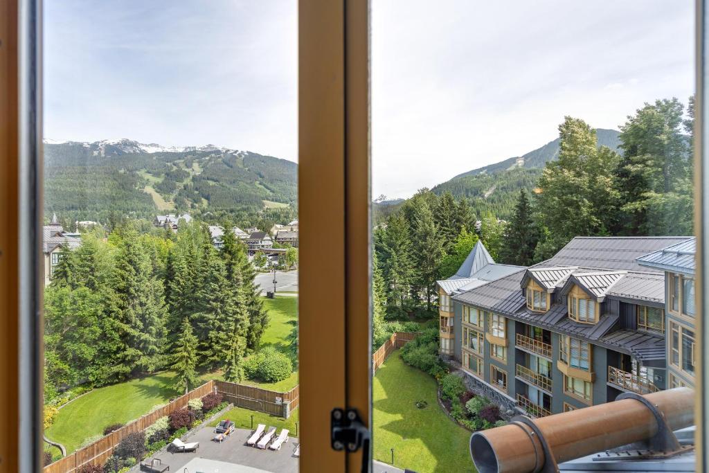
Today, you'll follow in the footsteps of star Olympians to the renowned winter resort of Whistler. The town beneath the Olympic rings will provide you with many unforgettable experiences. Just head to the center of the local ski resort, hop on a gondola, and let the magic of the local nature take care of the rest. The iconic Peak 2 Peak gondola, running between two peaks, offers breathtaking views of the surrounding mountain landscape. Go even higher to the very top of Whistler Mountain and walk across the suspension bridge around the glacier, lost in the clouds. Finally, step onto the Olympic podium and imagine yourself as a successful racer. The spirit of the Olympics still lives here!
Welcome to the Olympic town of Whistler, the venue for skiing and snowboarding competitions. Today you will visit the Whistler-Blackcomb ski resort, formed by the slopes around these two majestic mountains under which the town lies. A system of several cable cars will take you into their interior, the most interesting of which is definitely the Peak 2 Peak gondola, which connects the two mentioned mountains. During the ride between two peaks on one of the longest and highest cable cars in the world, you will enjoy beautiful views of the glacier-covered mountain peaks and the dense taiga at their foot. Maybe you'll see a family of bears frolicking in the mountain meadows from the cable car, as the itinerary author was lucky enough to see :)
First, at the bottom station of the Blackcomb base, buy a ticket for the Peak 2 Peak gondola (which can of course also be purchased in advance on the web). When you buy a full-day multi-lift ticket, the ticket is valid for all the cable cars needed to complete the high-altitude circuit in the itinerary, i.e. the Blackcomb gondola, Peak 2 Peak gondola, Peak express and Whistler village gondola.
You can find the website about the cable car with the possibility of buying tickets here.
TIP: Some cable cars have a glass floor. The price is the same and it is worth waiting for this type (Silver)

First, at the Blackcomb base gondola station, board the Blackcomb gondola, which will take you to the Rendezvous viewing platform and restaurant.
The upper station of the cable car leading from the Blackcomb resort will take you to the landscape of alpine meadows and rocky scree hidden under the majestic peak of Blackcomb Mountain, from which the glacier of the same name flows. It created picturesque lakes, to which relatively easy paths lead more or less along the contour line alternately across blooming meadows and glacial moraine. So, before you get on the famous Peak 2 Peak gondola, take a walk around the area and take the Alpine Walk trail, perhaps as far as Blackcomb Lake.

The Peak 2 Peak gondola, connecting two mountain peaks above a vast valley, will take you below the summit of Whistler Mountain to the observation deck at the Roundhouse Lodge restaurant with its popular stone statue.
Once you've admired the views, refreshed yourself, and taken a photo at the famous stone Inukshuk statue created by native Eskimos, take the short path to the cable car that will take you to the very top.

Take the Peak Express gondola to the very top of Whistler Mountain. This is where the gondolas end, and it's hiking only from here on out :)
At the very top of the Olympic area, you can step into the shoes of Olympic medalists and climb onto the podium with the Olympic rings. Above all, you can enjoy the panorama of the local high mountains and walk along the most famous attraction - the Cloudraker Skybridge, which runs along the Whistler Glacier and, during the frequent fog, resembles walking in the clouds.

Take the Peak express gondola down to the gondola station leading to the town of Whistler.
The Whistler Village Gondola will take you down to the town of Whistler to the Whistler base area.
Welcome back to earth! From the base in Whistler Village, it is less than a kilometer to the city center to the square.
The city center is a square built for the 2010 Winter Olympics. Medal ceremonies and various fan events took place here. In addition to the winter stadium, its vast area also features the main symbols of the Olympics - the rings and the torch. There are also restaurants, bars and souvenir shops around the square. You can also relax and enjoy the atmosphere of the place in the adjacent park with fountains.

Today, you'll embark on a classic Canadian road trip through the interior of British Columbia, with stunning scenery of forested mountains and glaciers towering above you. Your stops will mainly be about water – you'll admire beautiful glacial lakes with turquoise surfaces and follow wild mountain rivers towards roaring waterfalls. Physically fit individuals can even hike to the foot of a massive glacier. So, get in your car and enjoy the fairytale landscape of this magnificent province.
!!ATTENTION!! Don't forget to obtain a permit to enter Joffre Lakes Provincial Park in advance. You can find information in the place description.
The lake near Whistler is a popular swimming spot thanks to its calm and relatively warm water and easy access (it can be reached on foot or by bike directly from the city center), with local beaches and piers serving this purpose. If you don't want to get wet, don't despair - you can also have fun at the lake in other ways, such as walking or cycling around the lake, or relaxing and having a picnic on the beach.
TIP: Parking spaces are limited and paid. Consider leaving your car at the hotel and walking
A short, easy walk to the Rainbow Waterfalls (named for the rainbow that often appears over the water in summer) is a great way to stretch your legs in the morning. The forest path will take you to a viewpoint overlooking the waterfall.
TIP: For the way back, you can choose a path that leads along the opposite side of the stream, which you cross via a footbridge.
Follow the pleasant path through the canyon along the Green River to the beautiful cascading Nairn Falls in the heart of the provincial park of the same name.
On the way, you can make a short visit to the lake and One Mile Lake Provincial Park located near the town of Pemberton.
The main destination of today's lake and waterfall tour is the magnificent Joffre Lakes Provincial Park. The system of three turquoise lakes interconnected by the wild Joffre River with beautiful waterfalls and rapids set in the dramatic landscape of forested mountains, which are replaced by glaciers at higher altitudes, will surely captivate you. This place deserves the most attention from today's stops, and if you can, take the moderately challenging Joffre Lakes Trail leading from the parking lot gradually around all the lakes to the highest Upper Lake, from where you will see not only the beautiful surface of the lake but also the breathtaking Matier Glacier. More information about the park here.
!!ATTENTION!! In the summer season, a permit is often required to enter the park. It's free to obtain, but you won't be allowed on the trail without it. You can arrange it online on the website here. Reservations are released 2 days before the date of your visit at 7:00 AM local time.

Enjoy a long drive along the shore of the vast Duffey Lake on your way.
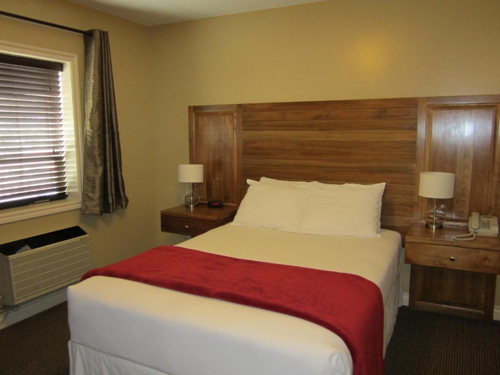


Your scenic drive through the stunning mountain landscape of inland British Columbia continues today. Head along the Fraser Canyon for a variety of exciting experiences. You'll ride a cable car over the gorge of this wild river and gaze down at its raging riverbed mercilessly lashing the surrounding rock faces from a rope bridge. In the romantically named town of Hope, you'll commemorate the legendary Rambo film, paying homage at the famous statue. Later, you'll embark on a unique trail leading through a system of bridges and tunnels carved into the surrounding rocky landscape. Finally, treat your body, weary from mountain hiking, to well-deserved regeneration in hot mineral springs nestled in the fairytale landscape of mountains and lakes.
Embark on a road trip through the beautiful Fraser Canyon, constantly following its flow. Along the way, you can stop to explore several areas with petroglyphs (rock carvings by native people).
In the southern part of the Fraser River Canyon, the riverbed suddenly narrows due to the surrounding rocky gorge. You can view this section of the river, aptly named Hell's Gate, from a unique cable car that crosses the river. At the lower station, you will find a suspension bridge across the river, a museum, and beautiful views of the canyon. The price includes a round-trip ticket on the cable car and all admissions (viewpoints, bridge, museums). More information can be found here.
Opening hours: depending on the season, usually 10:00–16:00 / 17:00
The historic suspension bridge over the Fraser River is part of the provincial park of the same name. Originally used by cars, they were later diverted to a new bridge, and the original bridge is now used only by hikers, who admire the views into the canyon. More information about the entire park can be found here.

Parking: You can usually park for free directly in the center along the main streets or in smaller parking lots (watch out for signs with time limits).
Hope:
The picturesque town at the confluence of the Fraser and Coquihalla rivers, nestled between high cliffs, is the gateway to the beautiful natural area of the Fraser River Canyon, which you are currently passing through. In addition to nature, the town offers a glimpse of the culture and traditions of the original settlement, including the gold rush era, which you can see in the Hope Museum. It also houses the oldest church in the country. Due to its charm, the town even became the setting for the famous film "First Blood" (Rambo), whose statue still stands in the town.

In the nearby Coquihalla Canyon Provincial Park, you'll find the iconic Othello / Quintette Tunnels railway tunnels and suspension bridges. The system of bridges and tunnels carved into the rocks now serves as hiking trails. Some sections leading through the old tunnels are very dark - I recommend packing a headlamp, flashlight, or at least using the light on your phone. More information about the park can be found here.

Parking: usually paid parking in the city center and around the pool (around 4 CAD per hour), further away from the center you can park for free (the town is small and you can walk anywhere)
Harrison hot springs:
This spa town nestled in the charming landscape of hot mineral springs on the southern shore of the picturesque Harrison Lake is a wonderful place to relax after strenuous days spent in the mountains. In addition to strolling along the coastal promenades and relaxing on the beaches along the lagoon, be sure not to miss the main attraction - the mineral spa built on the local hot springs rich in healing minerals. Some are only accessible to guests of nearby hotels, but the Public Mineral Pool located in the heart of the town near the coast is open to the public. You can find information about the town here.
You can find information about the public mineral pool here.
pool opening hours: are quite variable, usually around 10:00 - 20:00, but may change
TIP: The town is also an excellent starting point for mountain hiking, for example in the nearby Sasquatch Provincial Park with beautiful mountain scenery rich in lakes and waterfalls and the living local legend Sasquatch - a creature from Indian mythology living in the local mountains (something like the famous Bigfoot :))


It's time to leave the mountainous interior of British Columbia and head towards the ocean to the mysterious Vancouver Island. From the outdoor deck of the ferry, you can wave goodbye to busy Vancouver and watch its skyline gradually disappear. If you're lucky, your journey through the sea bay will be enlivened by groups of dolphins jumping out of the water or even a whale emerging from the depths with a typical geyser of water. Soon you will see your next destination - the beautiful Vancouver Island surrounded by the ocean with beautiful beaches covered with rainforest and mountainous interior with waterfalls and lakes. Today's stop will be right in the capital of the island and the entire province - the beautiful Victoria proudly bearing the name of the famous British queen. Take a walk through this pleasant city, where the blue surface of the bay alternates with rich and well-kept greenery, and history and architecture of good old Britain breathe at every corner.
It's time to head to the beautiful Vancouver Island. From the Tsawwassen terminal located near Delta in Greater Vancouver, take a ferry that will take you and your car across the bay separating the island from the mainland.
Ferries are operated by BC Ferries, and you can buy a ticket either in advance online at the website or directly at the kiosk at the terminal (card payment is possible). The fare varies depending on the season, day of the week, time of sailing, type of vehicle, and the number and age of passengers. You can find the fare calculator here.
!!ATTENTION!! Especially on summer weekends or holidays, a lot of cars head to the island, and without a reservation, you may have to wait a long time for the next available boat. Consider booking your trip in advance.
TIP: Tickets are cheaper in the early morning or evening hours.
You can find the official website of BC Ferries, where you can find information regarding sea routes, price list, ticket reservation, and services on board, here

BC Ferries Ferry:
Frequency - every hour in the summer season
Journey time - 1 hour 35 minutes (net sailing time excluding waiting for cars and passengers to board, etc.)
Arrival at the terminal - preferably at least 30, preferably 60 minutes before departure time
Process:
1) Arrive at the terminal where you purchase or show your purchased ticket at the kiosk
2) Join the queue of cars heading to the ferry, which can take up to an hour of waiting in the summer
3) Drive onto the ferry into the underdeck area, from where you can go out on deck
4) You can use the indoor areas with a bar, or go out to the outdoor viewing terraces and admire the surrounding islands
5) Upon reaching the island, go back to your car and drive off the ferry to the terminal, from where you continue on
NOTE: In the case of this cruise, it is far from just a boring transport between two places. The views of the sea and the surrounding islands are amazing, and with a little luck you might spot a whale or dolphins from the ferry, as the itinerary author was lucky enough to do. The cruise itself is therefore a great experience, just be prepared for unpleasant winds on the outdoor terraces
Welcome to Vancouver Island. Get off the ferry and head for the next adventure the island brings you.
One of the most beautiful parks in the country, with a distinctly Victorian style typical of the entire city, whose name Victoria speaks for itself. Its location between the city center and the coast of the Juan de Fuca Strait gives a foretaste of the amazing views of the nearby ocean and the distant peaks of the Olympic Mountains, already located in the USA. In addition to the views, you can come across freely moving peacocks while walking through the beautifully manicured lawns and flower gardens. Be sure to stop at the famous totem and the Mile 0 monument, which marks the beginning of the famous Trans-Canada Highway. You can find information about the park here.
TIP: The park has easily accessible parking, which is free for the first three hours. This makes it an excellent starting point for exploring the nearby city center around the harbor.
You can find parking information in the city on the website here

A very nice museum maps the history, culture and nature of the province of British Columbia. Through interactive exhibitions, you can learn about the rich history of the province, including the era of English rule, which gave the city its form, including place names. Of course, there is also the culture and traditions of the local native Indian tribes, and there is also the beautiful nature of the local forested mountains and the dark waters of the ocean.
Practical information about the museum, including opening hours and admission fees, can be found on the official website.
Opening hours: 10:00 - 17:00
!!ATTENTION!! There is no parking available directly at the museum. Leave your car either in Beacon Hill Park, or somewhere in the surrounding streets (paid). The city center is small and you can easily walk everywhere.

Right across from the museum stands the majestic British Columbia Parliament Building. This iconic building, one of the city's most beautiful architectural landmarks, houses the government of the province of British Columbia, of which Victoria is the capital. In addition to the beautiful exterior, you can also enter and tour the interior of the building for free. A guide will show you the assembly halls and explain how the local government works. In front of the building, see interesting sculptures and monuments, such as the statue of Queen Victoria, who gave the city its name, a totem pole, and the coats of arms of all Canadian provinces and territories. From the building, you also have a beautiful view of the bay with the harbor, where you should go after your visit. More information here
Opening hours: MON - FRI: 8:30 AM - 4:30 PM (self-guided entry), public tours see website
!!ATTENTION!! There is no parking available directly at the Parliament Building. Leave your car either in Beacon Hill Park or somewhere in the surrounding streets (paid).

The waterfront promenade around the bay with the harbor offers a pleasant walk, during which you can enjoy views of the bay and yachts, as well as the floral decorations of the park areas and many interesting statues, including the "living" ones made of plants. You definitely won't miss the iconic The Fairmont Empress hotel.
TIP: Wait for one of the seaplanes landing in the bay. It is a very interesting sight.
TIP: Excursion boats also depart from the harbor for whale watching. Various companies have their stands directly on the waterfront to mediate this experience.

Along the coast, you will reach the picturesque harbor district with floating houses (houseboats). This colorful and very lively place offers a breathtaking experience while walking along the wooden piers between the colorful houses, where people still live permanently. In addition to residential houses, you will find many cozy restaurants and cafes here. The fishing past and present cannot be denied thanks to the boats present and the offer of local restaurants. There is no better place for an evening sitting, for example, with fish and chips or seafood in one of the local street foods.
TIP: In addition to the colorful houses, sometimes look from the pier into the sea - with a little luck you will see seals that often appear right next to the piers near human dwellings. You can also take a boat taxi

If you left your car parked in Beacon Park, head back to it. If you've gone to the center, hop in the car and head to the hotel.
It's time to leave this beautiful city and head to the hotel to get some sleep before tomorrow's busy day.


Lovers of challenging hiking in the wilderness or passionate photographers of natural scenery will be in seventh heaven today. The coast of Juan de Fuca Bay, covered with a dense rainforest transitioning into a rocky coastline with recessed bays and wild beaches, will offer you fascinating panoramas including the possibility of observing wildlife. The famous Juan de Fuca trail is home to many wild animals, and encountering a bear or cougar in the rainforest, a whale and dolphins in the ocean, or an eagle circling overhead is not uncommon here :) Wilderness adventure enthusiasts can walk a section of this challenging multi-day trail, but even less physically fit people will enjoy it – the trail has several beautiful places accessible by car. Just park and take a short forest path and you will quickly find yourself on a beautiful beach with rocky cliffs lashed by the sea surf. As a bonus, picturesque waterfalls hidden in narrow gorges and rope bridges over wild rivers await you in the surrounding jungle. Simply a fairy tale :)
You can find parking here. From there, a short path leads to the lighthouse at the very tip of the small cape, where you will feel like you are at the end of the world. The beautifully renovated lighthouse from 1912 still serves to navigate sailors sailing through the Strait of Juan de Fuca, which you can see from the lighthouse. On its opposite shore lies the American mainland, specifically the peaks of the Olympic Mountains. The interior of the lighthouse, which you can enter for free (but it is good to donate at least a small contribution), serves as a miniature museum. The view of the strait and the rocky coast will serve as a starter before the march along the Juan de Fuca Trail, which will follow.

The parking lot is where the famous multi-day Juan de Fuca trail begins (or ends - depending on the direction of the route). This is described in more detail elsewhere. The first section of the trail takes you through the jungle of the rainforest to the ocean shore. Here you will find a beautiful beach set in the dramatic landscape of vertical rock walls covered in dense rainforest. The beach is covered with fine sand with scattered smooth boulders eroded by the wild surf of the ocean. From the beach you can return to your car and drive on, or take a section of the Juan de Fuca trail. However, you always have to return the same way, there is no possibility of a circular route.

As mentioned in the previous location, the parking lot near Mystic Beach is the beginning of the amazing Juan de Fuca Trail. This 47-kilometer trail through the rainforest wilderness, following the rocky coast with beaches of the Strait of Juan de Fuca separating the coastal areas of Canada and the USA, offers fantastic natural scenery and adventure as you conquer peaks, cross mountain streams via rope bridges, and navigate sharp, eroded stones on rocky and sandy beaches. The contrast between the dramatic ocean coastline with beaches and secluded bays, sharply transitioning into the lush vegetation of the surrounding rainforest, offers a unique natural spectacle where two seemingly different worlds intertwine. Where else can you simultaneously watch whales and dolphins swimming in the ocean and a bear or cougar walking in the dense rainforest or directly on the beach? This is possible in the local wilderness, and the author has experienced it.
Given the length of the route and its physical demands, it is of course not realistic to complete the entire trek in one day. Completing the entire route requires a multi-day hike with overnight stays in several primitive campsites equipped with, at most, dry toilets. In your case, it is therefore advisable to complete one longer, or several shorter, one-way sections, returning to the car via the same route (the trail is not circular).
Recommended sections of the route accessible by car:
1) Parking lot → Mystic Beach and further around (e.g., to the waterfall or footbridge over the stream) - see previous location
2) Parking lot → Sombrio Beach and further around to the waterfalls and chain bridge - see next location
3) Parking lot → Botanical Beach (start/end of the trail) and along the coast to the next beach and back - see next location
The entire trail and its surroundings, except for a few gaps, lie within the provincial Juan de Fuca Park. Information about it can be found here.
!!ATTENTION!! Certain natural risks apply in the local wilderness in the form of unstable ground during rains, inaccessibility of coastal sections of the trail during high tide, and, of course, the possibility of encountering wildlife (bears, cougars, wolves). I recommend (in addition to suitable clothing and footwear) also a bell and bear spray.

One of the most beautiful spots along the Juan de Fuca trail is this stunning beach with the dramatic scenery of a rocky coastline shaped by the wild Pacific Ocean. All of this is surrounded by an inland rainforest with waterfalls on rushing rivers. Besides the beach itself, definitely don't miss the amazing Suspension bridge leading through the jungle over the Loss creek river. From the beach, take the trail eastward, and don't forget to turn inland to reach the hidden gem of this area - a beautiful waterfall hidden in a narrow gorge.
Due to its excellent accessibility by car, it is probably the busiest place along the Juan de Fuca trail. You will probably meet many day visitors, including surfers.

Another of the beautiful beaches along the Juan de Fuca Trail lies at its beginning/end near the harbor village of Port Renfrew, which is the only civilization far and wide and therefore the main starting/ending point for tourists heading to the Juan de Fuca Trail. The rugged rocky coast here is known for its tide pools, which were created by the raised sea level at high tide, which filled the holes in the rocks as it receded. Low tide is also a great opportunity to observe stranded animals such as crabs and starfish.


If you enjoyed the rainforest wilderness and the natural ocean-whipped beaches, you can experience a similar adventure today on the West Coast Trail. Unlike the Juan de Fuca Trail, however, you have to pay considerable fees to enter it and book everything in advance. Those interested can find details directly in the place description. If you prefer a more relaxing option, a visit to Cowichan Lake is ideal for you, which, in addition to the picturesque mountain scenery, offers an ideal opportunity for swimming on the local beaches thanks to its pleasant temperature. If you still want to experience a little more adventure and exercise, the ideal choice is to rent a bike in the town on the lake shore and ride the beautiful trail through the Cowichan Valley. In the evening, enjoy a romantic walk along the promenade in seaside Nanaimo and taste the local sweet specialty.
If you were enchanted by the beauty of the West Coast wilderness during the Juan de Fuca Trail and haven't had enough, you can embark on a similar trail that is essentially a continuation of the Juan de Fuca, interrupted by Port San Juan. The town of Port Renfrew is a link between the two trails, offering necessary facilities, and both trails start/end near it. The entire West Coast Trail leads through the wild Pacific Rim National Park.
!!ATTENTION!! If you are interested in this trek, you must make a reservation online here at least 2 days before the planned start (but preferably much earlier), or by phone at 1-519-826-5391. Reservations for the 2026 season open on February 5th.
First, visit the information center, where you will pay the entrance fee to the national park, which is (March 2026) 12.25 CAD per person, or 24.50 CAD per family (group) per day. At the same time, you will show the previous reservation with the so-called backcountry permit (208.5 CAD plus a reservation fee of 11.5 CAD). Then you will watch a mandatory safety video (the so-called safety briefing) with an additional fee of 23.75 CAD (the so-called orientation fee). You also pay for parking in the gravel area in front of the information center, approximately 10 CAD per day.
From the information center, you can walk to the nearby dock at the point where the Gordon River flows into the bay. The ferry will take you to the other side of the bay, where the trail begins. There is another fee for the ferry (as of March 2026, it was 28 CAD/person/way)
ferry operating hours:
May 1 - October 7: 8:45, 10:30, 11:30, 12:30, 13:30, 14:30, 15:30
You can take a circular route, which leads in one direction along the coast through picturesque beaches and in the other direction inland through the rainforest. Although it is a fraction of the total length of the route, it is still a relatively long and physically demanding trek full of climbs on stairs, ladders or paths and overcoming obstacles, which takes (including getting to it and completing all the formalities) a lot of time. You must also consider the return ferry times. Consider all these factors. Circular route here.
Information about Pacific Rim National Park - here
Information about the West Coast Trail - here
!!ATTENTION!! As with the Juan de Fuca Trail, there are certain natural hazards here in the form of unstable ground during rains, inaccessibility of coastal sections of the trail during high tide, and, of course, the possibility of encountering wildlife (bears, cougars, wolves). I recommend (in addition to suitable clothing and footwear) also a bell and bear spray.
NOTE: To complete the trip, it is necessary to pay relatively large fees, you can find an overview of them here
SUMMARY: The trail is a great experience, but on the other hand, due to the high fees and organizational formalities, it is more worthwhile for adventurers who hike the entire trail over several days, including camping. Consider whether all the fees and organization are worth a day trip

Cowichan Lake is known for having some of the warmest water in the country, making it great for swimming during the summer without having to be particularly hardy. But even if you don't end up going into the water, you can relax on the shore at one of the beaches and enjoy the surrounding nature. You can also rent a canoe or kayak and enjoy the surrounding wooded mountains directly from the lake.
Alternatively, you can rent bikes and cycle around the island on the paved road, or take a beautiful nature trail like the Cowichan Valley Trail leading through the forest along the river in Cowichan River Provincial Park.
Nice beaches can be found directly in the town, e.g. along Lakeview Park. If you are looking for quieter and more natural beaches, you will find them further away from the city, e.g. in Gordon Bay Provincial Park.

In the evening, you can spend time in this pleasant seaside town taking a walk around the small center near the harbor with the Harbour front walkway, offering views of the sea and pleasant park landscaping. From McGregor Park, you can walk to Maffeo Sutton Park. Along the way, you can watch seaplanes landing.
You can taste the local specialty - the Nanaimo bar, a no-bake dessert consisting of a custard filling between a biscuit base and a chocolate glaze. Most local businesses offer it.
NOTE: For an overview of parking options and pricing, use this website. For a walk along the waterfront, a good starting point is the covered parking garage Harbour front parkade


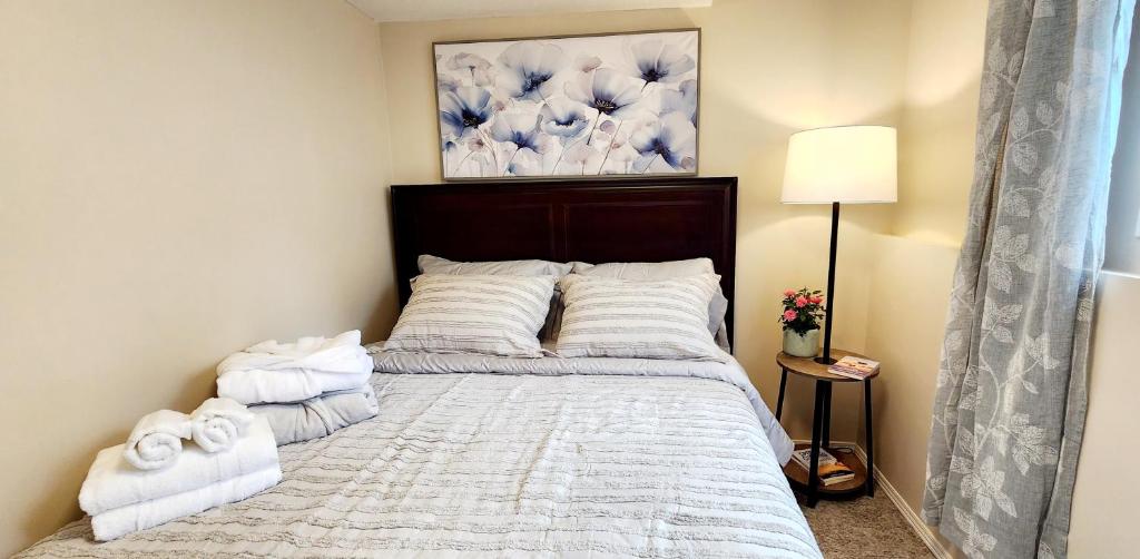
Today you will head to the heart of the island, Pacific Rim National Park. In this enchanting landscape of rainforests and magnificent wild ocean beaches, you will fully merge with nature and feel its energy. Surfing enthusiasts, as well as beginners and those interested in this sport, can take advantage of this area near the town of Tofino, thanks to the local beaches and the wild Pacific. Once you have fully enjoyed the rugged beauty of the coast, return inland, where other picturesque lakes hidden in the omnipresent rainforest await you. The fresh green color of the local jungle, together with the sparkling blue color of the lakes, forms a great combination that will soothe your soul.
After a long journey through beautiful scenery, you will enter the wild Pacific Rim National Park, with nature formed by rainforests and sandy beaches with rock formations of all shapes. Stop at the visitor center to plan your movement around the park, taking into account the weather and any closures. You can also pay for entry to the park here, which is (March 2026) CAD 12.25 per person or CAD 24.50 per family (group) per day.
NOTE: Another option to pay for entry to the national park is at the parking lots near the trails or beaches, where you will find self-service machines where you can pay
Pacific Rim National Park Information - here
Information center opening hours: daily 10:00 - 19:00, from September to December only FRI - SUN from 9:30 to 17:00
From coastal and lakeside relaxation back to the heart of the jungle. On the way to the seaside town of Tofino, you will pass through a lush jungle, which is easily accessible via two trails leading along a wooden walkway, making it the easiest and most comfortable way to walk through the rainforest so typical of this island. The circular trails named Loop A and Loop B are located on opposite sides of the road.

You can seamlessly transition from rainforest to beach – a typical thing for Vancouver Island :) The ocean on this island blends particularly easily with other natural elements. You can observe the marine world in the distance, while behind you a bear huffs, running out of the rainforest, all under the watchful eye of a circling eagle :) All of this is, of course, meant with exaggeration, but it is real :) The beach is very long (see the name), wild with surf and tree trunks washed up on the beach or in the shallows. The surrounding rainforest completes the wild atmosphere of the place.

Another of the many west coast beaches on the map resembles a bird with outstretched wings and thanks to a natural rampart of sand and stones, it is divided into northern and southern parts. The sandy beach, whipped by the waves of the wild Pacific under a veil of frequent fogs, has a very raw feel. In addition to watching the sunsets, it is also popular with surfers.
TIP: A popular walk to Frank Island is only accessible at low tide
TIP: If you enjoy beach tourism, in addition to Long Beach and Chesterman Beach, the area around Tofino is rich in other beaches, such as Cox Bay beach or MacKenzie beach.
Parking: You'll find many parking lots and street parking options throughout the downtown area, often paid, but some are free for certain times of the day or for a certain period. Explore the website.
Tofino:
Welcome to the end of the world. The seaside town of Tofino is located at the very tip of the peninsula and is surrounded by the bay and the surrounding rugged coastline. You can't get any further by road from here. The town has become a popular tourist center and is famous especially among surfers thanks to the surrounding beaches, and whale watching trips are also undertaken from here. Several agencies operate cruises to see these marine mammals, or you can rent surfboards here, including the option of taking a course. The surfing culture is unmistakable here, as is the legacy of the indigenous tribes, whose culture you can explore in the Naa’Waya’Sum Coastal Indigenous Gardens.

Where better to say goodbye to the wild, rugged Pacific coast than on a small promontory of a long peninsula near the town of Ucluelet. Take the Wild Pacific Trail, which follows the coastal cliffs, and walk to the Amphitrite Point Lighthouse. From the viewpoints along the route, enjoy views of the wild ocean waters relentlessly lashing the local rugged coastline. Maybe you'll spot a "geyser" created by a passing whale in the distance. The author of the itinerary was lucky enough to see one :)

On the way to the hotel, you will pass by the beautiful Sproat Lake. It would be a shame to just pass it by and not take advantage of the beach, which is easily accessible via a short path leading from the parking lot through a tunnel under the road and then through a lush rainforest. The area is part of the Taylor Arm Provincial Park.

A nice combination of rainforest, lake beach and monuments to the culture of indigenous peoples is represented by a short trail leading along the shore of Sproat Lake to a rock covered with engravings, the so-called petroglyphs, depicting animals or scenes from the life of the Indians.
TIP: At the beach you will find picnic tables, making it a pleasant place for dinner, for example.


You'll spend your last moments on the island experiencing its main natural attractions one last time. First, you'll say goodbye to the ubiquitous rainforest with a pleasant walk along a wooden boardwalk through the lush jungle formed by old, moss-covered cedars. Later, relax on the beach by a beautiful lake where you can enjoy a picnic. Then, stylishly conclude your exploration of the picturesque island with a walk along a mountain stream with iconic waterfalls, which will be a more than fitting end to your stay. Now it's time to head to the ferry to the mainland. Your stay in beautiful British Columbia is coming to an end.
Before leaving the town of Port Alberni, take a short morning stretch on the easy trail leading to a natural attraction – a circular hole in the rock wall through which a stream flows. From the parking lot near the confectionery, you must first cross to the other side of the road, where the trail begins. The forest then leads to the rocks with the stream, where the hole lies.

Since your stay on the island ends today, it's time to say goodbye to the typical landscape features you've encountered during your stay. Yesterday you said goodbye to the wild Pacific coast, today it's time to bid farewell to the local rainforests. A short, easy walk along wooden walkways through a rainforest of up to 800-year-old cedars will serve this purpose. On each side of the road you will find one short circular route. The area of old cedars is part of MacMillan Provincial Park.
You'll say goodbye to the lakes, another typical feature of the island, just a little further on. You will drive along the southern shore of Cameron Lake, and you can stop for lunch at the Beaufort Picnic Area at the beach with excellent facilities with picnic tables and toilets. Lunch overlooking the beautiful blue surface of the lake surrounded by green forest always tastes better :)
Waterfalls are also part of the wild nature of forests, mountains and lakes. These will be your last stop on the island. The cascading waterfall is accessible via a comfortable forest path along the Qualicum River. From the viewpoints along the circular route you will gradually see both main waterfalls (Lower and Upper). Like nearby Cameron Lake, the waterfalls are part of the Little Qualicum Falls Provincial Park.
Everything beautiful comes to an end, and it's time to leave the picturesque Vancouver Island. From the pier in Nanaimo, you'll once again take a ferry that will transport you and your car across the bay separating the island from the mainland and the city of Vancouver.
Again, you will use BC Ferries, and tickets can be purchased either in advance online on the website or directly at the kiosk at the terminal (card payment is possible). The price of the trip varies depending on the season, day of the week, time of the trip, type of vehicle, and the number and age composition of passengers. You can find a fare calculator here.
!!ATTENTION!! Especially on summer weekends or holidays, many cars travel between the island and the mainland, and without a reservation, you may experience a long wait for the next available ship. Therefore, consider booking your trip in advance.
TIP: Tickets tend to be cheaper in the early morning or evening hours.
The official website of BC Ferries, where you can find information regarding sea routes, price lists, ticket reservations, and onboard services, can be found here.

BC Ferries Ferry:
frequency - every 2-3 hours in the summer season
travel time - 1 hour 42 minutes (net sailing time, excluding waiting for boarding of cars and passengers, etc.)
arrival at the terminal - preferably at least 30, or rather 60 minutes before departure time
Welcome back to the mainland in the picturesque Horseshoe Bay, located on the northern periphery of the Vancouver metropolitan area near the West Vancouver district. Disembark the ferry and make your way to the hotel.

Your Canadian adventure is coming to an end, and all that remains is a safe transfer to the airport, returning the car, checking in, and returning home. Don't forget to allow plenty of time – the formalities associated with returning the car, possible traffic jams, the check-in process, customs controls, etc., can take up a lot of time.
Depending on your departure time, you may still have some time for last visits to interesting places in the city or surroundings. You can visit some of the places offered on the arrival day, which you may not have reached due to time constraints, or return to some of them. Lovers of quiet walks in greenery with flowering plants will certainly appreciate the VanDusen Botanical Garden located near Queen Elizabeth Park.
If you want to bring back a souvenir from your trip, visit Chinatown or Gastown, where, especially along Water Street, you will find many shops offering souvenirs with the theme of Vancouver, the surrounding mountains, and all of Canada. You can buy, for example, hockey jerseys of the national team or local Canucks, pucks, baseballs, and many other items with motifs of the country's main symbol - the maple leaf.
You've arrived at the airport, which means only one thing - return the car and hurry to the check-in process. Goodbye, British Columbia.

During the long check-in procedures and the subsequent demanding flight, you have enough space to finalize the recap of your Canadian adventure.
This road trip has taken you through the greatest jewels of British Columbia and perhaps all of Canada. The panoramas in the local mountains, formed by sharp peaks with glaciers and crystal-clear lakes, are in places a truly breathtaking display of the beauty, power, and energy of nature. Picturesque valleys formed by wild mountain rivers, grassy meadows, and endless taiga are a feast for the eyes and grateful objects of photographs. All this contrasts with the rugged coastline of the ocean with erosion-shaped rocks and beaches, which create a unique natural harmony in the shadow of the surrounding mountains. If you add the adrenaline associated with meeting bears, kind and helpful Canadians, and the Olympic atmosphere of Vancouver and Whistler, you will be guaranteed fun, adventure, and experiences for a lifetime.
If you haven't managed to satisfy your appetite for the natural beauty of the Canadian mountains during your road trip, don't despair - you can always come back and explore another area. There is really a lot to see in Canada. The author of the itinerary offers another Canadian road trip - this time through the national parks of Alberta and British Columbia, which will take you through the most beautiful places in the Canadian Rocky Mountains, the so-called "Rockies". Your eTA form is valid for 5 years, so you will have one less worry and expense on your next trip during this period.
So bye bye, Canada! See you next time!
Canada - the land of the maple leaf, the cradle of hockey, and endless natural scenery, is one of the most attractive destinations in the world. It offers everything from modern and clean cities to the famous Niagara Falls and wild landscapes full of mountains, lakes, and forests. Every traveler will find something for themselves here, whether they are looking for adventure, nature, or the unique atmosphere of this vast country.
In this itinerary, you will explore one of the most beautiful regions of Canada, the province of British Columbia, between the Pacific Ocean and the mountain ranges. Your base will be Vancouver, a modern city surrounded by nature, from where you can quickly reach breathtaking wilderness. Mountain scenery, glaciers, turquoise lakes, and encounters with wild animals await you, making this landscape so unique and unforgettable.
Practical information about Canada and traveling in it can be found here.
Your arrival day is mainly for rest and acclimatization. You need to get used to the different time zone, climate, and culture. Depending on your arrival time, you can then explore the city. However, be careful not to forget - due to its location by the ocean, the city is sometimes nicknamed "Raincouver" in reference to the frequent rains.
The places listed for today are a suggestion of options for how to spend not only your arrival day but also any time on your departure day. If you have the time and desire, head to Queen Elizabeth Park, located almost in the geographical center of the city, which is full of pleasant trails with rich greenery and a greenhouse with exotic plants and animals at its peak. Another stop could be Granville Island, which is a popular shopping and entertainment district in the city center. From there, you can take a pleasant stroll along the coast to the popular Kitsilano Beach - a center for relaxation and sports.
The listed places and brief information about them are provided below, it depends on your time whether you visit them.
Hello, welcome to Canada! Welcome to British Columbia - a beautiful province made up of the rugged coastline of the endless Pacific and high, glaciated mountains. Today will be more about organization (immigration control) and relaxation after a tiring flight, however, depending on your arrival time, it is possible to use this day meaningfully.
After arrival, you will move to your accommodation (depending on the time of your arrival and check-in), where you can rest and refresh yourself after a tiring flight. On the way from the airport or later after stopping at the hotel, you can replenish energy after a tiring flight in one of the many more or less known fast foods offering cuisines from all over the world and tune in to the local food culture. You can also try the Canadian national dish - fries topped with brown meat sauce sprinkled with cheese, so-called poutine. You can improve it a bit, for example, by adding bacon or pulled meat. Then you can go to the city, to explore which you will use very well-organized public transport.
Queen Elizabeth Park is accessible by the automated SkyTrain light blue Canada Line:
Target stop: 61372 King Edward station
Frequency of connections: 4 - 8 min
Travel time from the center/airport area: approx. 10 min
You can find information about public transport in Vancouver in the practical information about the country (link in the introduction of the itinerary).
TIP: If you live far from a metro stop, a dense network of bus lines will get you closer; you can find a list of their lines and timetables again in the practical information about the country.
On Little Mountain (which is the highest point of the flat metropolis), almost in the center of the city, lies this extensive park and city arboretum, which is a welcome green oasis in the middle of the concrete jungle. You can walk along the many paths leading through the flowering gardens or relax on one of the green plains. Among other things, you will also find a rock garden with a waterfall and, at the very top, the Bloedel Conservatory - a dome-shaped greenhouse that houses several hundred exotic plants as well as various species of birds, amphibians and fish thematically divided according to landscapes (deserts, subtropics, etc.). Admission to the park is NON-STOP and free, but there is a charge for admission to the greenhouse. The Hillcrest Centre sports center, built for the purpose of holding the Olympics, is adjacent to the park.
Information about the Bloedel Conservatory (opening hours, admission, etc.) can be found here.
Bloedel Conservatory opening hours: vary depending on the season, you can find them here
You can get to the island from the park by a combination of subway and bus.
1) SkyTrain light blue line Canada line:
Entrance: stop 61372 King Edward station, direction Waterfront station
Exit: 61368 Olympic Village station, transfer to bus No. 50
2) bus No. 50:
Entrance: stop 61040 Olympic Village station, bay 1, direction Waterfront station
Exit: 52061 WB W 2 AVE FS ANDERSON ST, then walk across the bridge to the island
Originally a fishing district with a harbor located on the peninsula under the Granville Bridge leading to Downtown, it has now been transformed into a shopping and entertainment center with a popular market (even among locals) offering local products from local vendors. You can also find tasting breweries, art studios, galleries and theaters. The place is also a center for street artists and various festivals and performances. You can walk around the local marina. There is also a beautiful view of the Downtown skyscrapers from the coast. More information can be found here.
Public market opening hours: 9:00 - 18:00
Take a pleasant walk through the park along the coast.
The seaside park offers greenery, beaches, and promenades with views of downtown and the surrounding mountains, as well as many opportunities for cultural activities:
1) Museum of Vancouver - here you can learn about the history and culture of the city, website here
2) Space Centre - ideal for science, space, and observation enthusiasts, including a planetarium, website here
3) Bard on the Beach - summer Shakespeare festival in the open air (June - September), website here
4) Maritime Museum - the maritime museum is actually part of the adjacent Hadden Park, where you can learn about naval history and sea exploration, website here
Continue along the park promenade along the beaches to the most famous one.
A favorite spot for relaxation and sports activities for locals and tourists alike (especially in the summer) is this pleasant beach with an adjacent park. In addition to lounging on the beach with a view of the Downtown skyline and the opposite peninsula with Stanley Park, you can also play sports here. For this purpose, there are tennis and beach volleyball courts, a table tennis table, a basketball court, and more. There are also facilities such as toilets, showers, drinking water, and refreshments. More here
You can spend pleasant moments over a glass of wine on the terrace overlooking the beach at The Boathouse restaurant.
From the park, you can take a bus to downtown, and from there you can continue by metro.
Bus #2:
Boarding: Walk to the bus stop 50069 EB CORNWALL AVE FS YEW ST, direction MACDONALD/TO BURRARD STN
Alighting: 50031 BURRARD STN BAY 7, then walk to the metro stops:
61363 VANCOUVER CITY CENTRE STATION - light blue line Canada line
60826 BURRARD STATION - dark blue line Expo Line
Today, you'll explore downtown Vancouver. You'll start in the heart of the city at the center of major events - Canada Place, where you can take a quick virtual flight across the country thanks to a local virtual attraction. Via the square with the Olympic cauldron, where you can reminisce about the 2010 Winter Olympics, which the city hosted, you'll gradually reach two of the most important sports venues - multi-purpose arenas that are home to major sports clubs, led by the hockey Canucks. In nearby Chinatown, you can taste some of the delicacies of the Far East and stroll through the Zen garden. With a full stomach, you'll then head to the historic part of the city, where not only you but also the local iconic steam clock will "let off steam." Finally, you'll see the city and its picturesque surroundings from the observation tower.
Waterfront station is a transfer hub located in the heart of the city. Subway and ferry lines intersect here:
Light blue Canada Line: from the airport, the city of Richmond, and the southern periphery
Dark blue Expo Line: from the eastern periphery and the city of Surrey
SeaBus ferry: travels across the bay between Downtown and North Vancouver
Frequency: 4 - 8 min
Travel time from peripheral areas: approx. 20 - 30 min
The center of activity in the city is this pier with the iconic building with a roof structure resembling ship sails. It is a multifunctional center built for the EXPO exhibition. In addition to walking along the pier with views of the bay with boats and seaplanes, you will find a congress center, a terminal for cruise ships sailing to Alaska, and also the main attraction - the Canada "FlyOver Canada" flight simulator, where you can experience a flight across the country in about eight minutes using advanced technologies of curved projection screens, moving seats, wind or fog. The place is also the center of celebrations of the most important national holiday - Canada Day. First, visit the Canada Place Welcome Centre, where you can get the necessary information, or study the website here.
Canada Place opening hours: 7:00 AM - 10:00 PM
FlyOver Canada: information on the website here
Opening hours: 10:00 AM - 8:30 PM
NOTE: I recommend booking tickets in advance during the summer season
The main square located right next to Canada Place and the convention center by the sea, offering a beautiful view. The main attraction is the Olympic Cauldron, which was lit during the Winter Olympics that the city hosted in 2010. In winter, the square hosts Christmas markets.
Another of the city's everyday hubs is an architecturally interesting square built in a cascading style with water features and staircases with ramps connecting the individual levels. Around the square you will find court buildings or the Vancouver Art Gallery. In the summer, the square becomes the venue for cultural events, and in the winter it is a popular ice rink. The busy shopping street Robson Street emerges from the square.
From the square, continue along the bustling Robson Street - the city's main shopping and cultural artery that runs through the entire Downtown area. Along this boulevard, you will find a myriad of boutiques and restaurants offering food from all over the world, and you will fully experience the city's multicultural character. This street is an ideal place for a lunch break - the choice is really great here.
The city is known for its extensive areas on the shores of the bays that form its character. One such place is this sprawling square offering views of False Creek Bay. The area was created for the EXPO exhibition, but today it is a quieter area with opportunities for walks along the coast. In its vicinity are two major sports arenas (described as sub-locations).
You definitely won't miss this multi-purpose stadium with its modern retractable roof. It's home to the local Whitecaps (European football) and BC Lions (American football) teams. It also hosts major sporting and cultural events (e.g. concerts, world championships, etc.). During the city's Olympics, it was the main venue for medal ceremonies. More here https://www.bcplace.com/
Another pair of popular city sports clubs – the Warriors lacrosse team and, above all, the local darlings, the Canucks hockey players, are based in this multifunctional hall. Like BC Place, it was also the venue for the Olympic Games (then still called Canada Hockey Place). More here
A distinctive building in the shape of a glass sphere standing on the shore of the bay offers interactive exhibitions mediating scientific knowledge from natural science fields such as biology, physics, and mathematics. It is not a classic museum with a passive tour of exhibits; here, you can touch everything and playfully explore various phenomena and objects.
Information about the museum, including opening hours and admission fees, can be found here.
Every major city in North America has its own Chinatown, inhabited by a Chinese community, where you can find traditional architecture, bistros offering excellent local cuisine, and souvenir shops. In Vancouver, it's the area around Sun Yat-Sen Plaza with the adjacent beautiful Dr. Sun Yat-Sen Classical Chinese Garden. You can view the public part of the park for free, and there is an entrance fee for the garden. The entrance to Chinatown is usually guarded by monumental entrance gates. In Vancouver, it's the Chinatown Millennium Gate.
!!WARNING!! The northern part of Chinatown adjoins East Hastings Street, which is the dark side of an otherwise clean city. Homeless people and drug addicts roam the street and its immediate surroundings, under the influence of drugs at any time of the day. It is better to avoid the street and its surroundings if you do not want to witness images that you probably would not expect in the otherwise pleasant Vancouver and Canada in general. Unfortunately, the problem of fentanyl and other drugs has also spread from the USA to this country.
Information about Sun Yat-Sen Plaza, including opening hours and admission fees, can be found here.
The birthplace of today's modern Vancouver is this neighborhood named after “Gassy” Jack Deighton. This historic area, full of shops, restaurants, and galleries, offers an interesting combination of old Victorian architecture against the backdrop of a modern city with glass skyscrapers. If you want to take a souvenir from Vancouver, this area is a good choice. You will find many tourist shops here.
The main symbol of Gastown is this historic steam clock with four faces, which 'whistles' every 15 minutes thanks to a steam-powered mechanism. Every hour it plays a melody and releases steam.
At the top of the Harbour Centre building is an enclosed glass observation deck offering 360° views of the city, Stanley Park with the Lions Gate Bridge, and the surrounding panorama of ocean and mountains, including labels of prominent peaks. A glass elevator will take you to the lookout.
Information about the lookout, including opening hours and admission fees, can be found here.
TIP: Plan your visit to the lookout in the early evening to see the city and surrounding nature during the day and at night in the glow of lights.
Waterfront station is a transfer hub located in the heart of the city. Subway and ferry lines intersect here:
light blue Canada line: from the airport, the city of Richmond and the southern periphery
dark blue Expo Line: from the eastern periphery and the city of Surrey
SeaBus ferry: runs across the bay between Downtown and North Vancouver
frequency of connections: 4 - 8 min
travel time to peripheral areas: approx. 20 - 30 min
Today you can do some sports, because the most suitable means of transport for exploring the vast Stanley Park is a bicycle. This will give you the freedom and opportunity to go around the park, which you should definitely do! You will be rewarded with beautiful views of the bay and the city skyline with mountains in the background, which are offered by the rocky tips of the peninsula with picturesque white lighthouses. Don't forget to take a look at the culture of the local natives and experience a little spirituality under their sacred totems. The local aquarium will then allow you to see representatives of not only the underwater world from all corners of the Earth. You can absorb the kilometers you have traveled while relaxing on the local beautiful beaches with fine sand. When you give your body enough regeneration and gain strength, head to the bustle of the big city in the local lively district, which is a famous center of the LGBTQ+ community. Here you can have fun until the morning.
Waterfront station is a transport hub located in the heart of the city. It intersects with metro and ferry lines:
light blue Canada Line: from the airport, the city of Richmond and the southern periphery
dark blue Expo Line: from the eastern periphery and the city of Surrey
SeaBus ferry: runs across the bay between Downtown and North Vancouver
frequency of connections: 4 - 8 min
travel time from peripheral areas: approx. 20 - 30 min
Today is a perfect day to use a shared bike. Take advantage of the many bike racks with parked bikes of the city network MOBI by Rogers, located around Waterfront, and subscribe to a day pass via the app. You can find information about this type of transport in the practical information about the country (link in the introduction of the itinerary).
TIP: You can still take a pleasant walk to Devonian Harbor Park, but I recommend getting on a bike here at the latest, as the distances in Stanley Park are too long for a walking trip.
Use the app to unlock some of the bikes parked in the racks near the metro station. When you purchase a day pass, you can use the dense network of bike racks throughout the day. The only thing to watch out for is the 30-minute riding interval between individual bikes. Therefore, always check the map of stands in the app for the nearest stands to your target stop so you don't unnecessarily pay extra for exceeding the 30-minute limit of using one bike.
NOTE: You can easily walk to the park
Whether on foot or by bike, take the coastal promenade and cycle path aptly named "Seawall" that follows the bay's coastline. Along the way, stop at one of the pleasant parks right in Downtown, in the seaside district of Coal Harbour. In addition to views of the bay and the mountains rising in the distance, you can watch seaplanes during takeoff/landing.
Continue along the Seawall promenade along the coast past the marina towards Stanley Park.
NOTE: The park is easily accessible on foot
Another of the coastal parks is the last stop in the Coal Harbour port district before entering the peninsula with Stanley Park. If you haven't used a bicycle yet, I recommend getting on it here and getting around by bike for the rest of the day (or at least while visiting Stanley Park). It is a very pleasant and efficient way to get around the park.
The best way to get around Stanley Park is by bike on the Stanley Park Seawall Bike Path, which follows the coastline along the entire length of the park.
The most remote tip of the peninsula offers a beautiful view of the bay, Downtown, and the opposite district of North Vancouver with mountains rising behind the city skyline. The dominant feature of this cape is the white and red lighthouse, standing here as a landmark for ships sailing through Vancouver Bay.
One of the most interesting places in Stanley Park and the entire city is the park with totem poles carved by the original indigenous tribes (properly called "First Nations" in Canada), which inhabited the area in ancient times. Each of the totems has its own symbolism, and the place offers an amazing genius loci thanks to the historical and cultural significance against the backdrop of a modern metropolis.
While traveling along the coastal bike path between Brockton Point and the turnoff to the aquarium, take note of the bronze statue of Girl in a Wetsuit depicting a girl in a wetsuit sitting on a rock in the sea.
The largest aquarium in the country offers several pavilions thematically divided by landscape. Here you can observe polar penguins, seals and sea lions, dolphins, sea otters, or, conversely, colorful tropical species of fish. However, it is not just an exhibition of animals - the aquarium is focused on marine research, nature protection and rehabilitation of injured animals.
Information about the aquarium, including opening hours and admission fees, can be found here.
The northernmost part of Stanley Park is an ideal place to view the Lions Gate Bridge spanning the bay and connecting Downtown with North and West Vancouver. There is also a lighthouse here that navigates ships sailing across the bay to the local port, which you can easily observe from here.
Near the park's westernmost point, the rocky outcrop of Ferguson Point, you can relax after cycling many kilometers on a pleasant beach with fine sand. Return your bike to the nearby rack and enjoy walks on the beach and the surrounding rugged coastline with beautiful views of the bay. Compared to the nearby Second Beach, this one is more natural and quieter.
NOTE: Due to its location, the beach is a popular spot for watching the sunset. However, that may be far off. If you want to enjoy this experience, simply rearrange the order of places in the itinerary and plan a visit to this beach at the end of the day.
Another popular beach located on the border of Stanley Park and the West End is sought after not only for its views of the sea and classic beach activities but also for its outdoor heated pool, which is right on the beach.
Thirdly, a beach, this time located outside Stanley Park in the West End district. The beach is adjacent to the pleasant and tranquil English Bay and is a popular spot for sunbathing, swimming and watching breathtaking sunsets. Around the beach runs a pleasant Seaside English Bay trail seamlessly connecting to Stanley Park Seawall. The place is also the venue for various cultural events and shows, led by the famous Celebration of Light fireworks competition held every summer.
Part of Morton Park adjacent to the beach is a likeable group of 14 bronze little men depicted in various positions, but with one thing in common - spontaneous and very lively laughter.
One of the liveliest streets crossing the entire West End district offers an ideal end to the day and also the opportunity to soak up the evening atmosphere of the pulsating center. This distinctive avenue is a renowned center of the local LGBTQ+ community and hosts various parades and happenings, led by the Vancouver Pride Parade. You can experience the open queer atmosphere with rainbow flags and crossings, LGBTQ+ bars, clubs and businesses, especially in the center of the street - the Davie Village area.
At the eastern end of Davie Street is the Yaletown station on the SkyTrain light blue Canada Line.
SkyTrain Canada Line (light blue line):
Frequency: 4-8 minutes
Travel time to downtown (Waterfront): 5 minutes
Travel time to the periphery: approx. 20 minutes
The magic of Vancouver lies especially in its beautiful surroundings. You don't even have to leave the city to get into the beautiful nature of forested mountains, canyons of wild rivers, and deep sea bays. Today will be dedicated to exploring the beauty of Vancouver's peripheral areas. You will start the day in style with a visit to one of the city's most popular natural attractions - the Capilano Suspension Bridge, swaying 70 meters above the wild river, and the connecting path leading through the treetops of the local rainforest. Later, you will head towards one of the highest peaks lying on the very edge of the city, where a luxury cable car will take you. At its top, you can see a grizzly bear and, of course, the panorama of the nearby center of Vancouver. You will spend the end of the day in a quiet bay with a beach with the possibility of kayaking through a narrow fjord.
The airport is accessible by the automatic SkyTrain light blue Canada Line:
Destination stop: YVR–Airport station
Frequency: 4 - 8 min
Travel time from downtown: approx. 25 min
!!ATTENTION!! Some connections from Bridgeport station do not continue to the airport, but go to Richmond–Brighouse station. Look for connections with the final stop Airport station
Pick up your car (according to the instructions sent before the trip), which will give you the freedom to explore the natural beauty around Vancouver and more remote areas of the province.
Parking:
During summer weekends, the parking lot at the entrance is often full. In this case, staff will redirect you to alternative parking in the area. The price of the official parking lot at the entrance is (March 2026) 9 CAD for 3 hours; alternative parking lots in the area are usually free, often with a shuttle bus connection.
TIP: You can leave your car at the hotel and get to the park by shuttle bus from Downtown. If you have a ticket, this round-trip bus is free. More here
Capilano Suspension Bridge Park:
A popular natural park on the northern periphery of the city in the picturesque landscape of the wooded Capilano River canyon. You can cross it via the 140-meter-long cable bridge, the Suspension Bridge, which offers an adrenaline-filled view of the wild river and surrounding rainforest from a height of 70 meters. On the other bank of the river, the Treetops Adventure treetop path awaits you, leading through the rainforest with many interesting facts about the development of the forest and its species composition. Finally, don't forget to walk along the Cliffwalk, hanging over the canyon along the rock face. More information can be found here.
Opening hours: summer (May 16 - September 7): 8:30 AM - 8:00 PM, spring and autumn: 9:00 AM - 7:00 PM
NOTE: This is a commercial and relatively expensive attraction (as of March 2026, the entrance fee is 75 CAD). Something similar (albeit on a smaller scale) is offered by Lynn Canyon, which is free. This itinerary also includes a visit to it.
TIP: Tickets can be booked in advance for a specific time slot here
You can combine a visit to the Suspension Bridge with a walk through the adjacent natural forest park, formed by a rainforest along the Capilano River canyon, flowing from the Cleveland Dam created on Capilano Lake, which is an important source of water for the entire region. You can walk along the dam, as well as along the canyon. Unlike the crowded Suspension Bridge, you will enjoy more peace here. You can find a suggested route through the park, including visits to interesting viewpoints and the dam here. Near the parking lot, you will also find the Capilano Fish Hatchery. Admission to the park, the dam, and the fish hatchery is free, as is parking (near the hatchery).
Parking: You will find a paid parking lot directly at the bottom station of the cable car (as of March 2026, the prices are as follows - 10 CAD/3 hours, or 12 CAD/day)
TIP: You can also use the free shuttle bus from Downtown to get to and from the cable car. You can find info here
Grouse Mountain Skyride:
This mountain resort in the north of Vancouver is a sports and entertainment park in one. The gondola takes you to a large area just below the summit of the mountain, which in winter offers slopes and an ice rink for skating, and in summer hiking or cycling trails, a ZIP line, and even live performances in an outdoor theater.
You can find information about the cable car here
Take the Skyride gondola (price was around CAD 100 in March 2026 depending on the day of the week), which is an experience in itself thanks to the views of the city and the ocean. Alternatively, you can walk along the extremely challenging Grouse Grind trail, overcoming an elevation gain of 800 meters during a two-kilometer steep climb.
At the top station, which you can reach by gondola lift, you'll find a view of Vancouver, a demonstration of birds of prey, or grizzly bears (of course, only kept in captivity, but with a bit of luck, maybe even wild ones :)). You can take a leisurely route to the top of the mountain around the wind power plant with a lookout located inside the turbine called Eye of the wind. For the trip to the top of the mountain (or from it), you can use the connecting cable car, which is free. You can find more information about the area and tips for activities here.
TIP: Fit individuals can take the very challenging one-way route Grouse grind trail to the top, but it is definitely not for the faint of heart - during the approximately 2-kilometer steep journey, you overcome an incredible 800 meters of altitude difference alternately on stairs and a path.
Return via the Skyride gondola.
A nature park with many trails featuring wooden walkways and stairs leading through the Lynn Canyon rainforest. The most interesting part is the Baden Powell trail, which you can access from the parking lot and information center via the Suspension bridge. Then you can continue downstream to the footbridge at Twin Falls, from where you cross to the other bank and return via the Centennial Trail. The recommended easy circuit is here.
Entry to the park and the bridge is free. You only pay for parking in front of the entrance (in March 2026 it was 3 CAD per hour). Information about the nature park can be found here.
TIP: The park also includes the Ecology Centre with interactive exhibits about local ecosystems, located right next to the parking lot.
Park opening hours: from dawn to dusk
Ecology Centre opening hours: 10:00 - 16:00
Parking: Near the cultural center in Panorama Park by the beach in the bay
Deep Cove:
You can end the day at the pleasant Deep Cove, where you will find a beach with a beautifully landscaped park and the necessary facilities such as toilets, showers and refreshments. There is also a kayak or canoe rental with the possibility to ride the Indian Arm fjord surrounded by the beautiful surroundings of steep mountains and forests. More information about the bay, including activities around it, can be found here.
Sportier individuals can hike to the Quarry Rock lookout. The route leads from the parking lot along the marked and relatively steep Baden Powell Trail, with wooden walkways and stairs, to the rock offering a view of the bay.
It's time to leave the hustle and bustle of the big city and head deeper into the interior of beautiful British Columbia. The road with the symbolic name Sea to Sky, which you will take, is in itself a beautiful experience, where you start literally on the ocean shore and gradually climb up through the dramatic landscape of beautiful fjords with islands to the picturesque mountains with rocky peaks and wild waterfalls. In addition to the view from the car window, you can enjoy the view of the local beautiful landscape much closer and more intensely from the deck of the gondola lift and later from the observation platforms literally hanging on the edges of the cliffs on the wooded slopes of the rocky mountains. There will also be a good dose of adrenaline, whether while walking on a rope bridge suspended above a deep ravine, or while climbing the rocky peaks around the town of Squamish. A sweet end to a wonderful day will be several picturesque waterfalls.
Hit the road on the aptly named Sea to Sky Highway, leading from the ocean coast to the mountain resort of Whistler and then further into the mountainous interior of British Columbia. The journey itself promises a beautiful experience and plenty of wonderful views of the sea bays on one side and the mountain ridges on the other.
Some of the highest waterfalls in British Columbia are located in the rocky mountain landscape around Squamish and are part of Shannon Falls Provincial Park. The viewing platform below the cascading waterfall flowing down the rocky ground is easily accessible by a pleasant walk from the parking lot. You can also climb closer to the base of the waterfall along a slightly more challenging path to the higher viewpoint here.
More information about Shannon Falls Provincial Park can be found here.
TIP: You can also get to the viewpoint to the upper waterfall. The challenging Sea to Summit trail with stairs and forest paths leading up a steep hill starts in the neighboring Stawamus Chief Provincial Park and takes you to the upper cable car station (see next location). It gradually leads through a viewpoint on the pools created between the cascades and then to the upper waterfall.
A very convenient way to explore Stawamus Chief Provincial Park is to take the cable car, which will take you approximately 900 meters high to a viewing platform where another adventure awaits. You can also hike up the Sea to Summit trail, but the route is very challenging, with steep climbs including climbing sections with the help of a chain. Information about the cable car can be found here.
cable car operating hours: 9:00 - 17:00 (last ride down at 18:00)
Take the Sea to Sky Gondola. Tickets can be booked online on the website. The price for a round trip (as of March 2026) is approximately CAD 72.
At the top of the cable car, in addition to the beautiful views of the rocky mountains and Howe Sound fjord, an adrenaline attraction awaits you in the form of the Sky Pilot Suspension Bridge. The bridge is accessed directly from the viewing platform at the upper cable car station. On the other side of the station, you can follow the trails to the Chief Overlook Viewpoint with stunning panoramic views of the surrounding area. Around the upper station you will find many shorter and longer trails leading through the beautiful mountain scenery. Explore, for example, Wonderland Lake.
Return down by gondola or the steep Sea to Summit trail.
The trail to the rocky peaks starts from the parking lot at the lower cable car station.
The symbol of the area is the rocky granite monolith Stawamus Chief, rising dramatically from the surrounding forests near the town of Squamish. It consists of three peaks marked with ordinal numbers (i.e., 1st Peak, 2nd Peak, etc.). Thanks to its relief, the area is a popular destination for climbers, but it is possible to climb to the top without equipment. However, it is a challenging climb full of stairs, boulders, roots, and other obstacles, and also includes minor climbing sections with chains and ladders. The shortest ascent leads to the first peak and is therefore the most popular. It offers beautiful views of the rocky forest landscape and the fjord with islands.
!!ATTENTION!! Avoid climbing to the top in rainy weather - wet, smooth rocks are extremely dangerous and the risk of slipping and falling is high. Suitable shoes are a must.
Return the same way back to the parking lot near the cable car.
Continue by car along the beautiful Sea to Sky Highway.
Just before Whistler, stop for a moment inside the bend of the Cheakamus River and take a pleasant forest path to an unusual destination - the wrecks of wagons lying around like garbage in the middle of the forest on the banks of the river. These wagons are the remains of a 1956 accident when a freight train derailed at this location. The wagons were never removed and remained lying in the middle of the forest. They have gradually been decorated with colorful graffiti by local artists.
The trail to them is interesting in itself, as it leads across another (typical of British Columbia) rope bridge, which offers a great experience in the form of swinging above the stream of a wild river. After viewing the wrecks, you can follow the Trash trail along the riverbank to a gorge with a small waterfall. The entire recommended circular route is here.
Today, you'll follow in the footsteps of star Olympians to the renowned winter resort of Whistler. The town beneath the Olympic rings will provide you with many unforgettable experiences. Just head to the center of the local ski resort, hop on a gondola, and let the magic of the local nature take care of the rest. The iconic Peak 2 Peak gondola, running between two peaks, offers breathtaking views of the surrounding mountain landscape. Go even higher to the very top of Whistler Mountain and walk across the suspension bridge around the glacier, lost in the clouds. Finally, step onto the Olympic podium and imagine yourself as a successful racer. The spirit of the Olympics still lives here!
Welcome to the Olympic town of Whistler, the venue for skiing and snowboarding competitions. Today you will visit the Whistler-Blackcomb ski resort, formed by the slopes around these two majestic mountains under which the town lies. A system of several cable cars will take you into their interior, the most interesting of which is definitely the Peak 2 Peak gondola, which connects the two mentioned mountains. During the ride between two peaks on one of the longest and highest cable cars in the world, you will enjoy beautiful views of the glacier-covered mountain peaks and the dense taiga at their foot. Maybe you'll see a family of bears frolicking in the mountain meadows from the cable car, as the itinerary author was lucky enough to see :)
First, at the bottom station of the Blackcomb base, buy a ticket for the Peak 2 Peak gondola (which can of course also be purchased in advance on the web). When you buy a full-day multi-lift ticket, the ticket is valid for all the cable cars needed to complete the high-altitude circuit in the itinerary, i.e. the Blackcomb gondola, Peak 2 Peak gondola, Peak express and Whistler village gondola.
You can find the website about the cable car with the possibility of buying tickets here.
TIP: Some cable cars have a glass floor. The price is the same and it is worth waiting for this type (Silver)
First, at the Blackcomb base gondola station, board the Blackcomb gondola, which will take you to the Rendezvous viewing platform and restaurant.
The upper station of the cable car leading from the Blackcomb resort will take you to the landscape of alpine meadows and rocky scree hidden under the majestic peak of Blackcomb Mountain, from which the glacier of the same name flows. It created picturesque lakes, to which relatively easy paths lead more or less along the contour line alternately across blooming meadows and glacial moraine. So, before you get on the famous Peak 2 Peak gondola, take a walk around the area and take the Alpine Walk trail, perhaps as far as Blackcomb Lake.
The Peak 2 Peak gondola, connecting two mountain peaks above a vast valley, will take you below the summit of Whistler Mountain to the observation deck at the Roundhouse Lodge restaurant with its popular stone statue.
Once you've admired the views, refreshed yourself, and taken a photo at the famous stone Inukshuk statue created by native Eskimos, take the short path to the cable car that will take you to the very top.
Take the Peak Express gondola to the very top of Whistler Mountain. This is where the gondolas end, and it's hiking only from here on out :)
At the very top of the Olympic area, you can step into the shoes of Olympic medalists and climb onto the podium with the Olympic rings. Above all, you can enjoy the panorama of the local high mountains and walk along the most famous attraction - the Cloudraker Skybridge, which runs along the Whistler Glacier and, during the frequent fog, resembles walking in the clouds.
Take the Peak express gondola down to the gondola station leading to the town of Whistler.
The Whistler Village Gondola will take you down to the town of Whistler to the Whistler base area.
Welcome back to earth! From the base in Whistler Village, it is less than a kilometer to the city center to the square.
The city center is a square built for the 2010 Winter Olympics. Medal ceremonies and various fan events took place here. In addition to the winter stadium, its vast area also features the main symbols of the Olympics - the rings and the torch. There are also restaurants, bars and souvenir shops around the square. You can also relax and enjoy the atmosphere of the place in the adjacent park with fountains.
Today, you'll embark on a classic Canadian road trip through the interior of British Columbia, with stunning scenery of forested mountains and glaciers towering above you. Your stops will mainly be about water – you'll admire beautiful glacial lakes with turquoise surfaces and follow wild mountain rivers towards roaring waterfalls. Physically fit individuals can even hike to the foot of a massive glacier. So, get in your car and enjoy the fairytale landscape of this magnificent province.
!!ATTENTION!! Don't forget to obtain a permit to enter Joffre Lakes Provincial Park in advance. You can find information in the place description.
The lake near Whistler is a popular swimming spot thanks to its calm and relatively warm water and easy access (it can be reached on foot or by bike directly from the city center), with local beaches and piers serving this purpose. If you don't want to get wet, don't despair - you can also have fun at the lake in other ways, such as walking or cycling around the lake, or relaxing and having a picnic on the beach.
TIP: Parking spaces are limited and paid. Consider leaving your car at the hotel and walking
A short, easy walk to the Rainbow Waterfalls (named for the rainbow that often appears over the water in summer) is a great way to stretch your legs in the morning. The forest path will take you to a viewpoint overlooking the waterfall.
TIP: For the way back, you can choose a path that leads along the opposite side of the stream, which you cross via a footbridge.
Follow the pleasant path through the canyon along the Green River to the beautiful cascading Nairn Falls in the heart of the provincial park of the same name.
On the way, you can make a short visit to the lake and One Mile Lake Provincial Park located near the town of Pemberton.
The main destination of today's lake and waterfall tour is the magnificent Joffre Lakes Provincial Park. The system of three turquoise lakes interconnected by the wild Joffre River with beautiful waterfalls and rapids set in the dramatic landscape of forested mountains, which are replaced by glaciers at higher altitudes, will surely captivate you. This place deserves the most attention from today's stops, and if you can, take the moderately challenging Joffre Lakes Trail leading from the parking lot gradually around all the lakes to the highest Upper Lake, from where you will see not only the beautiful surface of the lake but also the breathtaking Matier Glacier. More information about the park here.
!!ATTENTION!! In the summer season, a permit is often required to enter the park. It's free to obtain, but you won't be allowed on the trail without it. You can arrange it online on the website here. Reservations are released 2 days before the date of your visit at 7:00 AM local time.
Enjoy a long drive along the shore of the vast Duffey Lake on your way.
Your scenic drive through the stunning mountain landscape of inland British Columbia continues today. Head along the Fraser Canyon for a variety of exciting experiences. You'll ride a cable car over the gorge of this wild river and gaze down at its raging riverbed mercilessly lashing the surrounding rock faces from a rope bridge. In the romantically named town of Hope, you'll commemorate the legendary Rambo film, paying homage at the famous statue. Later, you'll embark on a unique trail leading through a system of bridges and tunnels carved into the surrounding rocky landscape. Finally, treat your body, weary from mountain hiking, to well-deserved regeneration in hot mineral springs nestled in the fairytale landscape of mountains and lakes.
Embark on a road trip through the beautiful Fraser Canyon, constantly following its flow. Along the way, you can stop to explore several areas with petroglyphs (rock carvings by native people).
In the southern part of the Fraser River Canyon, the riverbed suddenly narrows due to the surrounding rocky gorge. You can view this section of the river, aptly named Hell's Gate, from a unique cable car that crosses the river. At the lower station, you will find a suspension bridge across the river, a museum, and beautiful views of the canyon. The price includes a round-trip ticket on the cable car and all admissions (viewpoints, bridge, museums). More information can be found here.
Opening hours: depending on the season, usually 10:00–16:00 / 17:00
The historic suspension bridge over the Fraser River is part of the provincial park of the same name. Originally used by cars, they were later diverted to a new bridge, and the original bridge is now used only by hikers, who admire the views into the canyon. More information about the entire park can be found here.
Parking: You can usually park for free directly in the center along the main streets or in smaller parking lots (watch out for signs with time limits).
Hope:
The picturesque town at the confluence of the Fraser and Coquihalla rivers, nestled between high cliffs, is the gateway to the beautiful natural area of the Fraser River Canyon, which you are currently passing through. In addition to nature, the town offers a glimpse of the culture and traditions of the original settlement, including the gold rush era, which you can see in the Hope Museum. It also houses the oldest church in the country. Due to its charm, the town even became the setting for the famous film "First Blood" (Rambo), whose statue still stands in the town.
In the nearby Coquihalla Canyon Provincial Park, you'll find the iconic Othello / Quintette Tunnels railway tunnels and suspension bridges. The system of bridges and tunnels carved into the rocks now serves as hiking trails. Some sections leading through the old tunnels are very dark - I recommend packing a headlamp, flashlight, or at least using the light on your phone. More information about the park can be found here.
Parking: usually paid parking in the city center and around the pool (around 4 CAD per hour), further away from the center you can park for free (the town is small and you can walk anywhere)
Harrison hot springs:
This spa town nestled in the charming landscape of hot mineral springs on the southern shore of the picturesque Harrison Lake is a wonderful place to relax after strenuous days spent in the mountains. In addition to strolling along the coastal promenades and relaxing on the beaches along the lagoon, be sure not to miss the main attraction - the mineral spa built on the local hot springs rich in healing minerals. Some are only accessible to guests of nearby hotels, but the Public Mineral Pool located in the heart of the town near the coast is open to the public. You can find information about the town here.
You can find information about the public mineral pool here.
pool opening hours: are quite variable, usually around 10:00 - 20:00, but may change
TIP: The town is also an excellent starting point for mountain hiking, for example in the nearby Sasquatch Provincial Park with beautiful mountain scenery rich in lakes and waterfalls and the living local legend Sasquatch - a creature from Indian mythology living in the local mountains (something like the famous Bigfoot :))
It's time to leave the mountainous interior of British Columbia and head towards the ocean to the mysterious Vancouver Island. From the outdoor deck of the ferry, you can wave goodbye to busy Vancouver and watch its skyline gradually disappear. If you're lucky, your journey through the sea bay will be enlivened by groups of dolphins jumping out of the water or even a whale emerging from the depths with a typical geyser of water. Soon you will see your next destination - the beautiful Vancouver Island surrounded by the ocean with beautiful beaches covered with rainforest and mountainous interior with waterfalls and lakes. Today's stop will be right in the capital of the island and the entire province - the beautiful Victoria proudly bearing the name of the famous British queen. Take a walk through this pleasant city, where the blue surface of the bay alternates with rich and well-kept greenery, and history and architecture of good old Britain breathe at every corner.
It's time to head to the beautiful Vancouver Island. From the Tsawwassen terminal located near Delta in Greater Vancouver, take a ferry that will take you and your car across the bay separating the island from the mainland.
Ferries are operated by BC Ferries, and you can buy a ticket either in advance online at the website or directly at the kiosk at the terminal (card payment is possible). The fare varies depending on the season, day of the week, time of sailing, type of vehicle, and the number and age of passengers. You can find the fare calculator here.
!!ATTENTION!! Especially on summer weekends or holidays, a lot of cars head to the island, and without a reservation, you may have to wait a long time for the next available boat. Consider booking your trip in advance.
TIP: Tickets are cheaper in the early morning or evening hours.
You can find the official website of BC Ferries, where you can find information regarding sea routes, price list, ticket reservation, and services on board, here
BC Ferries Ferry:
Frequency - every hour in the summer season
Journey time - 1 hour 35 minutes (net sailing time excluding waiting for cars and passengers to board, etc.)
Arrival at the terminal - preferably at least 30, preferably 60 minutes before departure time
Process:
1) Arrive at the terminal where you purchase or show your purchased ticket at the kiosk
2) Join the queue of cars heading to the ferry, which can take up to an hour of waiting in the summer
3) Drive onto the ferry into the underdeck area, from where you can go out on deck
4) You can use the indoor areas with a bar, or go out to the outdoor viewing terraces and admire the surrounding islands
5) Upon reaching the island, go back to your car and drive off the ferry to the terminal, from where you continue on
NOTE: In the case of this cruise, it is far from just a boring transport between two places. The views of the sea and the surrounding islands are amazing, and with a little luck you might spot a whale or dolphins from the ferry, as the itinerary author was lucky enough to do. The cruise itself is therefore a great experience, just be prepared for unpleasant winds on the outdoor terraces
Welcome to Vancouver Island. Get off the ferry and head for the next adventure the island brings you.
One of the most beautiful parks in the country, with a distinctly Victorian style typical of the entire city, whose name Victoria speaks for itself. Its location between the city center and the coast of the Juan de Fuca Strait gives a foretaste of the amazing views of the nearby ocean and the distant peaks of the Olympic Mountains, already located in the USA. In addition to the views, you can come across freely moving peacocks while walking through the beautifully manicured lawns and flower gardens. Be sure to stop at the famous totem and the Mile 0 monument, which marks the beginning of the famous Trans-Canada Highway. You can find information about the park here.
TIP: The park has easily accessible parking, which is free for the first three hours. This makes it an excellent starting point for exploring the nearby city center around the harbor.
You can find parking information in the city on the website here
A very nice museum maps the history, culture and nature of the province of British Columbia. Through interactive exhibitions, you can learn about the rich history of the province, including the era of English rule, which gave the city its form, including place names. Of course, there is also the culture and traditions of the local native Indian tribes, and there is also the beautiful nature of the local forested mountains and the dark waters of the ocean.
Practical information about the museum, including opening hours and admission fees, can be found on the official website.
Opening hours: 10:00 - 17:00
!!ATTENTION!! There is no parking available directly at the museum. Leave your car either in Beacon Hill Park, or somewhere in the surrounding streets (paid). The city center is small and you can easily walk everywhere.
Right across from the museum stands the majestic British Columbia Parliament Building. This iconic building, one of the city's most beautiful architectural landmarks, houses the government of the province of British Columbia, of which Victoria is the capital. In addition to the beautiful exterior, you can also enter and tour the interior of the building for free. A guide will show you the assembly halls and explain how the local government works. In front of the building, see interesting sculptures and monuments, such as the statue of Queen Victoria, who gave the city its name, a totem pole, and the coats of arms of all Canadian provinces and territories. From the building, you also have a beautiful view of the bay with the harbor, where you should go after your visit. More information here
Opening hours: MON - FRI: 8:30 AM - 4:30 PM (self-guided entry), public tours see website
!!ATTENTION!! There is no parking available directly at the Parliament Building. Leave your car either in Beacon Hill Park or somewhere in the surrounding streets (paid).
The waterfront promenade around the bay with the harbor offers a pleasant walk, during which you can enjoy views of the bay and yachts, as well as the floral decorations of the park areas and many interesting statues, including the "living" ones made of plants. You definitely won't miss the iconic The Fairmont Empress hotel.
TIP: Wait for one of the seaplanes landing in the bay. It is a very interesting sight.
TIP: Excursion boats also depart from the harbor for whale watching. Various companies have their stands directly on the waterfront to mediate this experience.
Along the coast, you will reach the picturesque harbor district with floating houses (houseboats). This colorful and very lively place offers a breathtaking experience while walking along the wooden piers between the colorful houses, where people still live permanently. In addition to residential houses, you will find many cozy restaurants and cafes here. The fishing past and present cannot be denied thanks to the boats present and the offer of local restaurants. There is no better place for an evening sitting, for example, with fish and chips or seafood in one of the local street foods.
TIP: In addition to the colorful houses, sometimes look from the pier into the sea - with a little luck you will see seals that often appear right next to the piers near human dwellings. You can also take a boat taxi
If you left your car parked in Beacon Park, head back to it. If you've gone to the center, hop in the car and head to the hotel.
It's time to leave this beautiful city and head to the hotel to get some sleep before tomorrow's busy day.
Lovers of challenging hiking in the wilderness or passionate photographers of natural scenery will be in seventh heaven today. The coast of Juan de Fuca Bay, covered with a dense rainforest transitioning into a rocky coastline with recessed bays and wild beaches, will offer you fascinating panoramas including the possibility of observing wildlife. The famous Juan de Fuca trail is home to many wild animals, and encountering a bear or cougar in the rainforest, a whale and dolphins in the ocean, or an eagle circling overhead is not uncommon here :) Wilderness adventure enthusiasts can walk a section of this challenging multi-day trail, but even less physically fit people will enjoy it – the trail has several beautiful places accessible by car. Just park and take a short forest path and you will quickly find yourself on a beautiful beach with rocky cliffs lashed by the sea surf. As a bonus, picturesque waterfalls hidden in narrow gorges and rope bridges over wild rivers await you in the surrounding jungle. Simply a fairy tale :)
You can find parking here. From there, a short path leads to the lighthouse at the very tip of the small cape, where you will feel like you are at the end of the world. The beautifully renovated lighthouse from 1912 still serves to navigate sailors sailing through the Strait of Juan de Fuca, which you can see from the lighthouse. On its opposite shore lies the American mainland, specifically the peaks of the Olympic Mountains. The interior of the lighthouse, which you can enter for free (but it is good to donate at least a small contribution), serves as a miniature museum. The view of the strait and the rocky coast will serve as a starter before the march along the Juan de Fuca Trail, which will follow.
The parking lot is where the famous multi-day Juan de Fuca trail begins (or ends - depending on the direction of the route). This is described in more detail elsewhere. The first section of the trail takes you through the jungle of the rainforest to the ocean shore. Here you will find a beautiful beach set in the dramatic landscape of vertical rock walls covered in dense rainforest. The beach is covered with fine sand with scattered smooth boulders eroded by the wild surf of the ocean. From the beach you can return to your car and drive on, or take a section of the Juan de Fuca trail. However, you always have to return the same way, there is no possibility of a circular route.
As mentioned in the previous location, the parking lot near Mystic Beach is the beginning of the amazing Juan de Fuca Trail. This 47-kilometer trail through the rainforest wilderness, following the rocky coast with beaches of the Strait of Juan de Fuca separating the coastal areas of Canada and the USA, offers fantastic natural scenery and adventure as you conquer peaks, cross mountain streams via rope bridges, and navigate sharp, eroded stones on rocky and sandy beaches. The contrast between the dramatic ocean coastline with beaches and secluded bays, sharply transitioning into the lush vegetation of the surrounding rainforest, offers a unique natural spectacle where two seemingly different worlds intertwine. Where else can you simultaneously watch whales and dolphins swimming in the ocean and a bear or cougar walking in the dense rainforest or directly on the beach? This is possible in the local wilderness, and the author has experienced it.
Given the length of the route and its physical demands, it is of course not realistic to complete the entire trek in one day. Completing the entire route requires a multi-day hike with overnight stays in several primitive campsites equipped with, at most, dry toilets. In your case, it is therefore advisable to complete one longer, or several shorter, one-way sections, returning to the car via the same route (the trail is not circular).
Recommended sections of the route accessible by car:
1) Parking lot → Mystic Beach and further around (e.g., to the waterfall or footbridge over the stream) - see previous location
2) Parking lot → Sombrio Beach and further around to the waterfalls and chain bridge - see next location
3) Parking lot → Botanical Beach (start/end of the trail) and along the coast to the next beach and back - see next location
The entire trail and its surroundings, except for a few gaps, lie within the provincial Juan de Fuca Park. Information about it can be found here.
!!ATTENTION!! Certain natural risks apply in the local wilderness in the form of unstable ground during rains, inaccessibility of coastal sections of the trail during high tide, and, of course, the possibility of encountering wildlife (bears, cougars, wolves). I recommend (in addition to suitable clothing and footwear) also a bell and bear spray.
One of the most beautiful spots along the Juan de Fuca trail is this stunning beach with the dramatic scenery of a rocky coastline shaped by the wild Pacific Ocean. All of this is surrounded by an inland rainforest with waterfalls on rushing rivers. Besides the beach itself, definitely don't miss the amazing Suspension bridge leading through the jungle over the Loss creek river. From the beach, take the trail eastward, and don't forget to turn inland to reach the hidden gem of this area - a beautiful waterfall hidden in a narrow gorge.
Due to its excellent accessibility by car, it is probably the busiest place along the Juan de Fuca trail. You will probably meet many day visitors, including surfers.
Another of the beautiful beaches along the Juan de Fuca Trail lies at its beginning/end near the harbor village of Port Renfrew, which is the only civilization far and wide and therefore the main starting/ending point for tourists heading to the Juan de Fuca Trail. The rugged rocky coast here is known for its tide pools, which were created by the raised sea level at high tide, which filled the holes in the rocks as it receded. Low tide is also a great opportunity to observe stranded animals such as crabs and starfish.
If you enjoyed the rainforest wilderness and the natural ocean-whipped beaches, you can experience a similar adventure today on the West Coast Trail. Unlike the Juan de Fuca Trail, however, you have to pay considerable fees to enter it and book everything in advance. Those interested can find details directly in the place description. If you prefer a more relaxing option, a visit to Cowichan Lake is ideal for you, which, in addition to the picturesque mountain scenery, offers an ideal opportunity for swimming on the local beaches thanks to its pleasant temperature. If you still want to experience a little more adventure and exercise, the ideal choice is to rent a bike in the town on the lake shore and ride the beautiful trail through the Cowichan Valley. In the evening, enjoy a romantic walk along the promenade in seaside Nanaimo and taste the local sweet specialty.
If you were enchanted by the beauty of the West Coast wilderness during the Juan de Fuca Trail and haven't had enough, you can embark on a similar trail that is essentially a continuation of the Juan de Fuca, interrupted by Port San Juan. The town of Port Renfrew is a link between the two trails, offering necessary facilities, and both trails start/end near it. The entire West Coast Trail leads through the wild Pacific Rim National Park.
!!ATTENTION!! If you are interested in this trek, you must make a reservation online here at least 2 days before the planned start (but preferably much earlier), or by phone at 1-519-826-5391. Reservations for the 2026 season open on February 5th.
First, visit the information center, where you will pay the entrance fee to the national park, which is (March 2026) 12.25 CAD per person, or 24.50 CAD per family (group) per day. At the same time, you will show the previous reservation with the so-called backcountry permit (208.5 CAD plus a reservation fee of 11.5 CAD). Then you will watch a mandatory safety video (the so-called safety briefing) with an additional fee of 23.75 CAD (the so-called orientation fee). You also pay for parking in the gravel area in front of the information center, approximately 10 CAD per day.
From the information center, you can walk to the nearby dock at the point where the Gordon River flows into the bay. The ferry will take you to the other side of the bay, where the trail begins. There is another fee for the ferry (as of March 2026, it was 28 CAD/person/way)
ferry operating hours:
May 1 - October 7: 8:45, 10:30, 11:30, 12:30, 13:30, 14:30, 15:30
You can take a circular route, which leads in one direction along the coast through picturesque beaches and in the other direction inland through the rainforest. Although it is a fraction of the total length of the route, it is still a relatively long and physically demanding trek full of climbs on stairs, ladders or paths and overcoming obstacles, which takes (including getting to it and completing all the formalities) a lot of time. You must also consider the return ferry times. Consider all these factors. Circular route here.
Information about Pacific Rim National Park - here
Information about the West Coast Trail - here
!!ATTENTION!! As with the Juan de Fuca Trail, there are certain natural hazards here in the form of unstable ground during rains, inaccessibility of coastal sections of the trail during high tide, and, of course, the possibility of encountering wildlife (bears, cougars, wolves). I recommend (in addition to suitable clothing and footwear) also a bell and bear spray.
NOTE: To complete the trip, it is necessary to pay relatively large fees, you can find an overview of them here
SUMMARY: The trail is a great experience, but on the other hand, due to the high fees and organizational formalities, it is more worthwhile for adventurers who hike the entire trail over several days, including camping. Consider whether all the fees and organization are worth a day trip
Cowichan Lake is known for having some of the warmest water in the country, making it great for swimming during the summer without having to be particularly hardy. But even if you don't end up going into the water, you can relax on the shore at one of the beaches and enjoy the surrounding nature. You can also rent a canoe or kayak and enjoy the surrounding wooded mountains directly from the lake.
Alternatively, you can rent bikes and cycle around the island on the paved road, or take a beautiful nature trail like the Cowichan Valley Trail leading through the forest along the river in Cowichan River Provincial Park.
Nice beaches can be found directly in the town, e.g. along Lakeview Park. If you are looking for quieter and more natural beaches, you will find them further away from the city, e.g. in Gordon Bay Provincial Park.
In the evening, you can spend time in this pleasant seaside town taking a walk around the small center near the harbor with the Harbour front walkway, offering views of the sea and pleasant park landscaping. From McGregor Park, you can walk to Maffeo Sutton Park. Along the way, you can watch seaplanes landing.
You can taste the local specialty - the Nanaimo bar, a no-bake dessert consisting of a custard filling between a biscuit base and a chocolate glaze. Most local businesses offer it.
NOTE: For an overview of parking options and pricing, use this website. For a walk along the waterfront, a good starting point is the covered parking garage Harbour front parkade
Today you will head to the heart of the island, Pacific Rim National Park. In this enchanting landscape of rainforests and magnificent wild ocean beaches, you will fully merge with nature and feel its energy. Surfing enthusiasts, as well as beginners and those interested in this sport, can take advantage of this area near the town of Tofino, thanks to the local beaches and the wild Pacific. Once you have fully enjoyed the rugged beauty of the coast, return inland, where other picturesque lakes hidden in the omnipresent rainforest await you. The fresh green color of the local jungle, together with the sparkling blue color of the lakes, forms a great combination that will soothe your soul.
After a long journey through beautiful scenery, you will enter the wild Pacific Rim National Park, with nature formed by rainforests and sandy beaches with rock formations of all shapes. Stop at the visitor center to plan your movement around the park, taking into account the weather and any closures. You can also pay for entry to the park here, which is (March 2026) CAD 12.25 per person or CAD 24.50 per family (group) per day.
NOTE: Another option to pay for entry to the national park is at the parking lots near the trails or beaches, where you will find self-service machines where you can pay
Pacific Rim National Park Information - here
Information center opening hours: daily 10:00 - 19:00, from September to December only FRI - SUN from 9:30 to 17:00
From coastal and lakeside relaxation back to the heart of the jungle. On the way to the seaside town of Tofino, you will pass through a lush jungle, which is easily accessible via two trails leading along a wooden walkway, making it the easiest and most comfortable way to walk through the rainforest so typical of this island. The circular trails named Loop A and Loop B are located on opposite sides of the road.
You can seamlessly transition from rainforest to beach – a typical thing for Vancouver Island :) The ocean on this island blends particularly easily with other natural elements. You can observe the marine world in the distance, while behind you a bear huffs, running out of the rainforest, all under the watchful eye of a circling eagle :) All of this is, of course, meant with exaggeration, but it is real :) The beach is very long (see the name), wild with surf and tree trunks washed up on the beach or in the shallows. The surrounding rainforest completes the wild atmosphere of the place.
Another of the many west coast beaches on the map resembles a bird with outstretched wings and thanks to a natural rampart of sand and stones, it is divided into northern and southern parts. The sandy beach, whipped by the waves of the wild Pacific under a veil of frequent fogs, has a very raw feel. In addition to watching the sunsets, it is also popular with surfers.
TIP: A popular walk to Frank Island is only accessible at low tide
TIP: If you enjoy beach tourism, in addition to Long Beach and Chesterman Beach, the area around Tofino is rich in other beaches, such as Cox Bay beach or MacKenzie beach.
Parking: You'll find many parking lots and street parking options throughout the downtown area, often paid, but some are free for certain times of the day or for a certain period. Explore the website.
Tofino:
Welcome to the end of the world. The seaside town of Tofino is located at the very tip of the peninsula and is surrounded by the bay and the surrounding rugged coastline. You can't get any further by road from here. The town has become a popular tourist center and is famous especially among surfers thanks to the surrounding beaches, and whale watching trips are also undertaken from here. Several agencies operate cruises to see these marine mammals, or you can rent surfboards here, including the option of taking a course. The surfing culture is unmistakable here, as is the legacy of the indigenous tribes, whose culture you can explore in the Naa’Waya’Sum Coastal Indigenous Gardens.
Where better to say goodbye to the wild, rugged Pacific coast than on a small promontory of a long peninsula near the town of Ucluelet. Take the Wild Pacific Trail, which follows the coastal cliffs, and walk to the Amphitrite Point Lighthouse. From the viewpoints along the route, enjoy views of the wild ocean waters relentlessly lashing the local rugged coastline. Maybe you'll spot a "geyser" created by a passing whale in the distance. The author of the itinerary was lucky enough to see one :)
On the way to the hotel, you will pass by the beautiful Sproat Lake. It would be a shame to just pass it by and not take advantage of the beach, which is easily accessible via a short path leading from the parking lot through a tunnel under the road and then through a lush rainforest. The area is part of the Taylor Arm Provincial Park.
A nice combination of rainforest, lake beach and monuments to the culture of indigenous peoples is represented by a short trail leading along the shore of Sproat Lake to a rock covered with engravings, the so-called petroglyphs, depicting animals or scenes from the life of the Indians.
TIP: At the beach you will find picnic tables, making it a pleasant place for dinner, for example.
You'll spend your last moments on the island experiencing its main natural attractions one last time. First, you'll say goodbye to the ubiquitous rainforest with a pleasant walk along a wooden boardwalk through the lush jungle formed by old, moss-covered cedars. Later, relax on the beach by a beautiful lake where you can enjoy a picnic. Then, stylishly conclude your exploration of the picturesque island with a walk along a mountain stream with iconic waterfalls, which will be a more than fitting end to your stay. Now it's time to head to the ferry to the mainland. Your stay in beautiful British Columbia is coming to an end.
Before leaving the town of Port Alberni, take a short morning stretch on the easy trail leading to a natural attraction – a circular hole in the rock wall through which a stream flows. From the parking lot near the confectionery, you must first cross to the other side of the road, where the trail begins. The forest then leads to the rocks with the stream, where the hole lies.
Since your stay on the island ends today, it's time to say goodbye to the typical landscape features you've encountered during your stay. Yesterday you said goodbye to the wild Pacific coast, today it's time to bid farewell to the local rainforests. A short, easy walk along wooden walkways through a rainforest of up to 800-year-old cedars will serve this purpose. On each side of the road you will find one short circular route. The area of old cedars is part of MacMillan Provincial Park.
You'll say goodbye to the lakes, another typical feature of the island, just a little further on. You will drive along the southern shore of Cameron Lake, and you can stop for lunch at the Beaufort Picnic Area at the beach with excellent facilities with picnic tables and toilets. Lunch overlooking the beautiful blue surface of the lake surrounded by green forest always tastes better :)
Waterfalls are also part of the wild nature of forests, mountains and lakes. These will be your last stop on the island. The cascading waterfall is accessible via a comfortable forest path along the Qualicum River. From the viewpoints along the circular route you will gradually see both main waterfalls (Lower and Upper). Like nearby Cameron Lake, the waterfalls are part of the Little Qualicum Falls Provincial Park.
Everything beautiful comes to an end, and it's time to leave the picturesque Vancouver Island. From the pier in Nanaimo, you'll once again take a ferry that will transport you and your car across the bay separating the island from the mainland and the city of Vancouver.
Again, you will use BC Ferries, and tickets can be purchased either in advance online on the website or directly at the kiosk at the terminal (card payment is possible). The price of the trip varies depending on the season, day of the week, time of the trip, type of vehicle, and the number and age composition of passengers. You can find a fare calculator here.
!!ATTENTION!! Especially on summer weekends or holidays, many cars travel between the island and the mainland, and without a reservation, you may experience a long wait for the next available ship. Therefore, consider booking your trip in advance.
TIP: Tickets tend to be cheaper in the early morning or evening hours.
The official website of BC Ferries, where you can find information regarding sea routes, price lists, ticket reservations, and onboard services, can be found here.
BC Ferries Ferry:
frequency - every 2-3 hours in the summer season
travel time - 1 hour 42 minutes (net sailing time, excluding waiting for boarding of cars and passengers, etc.)
arrival at the terminal - preferably at least 30, or rather 60 minutes before departure time
Welcome back to the mainland in the picturesque Horseshoe Bay, located on the northern periphery of the Vancouver metropolitan area near the West Vancouver district. Disembark the ferry and make your way to the hotel.
Your Canadian adventure is coming to an end, and all that remains is a safe transfer to the airport, returning the car, checking in, and returning home. Don't forget to allow plenty of time – the formalities associated with returning the car, possible traffic jams, the check-in process, customs controls, etc., can take up a lot of time.
Depending on your departure time, you may still have some time for last visits to interesting places in the city or surroundings. You can visit some of the places offered on the arrival day, which you may not have reached due to time constraints, or return to some of them. Lovers of quiet walks in greenery with flowering plants will certainly appreciate the VanDusen Botanical Garden located near Queen Elizabeth Park.
If you want to bring back a souvenir from your trip, visit Chinatown or Gastown, where, especially along Water Street, you will find many shops offering souvenirs with the theme of Vancouver, the surrounding mountains, and all of Canada. You can buy, for example, hockey jerseys of the national team or local Canucks, pucks, baseballs, and many other items with motifs of the country's main symbol - the maple leaf.
You've arrived at the airport, which means only one thing - return the car and hurry to the check-in process. Goodbye, British Columbia.
During the long check-in procedures and the subsequent demanding flight, you have enough space to finalize the recap of your Canadian adventure.
This road trip has taken you through the greatest jewels of British Columbia and perhaps all of Canada. The panoramas in the local mountains, formed by sharp peaks with glaciers and crystal-clear lakes, are in places a truly breathtaking display of the beauty, power, and energy of nature. Picturesque valleys formed by wild mountain rivers, grassy meadows, and endless taiga are a feast for the eyes and grateful objects of photographs. All this contrasts with the rugged coastline of the ocean with erosion-shaped rocks and beaches, which create a unique natural harmony in the shadow of the surrounding mountains. If you add the adrenaline associated with meeting bears, kind and helpful Canadians, and the Olympic atmosphere of Vancouver and Whistler, you will be guaranteed fun, adventure, and experiences for a lifetime.
If you haven't managed to satisfy your appetite for the natural beauty of the Canadian mountains during your road trip, don't despair - you can always come back and explore another area. There is really a lot to see in Canada. The author of the itinerary offers another Canadian road trip - this time through the national parks of Alberta and British Columbia, which will take you through the most beautiful places in the Canadian Rocky Mountains, the so-called "Rockies". Your eTA form is valid for 5 years, so you will have one less worry and expense on your next trip during this period.
So bye bye, Canada! See you next time!

 We are a Czech companyWe are a Czech company

itinerary by Jakub
Canada - the land of the maple leaf, the cradle of hockey, and endless natural scenery, is one of the most attractive destinations in the world. It offers everything from modern and clean cities to the famous Niagara Falls and wild landscapes full of mountains, lakes, and forests. Every traveler will find something for themselves here, whether they are looking for adventure, nature, or the unique atmosphere of this vast country.
In this itinerary, you will explore one of the most beautiful regions of Canada, the province of British Columbia, between the Pacific Ocean and the mountain ranges. Your base will be Vancouver, a modern city surrounded by nature, from where you can quickly reach breathtaking wilderness. Mountain scenery, glaciers, turquoise lakes, and encounters with wild animals await you, making this landscape so unique and unforgettable.
Practical information about Canada and traveling in it can be found here.
Your arrival day is mainly for rest and acclimatization. You need to get used to the different time zone, climate, and culture. Depending on your arrival time, you can then explore the city. However, be careful not to forget - due to its location by the ocean, the city is sometimes nicknamed "Raincouver" in reference to the frequent rains.
The places listed for today are a suggestion of options for how to spend not only your arrival day but also any time on your departure day. If you have the time and desire, head to Queen Elizabeth Park, located almost in the geographical center of the city, which is full of pleasant trails with rich greenery and a greenhouse with exotic plants and animals at its peak. Another stop could be Granville Island, which is a popular shopping and entertainment district in the city center. From there, you can take a pleasant stroll along the coast to the popular Kitsilano Beach - a center for relaxation and sports.
The listed places and brief information about them are provided below, it depends on your time whether you visit them.
Hello, welcome to Canada! Welcome to British Columbia - a beautiful province made up of the rugged coastline of the endless Pacific and high, glaciated mountains. Today will be more about organization (immigration control) and relaxation after a tiring flight, however, depending on your arrival time, it is possible to use this day meaningfully.
After arrival, you will move to your accommodation (depending on the time of your arrival and check-in), where you can rest and refresh yourself after a tiring flight. On the way from the airport or later after stopping at the hotel, you can replenish energy after a tiring flight in one of the many more or less known fast foods offering cuisines from all over the world and tune in to the local food culture. You can also try the Canadian national dish - fries topped with brown meat sauce sprinkled with cheese, so-called poutine. You can improve it a bit, for example, by adding bacon or pulled meat. Then you can go to the city, to explore which you will use very well-organized public transport.
Queen Elizabeth Park is accessible by the automated SkyTrain light blue Canada Line:
Target stop: 61372 King Edward station
Frequency of connections: 4 - 8 min
Travel time from the center/airport area: approx. 10 min
You can find information about public transport in Vancouver in the practical information about the country (link in the introduction of the itinerary).
TIP: If you live far from a metro stop, a dense network of bus lines will get you closer; you can find a list of their lines and timetables again in the practical information about the country.
On Little Mountain (which is the highest point of the flat metropolis), almost in the center of the city, lies this extensive park and city arboretum, which is a welcome green oasis in the middle of the concrete jungle. You can walk along the many paths leading through the flowering gardens or relax on one of the green plains. Among other things, you will also find a rock garden with a waterfall and, at the very top, the Bloedel Conservatory - a dome-shaped greenhouse that houses several hundred exotic plants as well as various species of birds, amphibians and fish thematically divided according to landscapes (deserts, subtropics, etc.). Admission to the park is NON-STOP and free, but there is a charge for admission to the greenhouse. The Hillcrest Centre sports center, built for the purpose of holding the Olympics, is adjacent to the park.
Information about the Bloedel Conservatory (opening hours, admission, etc.) can be found here.
Bloedel Conservatory opening hours: vary depending on the season, you can find them here
You can get to the island from the park by a combination of subway and bus.
1) SkyTrain light blue line Canada line:
Entrance: stop 61372 King Edward station, direction Waterfront station
Exit: 61368 Olympic Village station, transfer to bus No. 50
2) bus No. 50:
Entrance: stop 61040 Olympic Village station, bay 1, direction Waterfront station
Exit: 52061 WB W 2 AVE FS ANDERSON ST, then walk across the bridge to the island
Originally a fishing district with a harbor located on the peninsula under the Granville Bridge leading to Downtown, it has now been transformed into a shopping and entertainment center with a popular market (even among locals) offering local products from local vendors. You can also find tasting breweries, art studios, galleries and theaters. The place is also a center for street artists and various festivals and performances. You can walk around the local marina. There is also a beautiful view of the Downtown skyscrapers from the coast. More information can be found here.
Public market opening hours: 9:00 - 18:00
Take a pleasant walk through the park along the coast.
The seaside park offers greenery, beaches, and promenades with views of downtown and the surrounding mountains, as well as many opportunities for cultural activities:
1) Museum of Vancouver - here you can learn about the history and culture of the city, website here
2) Space Centre - ideal for science, space, and observation enthusiasts, including a planetarium, website here
3) Bard on the Beach - summer Shakespeare festival in the open air (June - September), website here
4) Maritime Museum - the maritime museum is actually part of the adjacent Hadden Park, where you can learn about naval history and sea exploration, website here
Continue along the park promenade along the beaches to the most famous one.
A favorite spot for relaxation and sports activities for locals and tourists alike (especially in the summer) is this pleasant beach with an adjacent park. In addition to lounging on the beach with a view of the Downtown skyline and the opposite peninsula with Stanley Park, you can also play sports here. For this purpose, there are tennis and beach volleyball courts, a table tennis table, a basketball court, and more. There are also facilities such as toilets, showers, drinking water, and refreshments. More here
You can spend pleasant moments over a glass of wine on the terrace overlooking the beach at The Boathouse restaurant.
From the park, you can take a bus to downtown, and from there you can continue by metro.
Bus #2:
Boarding: Walk to the bus stop 50069 EB CORNWALL AVE FS YEW ST, direction MACDONALD/TO BURRARD STN
Alighting: 50031 BURRARD STN BAY 7, then walk to the metro stops:
61363 VANCOUVER CITY CENTRE STATION - light blue line Canada line
60826 BURRARD STATION - dark blue line Expo Line
Today, you'll explore downtown Vancouver. You'll start in the heart of the city at the center of major events - Canada Place, where you can take a quick virtual flight across the country thanks to a local virtual attraction. Via the square with the Olympic cauldron, where you can reminisce about the 2010 Winter Olympics, which the city hosted, you'll gradually reach two of the most important sports venues - multi-purpose arenas that are home to major sports clubs, led by the hockey Canucks. In nearby Chinatown, you can taste some of the delicacies of the Far East and stroll through the Zen garden. With a full stomach, you'll then head to the historic part of the city, where not only you but also the local iconic steam clock will "let off steam." Finally, you'll see the city and its picturesque surroundings from the observation tower.
Waterfront station is a transfer hub located in the heart of the city. Subway and ferry lines intersect here:
Light blue Canada Line: from the airport, the city of Richmond, and the southern periphery
Dark blue Expo Line: from the eastern periphery and the city of Surrey
SeaBus ferry: travels across the bay between Downtown and North Vancouver
Frequency: 4 - 8 min
Travel time from peripheral areas: approx. 20 - 30 min
The center of activity in the city is this pier with the iconic building with a roof structure resembling ship sails. It is a multifunctional center built for the EXPO exhibition. In addition to walking along the pier with views of the bay with boats and seaplanes, you will find a congress center, a terminal for cruise ships sailing to Alaska, and also the main attraction - the Canada "FlyOver Canada" flight simulator, where you can experience a flight across the country in about eight minutes using advanced technologies of curved projection screens, moving seats, wind or fog. The place is also the center of celebrations of the most important national holiday - Canada Day. First, visit the Canada Place Welcome Centre, where you can get the necessary information, or study the website here.
Canada Place opening hours: 7:00 AM - 10:00 PM
FlyOver Canada: information on the website here
Opening hours: 10:00 AM - 8:30 PM
NOTE: I recommend booking tickets in advance during the summer season
The main square located right next to Canada Place and the convention center by the sea, offering a beautiful view. The main attraction is the Olympic Cauldron, which was lit during the Winter Olympics that the city hosted in 2010. In winter, the square hosts Christmas markets.
Another of the city's everyday hubs is an architecturally interesting square built in a cascading style with water features and staircases with ramps connecting the individual levels. Around the square you will find court buildings or the Vancouver Art Gallery. In the summer, the square becomes the venue for cultural events, and in the winter it is a popular ice rink. The busy shopping street Robson Street emerges from the square.
From the square, continue along the bustling Robson Street - the city's main shopping and cultural artery that runs through the entire Downtown area. Along this boulevard, you will find a myriad of boutiques and restaurants offering food from all over the world, and you will fully experience the city's multicultural character. This street is an ideal place for a lunch break - the choice is really great here.
The city is known for its extensive areas on the shores of the bays that form its character. One such place is this sprawling square offering views of False Creek Bay. The area was created for the EXPO exhibition, but today it is a quieter area with opportunities for walks along the coast. In its vicinity are two major sports arenas (described as sub-locations).
You definitely won't miss this multi-purpose stadium with its modern retractable roof. It's home to the local Whitecaps (European football) and BC Lions (American football) teams. It also hosts major sporting and cultural events (e.g. concerts, world championships, etc.). During the city's Olympics, it was the main venue for medal ceremonies. More here https://www.bcplace.com/
Another pair of popular city sports clubs – the Warriors lacrosse team and, above all, the local darlings, the Canucks hockey players, are based in this multifunctional hall. Like BC Place, it was also the venue for the Olympic Games (then still called Canada Hockey Place). More here
A distinctive building in the shape of a glass sphere standing on the shore of the bay offers interactive exhibitions mediating scientific knowledge from natural science fields such as biology, physics, and mathematics. It is not a classic museum with a passive tour of exhibits; here, you can touch everything and playfully explore various phenomena and objects.
Information about the museum, including opening hours and admission fees, can be found here.
Every major city in North America has its own Chinatown, inhabited by a Chinese community, where you can find traditional architecture, bistros offering excellent local cuisine, and souvenir shops. In Vancouver, it's the area around Sun Yat-Sen Plaza with the adjacent beautiful Dr. Sun Yat-Sen Classical Chinese Garden. You can view the public part of the park for free, and there is an entrance fee for the garden. The entrance to Chinatown is usually guarded by monumental entrance gates. In Vancouver, it's the Chinatown Millennium Gate.
!!WARNING!! The northern part of Chinatown adjoins East Hastings Street, which is the dark side of an otherwise clean city. Homeless people and drug addicts roam the street and its immediate surroundings, under the influence of drugs at any time of the day. It is better to avoid the street and its surroundings if you do not want to witness images that you probably would not expect in the otherwise pleasant Vancouver and Canada in general. Unfortunately, the problem of fentanyl and other drugs has also spread from the USA to this country.
Information about Sun Yat-Sen Plaza, including opening hours and admission fees, can be found here.
The birthplace of today's modern Vancouver is this neighborhood named after “Gassy” Jack Deighton. This historic area, full of shops, restaurants, and galleries, offers an interesting combination of old Victorian architecture against the backdrop of a modern city with glass skyscrapers. If you want to take a souvenir from Vancouver, this area is a good choice. You will find many tourist shops here.
The main symbol of Gastown is this historic steam clock with four faces, which 'whistles' every 15 minutes thanks to a steam-powered mechanism. Every hour it plays a melody and releases steam.
At the top of the Harbour Centre building is an enclosed glass observation deck offering 360° views of the city, Stanley Park with the Lions Gate Bridge, and the surrounding panorama of ocean and mountains, including labels of prominent peaks. A glass elevator will take you to the lookout.
Information about the lookout, including opening hours and admission fees, can be found here.
TIP: Plan your visit to the lookout in the early evening to see the city and surrounding nature during the day and at night in the glow of lights.
Waterfront station is a transfer hub located in the heart of the city. Subway and ferry lines intersect here:
light blue Canada line: from the airport, the city of Richmond and the southern periphery
dark blue Expo Line: from the eastern periphery and the city of Surrey
SeaBus ferry: runs across the bay between Downtown and North Vancouver
frequency of connections: 4 - 8 min
travel time to peripheral areas: approx. 20 - 30 min
Today you can do some sports, because the most suitable means of transport for exploring the vast Stanley Park is a bicycle. This will give you the freedom and opportunity to go around the park, which you should definitely do! You will be rewarded with beautiful views of the bay and the city skyline with mountains in the background, which are offered by the rocky tips of the peninsula with picturesque white lighthouses. Don't forget to take a look at the culture of the local natives and experience a little spirituality under their sacred totems. The local aquarium will then allow you to see representatives of not only the underwater world from all corners of the Earth. You can absorb the kilometers you have traveled while relaxing on the local beautiful beaches with fine sand. When you give your body enough regeneration and gain strength, head to the bustle of the big city in the local lively district, which is a famous center of the LGBTQ+ community. Here you can have fun until the morning.
Waterfront station is a transport hub located in the heart of the city. It intersects with metro and ferry lines:
light blue Canada Line: from the airport, the city of Richmond and the southern periphery
dark blue Expo Line: from the eastern periphery and the city of Surrey
SeaBus ferry: runs across the bay between Downtown and North Vancouver
frequency of connections: 4 - 8 min
travel time from peripheral areas: approx. 20 - 30 min
Today is a perfect day to use a shared bike. Take advantage of the many bike racks with parked bikes of the city network MOBI by Rogers, located around Waterfront, and subscribe to a day pass via the app. You can find information about this type of transport in the practical information about the country (link in the introduction of the itinerary).
TIP: You can still take a pleasant walk to Devonian Harbor Park, but I recommend getting on a bike here at the latest, as the distances in Stanley Park are too long for a walking trip.
Use the app to unlock some of the bikes parked in the racks near the metro station. When you purchase a day pass, you can use the dense network of bike racks throughout the day. The only thing to watch out for is the 30-minute riding interval between individual bikes. Therefore, always check the map of stands in the app for the nearest stands to your target stop so you don't unnecessarily pay extra for exceeding the 30-minute limit of using one bike.
NOTE: You can easily walk to the park
Whether on foot or by bike, take the coastal promenade and cycle path aptly named "Seawall" that follows the bay's coastline. Along the way, stop at one of the pleasant parks right in Downtown, in the seaside district of Coal Harbour. In addition to views of the bay and the mountains rising in the distance, you can watch seaplanes during takeoff/landing.
Continue along the Seawall promenade along the coast past the marina towards Stanley Park.
NOTE: The park is easily accessible on foot
Another of the coastal parks is the last stop in the Coal Harbour port district before entering the peninsula with Stanley Park. If you haven't used a bicycle yet, I recommend getting on it here and getting around by bike for the rest of the day (or at least while visiting Stanley Park). It is a very pleasant and efficient way to get around the park.
The best way to get around Stanley Park is by bike on the Stanley Park Seawall Bike Path, which follows the coastline along the entire length of the park.
The most remote tip of the peninsula offers a beautiful view of the bay, Downtown, and the opposite district of North Vancouver with mountains rising behind the city skyline. The dominant feature of this cape is the white and red lighthouse, standing here as a landmark for ships sailing through Vancouver Bay.
One of the most interesting places in Stanley Park and the entire city is the park with totem poles carved by the original indigenous tribes (properly called "First Nations" in Canada), which inhabited the area in ancient times. Each of the totems has its own symbolism, and the place offers an amazing genius loci thanks to the historical and cultural significance against the backdrop of a modern metropolis.
While traveling along the coastal bike path between Brockton Point and the turnoff to the aquarium, take note of the bronze statue of Girl in a Wetsuit depicting a girl in a wetsuit sitting on a rock in the sea.
The largest aquarium in the country offers several pavilions thematically divided by landscape. Here you can observe polar penguins, seals and sea lions, dolphins, sea otters, or, conversely, colorful tropical species of fish. However, it is not just an exhibition of animals - the aquarium is focused on marine research, nature protection and rehabilitation of injured animals.
Information about the aquarium, including opening hours and admission fees, can be found here.
The northernmost part of Stanley Park is an ideal place to view the Lions Gate Bridge spanning the bay and connecting Downtown with North and West Vancouver. There is also a lighthouse here that navigates ships sailing across the bay to the local port, which you can easily observe from here.
Near the park's westernmost point, the rocky outcrop of Ferguson Point, you can relax after cycling many kilometers on a pleasant beach with fine sand. Return your bike to the nearby rack and enjoy walks on the beach and the surrounding rugged coastline with beautiful views of the bay. Compared to the nearby Second Beach, this one is more natural and quieter.
NOTE: Due to its location, the beach is a popular spot for watching the sunset. However, that may be far off. If you want to enjoy this experience, simply rearrange the order of places in the itinerary and plan a visit to this beach at the end of the day.
Another popular beach located on the border of Stanley Park and the West End is sought after not only for its views of the sea and classic beach activities but also for its outdoor heated pool, which is right on the beach.
Thirdly, a beach, this time located outside Stanley Park in the West End district. The beach is adjacent to the pleasant and tranquil English Bay and is a popular spot for sunbathing, swimming and watching breathtaking sunsets. Around the beach runs a pleasant Seaside English Bay trail seamlessly connecting to Stanley Park Seawall. The place is also the venue for various cultural events and shows, led by the famous Celebration of Light fireworks competition held every summer.
Part of Morton Park adjacent to the beach is a likeable group of 14 bronze little men depicted in various positions, but with one thing in common - spontaneous and very lively laughter.
One of the liveliest streets crossing the entire West End district offers an ideal end to the day and also the opportunity to soak up the evening atmosphere of the pulsating center. This distinctive avenue is a renowned center of the local LGBTQ+ community and hosts various parades and happenings, led by the Vancouver Pride Parade. You can experience the open queer atmosphere with rainbow flags and crossings, LGBTQ+ bars, clubs and businesses, especially in the center of the street - the Davie Village area.
At the eastern end of Davie Street is the Yaletown station on the SkyTrain light blue Canada Line.
SkyTrain Canada Line (light blue line):
Frequency: 4-8 minutes
Travel time to downtown (Waterfront): 5 minutes
Travel time to the periphery: approx. 20 minutes
The magic of Vancouver lies especially in its beautiful surroundings. You don't even have to leave the city to get into the beautiful nature of forested mountains, canyons of wild rivers, and deep sea bays. Today will be dedicated to exploring the beauty of Vancouver's peripheral areas. You will start the day in style with a visit to one of the city's most popular natural attractions - the Capilano Suspension Bridge, swaying 70 meters above the wild river, and the connecting path leading through the treetops of the local rainforest. Later, you will head towards one of the highest peaks lying on the very edge of the city, where a luxury cable car will take you. At its top, you can see a grizzly bear and, of course, the panorama of the nearby center of Vancouver. You will spend the end of the day in a quiet bay with a beach with the possibility of kayaking through a narrow fjord.
The airport is accessible by the automatic SkyTrain light blue Canada Line:
Destination stop: YVR–Airport station
Frequency: 4 - 8 min
Travel time from downtown: approx. 25 min
!!ATTENTION!! Some connections from Bridgeport station do not continue to the airport, but go to Richmond–Brighouse station. Look for connections with the final stop Airport station
Pick up your car (according to the instructions sent before the trip), which will give you the freedom to explore the natural beauty around Vancouver and more remote areas of the province.
Parking:
During summer weekends, the parking lot at the entrance is often full. In this case, staff will redirect you to alternative parking in the area. The price of the official parking lot at the entrance is (March 2026) 9 CAD for 3 hours; alternative parking lots in the area are usually free, often with a shuttle bus connection.
TIP: You can leave your car at the hotel and get to the park by shuttle bus from Downtown. If you have a ticket, this round-trip bus is free. More here
Capilano Suspension Bridge Park:
A popular natural park on the northern periphery of the city in the picturesque landscape of the wooded Capilano River canyon. You can cross it via the 140-meter-long cable bridge, the Suspension Bridge, which offers an adrenaline-filled view of the wild river and surrounding rainforest from a height of 70 meters. On the other bank of the river, the Treetops Adventure treetop path awaits you, leading through the rainforest with many interesting facts about the development of the forest and its species composition. Finally, don't forget to walk along the Cliffwalk, hanging over the canyon along the rock face. More information can be found here.
Opening hours: summer (May 16 - September 7): 8:30 AM - 8:00 PM, spring and autumn: 9:00 AM - 7:00 PM
NOTE: This is a commercial and relatively expensive attraction (as of March 2026, the entrance fee is 75 CAD). Something similar (albeit on a smaller scale) is offered by Lynn Canyon, which is free. This itinerary also includes a visit to it.
TIP: Tickets can be booked in advance for a specific time slot here
You can combine a visit to the Suspension Bridge with a walk through the adjacent natural forest park, formed by a rainforest along the Capilano River canyon, flowing from the Cleveland Dam created on Capilano Lake, which is an important source of water for the entire region. You can walk along the dam, as well as along the canyon. Unlike the crowded Suspension Bridge, you will enjoy more peace here. You can find a suggested route through the park, including visits to interesting viewpoints and the dam here. Near the parking lot, you will also find the Capilano Fish Hatchery. Admission to the park, the dam, and the fish hatchery is free, as is parking (near the hatchery).
Parking: You will find a paid parking lot directly at the bottom station of the cable car (as of March 2026, the prices are as follows - 10 CAD/3 hours, or 12 CAD/day)
TIP: You can also use the free shuttle bus from Downtown to get to and from the cable car. You can find info here
Grouse Mountain Skyride:
This mountain resort in the north of Vancouver is a sports and entertainment park in one. The gondola takes you to a large area just below the summit of the mountain, which in winter offers slopes and an ice rink for skating, and in summer hiking or cycling trails, a ZIP line, and even live performances in an outdoor theater.
You can find information about the cable car here
Take the Skyride gondola (price was around CAD 100 in March 2026 depending on the day of the week), which is an experience in itself thanks to the views of the city and the ocean. Alternatively, you can walk along the extremely challenging Grouse Grind trail, overcoming an elevation gain of 800 meters during a two-kilometer steep climb.
At the top station, which you can reach by gondola lift, you'll find a view of Vancouver, a demonstration of birds of prey, or grizzly bears (of course, only kept in captivity, but with a bit of luck, maybe even wild ones :)). You can take a leisurely route to the top of the mountain around the wind power plant with a lookout located inside the turbine called Eye of the wind. For the trip to the top of the mountain (or from it), you can use the connecting cable car, which is free. You can find more information about the area and tips for activities here.
TIP: Fit individuals can take the very challenging one-way route Grouse grind trail to the top, but it is definitely not for the faint of heart - during the approximately 2-kilometer steep journey, you overcome an incredible 800 meters of altitude difference alternately on stairs and a path.
Return via the Skyride gondola.
A nature park with many trails featuring wooden walkways and stairs leading through the Lynn Canyon rainforest. The most interesting part is the Baden Powell trail, which you can access from the parking lot and information center via the Suspension bridge. Then you can continue downstream to the footbridge at Twin Falls, from where you cross to the other bank and return via the Centennial Trail. The recommended easy circuit is here.
Entry to the park and the bridge is free. You only pay for parking in front of the entrance (in March 2026 it was 3 CAD per hour). Information about the nature park can be found here.
TIP: The park also includes the Ecology Centre with interactive exhibits about local ecosystems, located right next to the parking lot.
Park opening hours: from dawn to dusk
Ecology Centre opening hours: 10:00 - 16:00
Parking: Near the cultural center in Panorama Park by the beach in the bay
Deep Cove:
You can end the day at the pleasant Deep Cove, where you will find a beach with a beautifully landscaped park and the necessary facilities such as toilets, showers and refreshments. There is also a kayak or canoe rental with the possibility to ride the Indian Arm fjord surrounded by the beautiful surroundings of steep mountains and forests. More information about the bay, including activities around it, can be found here.
Sportier individuals can hike to the Quarry Rock lookout. The route leads from the parking lot along the marked and relatively steep Baden Powell Trail, with wooden walkways and stairs, to the rock offering a view of the bay.
It's time to leave the hustle and bustle of the big city and head deeper into the interior of beautiful British Columbia. The road with the symbolic name Sea to Sky, which you will take, is in itself a beautiful experience, where you start literally on the ocean shore and gradually climb up through the dramatic landscape of beautiful fjords with islands to the picturesque mountains with rocky peaks and wild waterfalls. In addition to the view from the car window, you can enjoy the view of the local beautiful landscape much closer and more intensely from the deck of the gondola lift and later from the observation platforms literally hanging on the edges of the cliffs on the wooded slopes of the rocky mountains. There will also be a good dose of adrenaline, whether while walking on a rope bridge suspended above a deep ravine, or while climbing the rocky peaks around the town of Squamish. A sweet end to a wonderful day will be several picturesque waterfalls.
Hit the road on the aptly named Sea to Sky Highway, leading from the ocean coast to the mountain resort of Whistler and then further into the mountainous interior of British Columbia. The journey itself promises a beautiful experience and plenty of wonderful views of the sea bays on one side and the mountain ridges on the other.
Some of the highest waterfalls in British Columbia are located in the rocky mountain landscape around Squamish and are part of Shannon Falls Provincial Park. The viewing platform below the cascading waterfall flowing down the rocky ground is easily accessible by a pleasant walk from the parking lot. You can also climb closer to the base of the waterfall along a slightly more challenging path to the higher viewpoint here.
More information about Shannon Falls Provincial Park can be found here.
TIP: You can also get to the viewpoint to the upper waterfall. The challenging Sea to Summit trail with stairs and forest paths leading up a steep hill starts in the neighboring Stawamus Chief Provincial Park and takes you to the upper cable car station (see next location). It gradually leads through a viewpoint on the pools created between the cascades and then to the upper waterfall.
A very convenient way to explore Stawamus Chief Provincial Park is to take the cable car, which will take you approximately 900 meters high to a viewing platform where another adventure awaits. You can also hike up the Sea to Summit trail, but the route is very challenging, with steep climbs including climbing sections with the help of a chain. Information about the cable car can be found here.
cable car operating hours: 9:00 - 17:00 (last ride down at 18:00)
Take the Sea to Sky Gondola. Tickets can be booked online on the website. The price for a round trip (as of March 2026) is approximately CAD 72.
At the top of the cable car, in addition to the beautiful views of the rocky mountains and Howe Sound fjord, an adrenaline attraction awaits you in the form of the Sky Pilot Suspension Bridge. The bridge is accessed directly from the viewing platform at the upper cable car station. On the other side of the station, you can follow the trails to the Chief Overlook Viewpoint with stunning panoramic views of the surrounding area. Around the upper station you will find many shorter and longer trails leading through the beautiful mountain scenery. Explore, for example, Wonderland Lake.
Return down by gondola or the steep Sea to Summit trail.
The trail to the rocky peaks starts from the parking lot at the lower cable car station.
The symbol of the area is the rocky granite monolith Stawamus Chief, rising dramatically from the surrounding forests near the town of Squamish. It consists of three peaks marked with ordinal numbers (i.e., 1st Peak, 2nd Peak, etc.). Thanks to its relief, the area is a popular destination for climbers, but it is possible to climb to the top without equipment. However, it is a challenging climb full of stairs, boulders, roots, and other obstacles, and also includes minor climbing sections with chains and ladders. The shortest ascent leads to the first peak and is therefore the most popular. It offers beautiful views of the rocky forest landscape and the fjord with islands.
!!ATTENTION!! Avoid climbing to the top in rainy weather - wet, smooth rocks are extremely dangerous and the risk of slipping and falling is high. Suitable shoes are a must.
Return the same way back to the parking lot near the cable car.
Continue by car along the beautiful Sea to Sky Highway.
Just before Whistler, stop for a moment inside the bend of the Cheakamus River and take a pleasant forest path to an unusual destination - the wrecks of wagons lying around like garbage in the middle of the forest on the banks of the river. These wagons are the remains of a 1956 accident when a freight train derailed at this location. The wagons were never removed and remained lying in the middle of the forest. They have gradually been decorated with colorful graffiti by local artists.
The trail to them is interesting in itself, as it leads across another (typical of British Columbia) rope bridge, which offers a great experience in the form of swinging above the stream of a wild river. After viewing the wrecks, you can follow the Trash trail along the riverbank to a gorge with a small waterfall. The entire recommended circular route is here.
Today, you'll follow in the footsteps of star Olympians to the renowned winter resort of Whistler. The town beneath the Olympic rings will provide you with many unforgettable experiences. Just head to the center of the local ski resort, hop on a gondola, and let the magic of the local nature take care of the rest. The iconic Peak 2 Peak gondola, running between two peaks, offers breathtaking views of the surrounding mountain landscape. Go even higher to the very top of Whistler Mountain and walk across the suspension bridge around the glacier, lost in the clouds. Finally, step onto the Olympic podium and imagine yourself as a successful racer. The spirit of the Olympics still lives here!
Welcome to the Olympic town of Whistler, the venue for skiing and snowboarding competitions. Today you will visit the Whistler-Blackcomb ski resort, formed by the slopes around these two majestic mountains under which the town lies. A system of several cable cars will take you into their interior, the most interesting of which is definitely the Peak 2 Peak gondola, which connects the two mentioned mountains. During the ride between two peaks on one of the longest and highest cable cars in the world, you will enjoy beautiful views of the glacier-covered mountain peaks and the dense taiga at their foot. Maybe you'll see a family of bears frolicking in the mountain meadows from the cable car, as the itinerary author was lucky enough to see :)
First, at the bottom station of the Blackcomb base, buy a ticket for the Peak 2 Peak gondola (which can of course also be purchased in advance on the web). When you buy a full-day multi-lift ticket, the ticket is valid for all the cable cars needed to complete the high-altitude circuit in the itinerary, i.e. the Blackcomb gondola, Peak 2 Peak gondola, Peak express and Whistler village gondola.
You can find the website about the cable car with the possibility of buying tickets here.
TIP: Some cable cars have a glass floor. The price is the same and it is worth waiting for this type (Silver)
First, at the Blackcomb base gondola station, board the Blackcomb gondola, which will take you to the Rendezvous viewing platform and restaurant.
The upper station of the cable car leading from the Blackcomb resort will take you to the landscape of alpine meadows and rocky scree hidden under the majestic peak of Blackcomb Mountain, from which the glacier of the same name flows. It created picturesque lakes, to which relatively easy paths lead more or less along the contour line alternately across blooming meadows and glacial moraine. So, before you get on the famous Peak 2 Peak gondola, take a walk around the area and take the Alpine Walk trail, perhaps as far as Blackcomb Lake.
The Peak 2 Peak gondola, connecting two mountain peaks above a vast valley, will take you below the summit of Whistler Mountain to the observation deck at the Roundhouse Lodge restaurant with its popular stone statue.
Once you've admired the views, refreshed yourself, and taken a photo at the famous stone Inukshuk statue created by native Eskimos, take the short path to the cable car that will take you to the very top.
Take the Peak Express gondola to the very top of Whistler Mountain. This is where the gondolas end, and it's hiking only from here on out :)
At the very top of the Olympic area, you can step into the shoes of Olympic medalists and climb onto the podium with the Olympic rings. Above all, you can enjoy the panorama of the local high mountains and walk along the most famous attraction - the Cloudraker Skybridge, which runs along the Whistler Glacier and, during the frequent fog, resembles walking in the clouds.
Take the Peak express gondola down to the gondola station leading to the town of Whistler.
The Whistler Village Gondola will take you down to the town of Whistler to the Whistler base area.
Welcome back to earth! From the base in Whistler Village, it is less than a kilometer to the city center to the square.
The city center is a square built for the 2010 Winter Olympics. Medal ceremonies and various fan events took place here. In addition to the winter stadium, its vast area also features the main symbols of the Olympics - the rings and the torch. There are also restaurants, bars and souvenir shops around the square. You can also relax and enjoy the atmosphere of the place in the adjacent park with fountains.
Today, you'll embark on a classic Canadian road trip through the interior of British Columbia, with stunning scenery of forested mountains and glaciers towering above you. Your stops will mainly be about water – you'll admire beautiful glacial lakes with turquoise surfaces and follow wild mountain rivers towards roaring waterfalls. Physically fit individuals can even hike to the foot of a massive glacier. So, get in your car and enjoy the fairytale landscape of this magnificent province.
!!ATTENTION!! Don't forget to obtain a permit to enter Joffre Lakes Provincial Park in advance. You can find information in the place description.
The lake near Whistler is a popular swimming spot thanks to its calm and relatively warm water and easy access (it can be reached on foot or by bike directly from the city center), with local beaches and piers serving this purpose. If you don't want to get wet, don't despair - you can also have fun at the lake in other ways, such as walking or cycling around the lake, or relaxing and having a picnic on the beach.
TIP: Parking spaces are limited and paid. Consider leaving your car at the hotel and walking
A short, easy walk to the Rainbow Waterfalls (named for the rainbow that often appears over the water in summer) is a great way to stretch your legs in the morning. The forest path will take you to a viewpoint overlooking the waterfall.
TIP: For the way back, you can choose a path that leads along the opposite side of the stream, which you cross via a footbridge.
Follow the pleasant path through the canyon along the Green River to the beautiful cascading Nairn Falls in the heart of the provincial park of the same name.
On the way, you can make a short visit to the lake and One Mile Lake Provincial Park located near the town of Pemberton.
The main destination of today's lake and waterfall tour is the magnificent Joffre Lakes Provincial Park. The system of three turquoise lakes interconnected by the wild Joffre River with beautiful waterfalls and rapids set in the dramatic landscape of forested mountains, which are replaced by glaciers at higher altitudes, will surely captivate you. This place deserves the most attention from today's stops, and if you can, take the moderately challenging Joffre Lakes Trail leading from the parking lot gradually around all the lakes to the highest Upper Lake, from where you will see not only the beautiful surface of the lake but also the breathtaking Matier Glacier. More information about the park here.
!!ATTENTION!! In the summer season, a permit is often required to enter the park. It's free to obtain, but you won't be allowed on the trail without it. You can arrange it online on the website here. Reservations are released 2 days before the date of your visit at 7:00 AM local time.
Enjoy a long drive along the shore of the vast Duffey Lake on your way.
Your scenic drive through the stunning mountain landscape of inland British Columbia continues today. Head along the Fraser Canyon for a variety of exciting experiences. You'll ride a cable car over the gorge of this wild river and gaze down at its raging riverbed mercilessly lashing the surrounding rock faces from a rope bridge. In the romantically named town of Hope, you'll commemorate the legendary Rambo film, paying homage at the famous statue. Later, you'll embark on a unique trail leading through a system of bridges and tunnels carved into the surrounding rocky landscape. Finally, treat your body, weary from mountain hiking, to well-deserved regeneration in hot mineral springs nestled in the fairytale landscape of mountains and lakes.
Embark on a road trip through the beautiful Fraser Canyon, constantly following its flow. Along the way, you can stop to explore several areas with petroglyphs (rock carvings by native people).
In the southern part of the Fraser River Canyon, the riverbed suddenly narrows due to the surrounding rocky gorge. You can view this section of the river, aptly named Hell's Gate, from a unique cable car that crosses the river. At the lower station, you will find a suspension bridge across the river, a museum, and beautiful views of the canyon. The price includes a round-trip ticket on the cable car and all admissions (viewpoints, bridge, museums). More information can be found here.
Opening hours: depending on the season, usually 10:00–16:00 / 17:00
The historic suspension bridge over the Fraser River is part of the provincial park of the same name. Originally used by cars, they were later diverted to a new bridge, and the original bridge is now used only by hikers, who admire the views into the canyon. More information about the entire park can be found here.
Parking: You can usually park for free directly in the center along the main streets or in smaller parking lots (watch out for signs with time limits).
Hope:
The picturesque town at the confluence of the Fraser and Coquihalla rivers, nestled between high cliffs, is the gateway to the beautiful natural area of the Fraser River Canyon, which you are currently passing through. In addition to nature, the town offers a glimpse of the culture and traditions of the original settlement, including the gold rush era, which you can see in the Hope Museum. It also houses the oldest church in the country. Due to its charm, the town even became the setting for the famous film "First Blood" (Rambo), whose statue still stands in the town.
In the nearby Coquihalla Canyon Provincial Park, you'll find the iconic Othello / Quintette Tunnels railway tunnels and suspension bridges. The system of bridges and tunnels carved into the rocks now serves as hiking trails. Some sections leading through the old tunnels are very dark - I recommend packing a headlamp, flashlight, or at least using the light on your phone. More information about the park can be found here.
Parking: usually paid parking in the city center and around the pool (around 4 CAD per hour), further away from the center you can park for free (the town is small and you can walk anywhere)
Harrison hot springs:
This spa town nestled in the charming landscape of hot mineral springs on the southern shore of the picturesque Harrison Lake is a wonderful place to relax after strenuous days spent in the mountains. In addition to strolling along the coastal promenades and relaxing on the beaches along the lagoon, be sure not to miss the main attraction - the mineral spa built on the local hot springs rich in healing minerals. Some are only accessible to guests of nearby hotels, but the Public Mineral Pool located in the heart of the town near the coast is open to the public. You can find information about the town here.
You can find information about the public mineral pool here.
pool opening hours: are quite variable, usually around 10:00 - 20:00, but may change
TIP: The town is also an excellent starting point for mountain hiking, for example in the nearby Sasquatch Provincial Park with beautiful mountain scenery rich in lakes and waterfalls and the living local legend Sasquatch - a creature from Indian mythology living in the local mountains (something like the famous Bigfoot :))
It's time to leave the mountainous interior of British Columbia and head towards the ocean to the mysterious Vancouver Island. From the outdoor deck of the ferry, you can wave goodbye to busy Vancouver and watch its skyline gradually disappear. If you're lucky, your journey through the sea bay will be enlivened by groups of dolphins jumping out of the water or even a whale emerging from the depths with a typical geyser of water. Soon you will see your next destination - the beautiful Vancouver Island surrounded by the ocean with beautiful beaches covered with rainforest and mountainous interior with waterfalls and lakes. Today's stop will be right in the capital of the island and the entire province - the beautiful Victoria proudly bearing the name of the famous British queen. Take a walk through this pleasant city, where the blue surface of the bay alternates with rich and well-kept greenery, and history and architecture of good old Britain breathe at every corner.
It's time to head to the beautiful Vancouver Island. From the Tsawwassen terminal located near Delta in Greater Vancouver, take a ferry that will take you and your car across the bay separating the island from the mainland.
Ferries are operated by BC Ferries, and you can buy a ticket either in advance online at the website or directly at the kiosk at the terminal (card payment is possible). The fare varies depending on the season, day of the week, time of sailing, type of vehicle, and the number and age of passengers. You can find the fare calculator here.
!!ATTENTION!! Especially on summer weekends or holidays, a lot of cars head to the island, and without a reservation, you may have to wait a long time for the next available boat. Consider booking your trip in advance.
TIP: Tickets are cheaper in the early morning or evening hours.
You can find the official website of BC Ferries, where you can find information regarding sea routes, price list, ticket reservation, and services on board, here
BC Ferries Ferry:
Frequency - every hour in the summer season
Journey time - 1 hour 35 minutes (net sailing time excluding waiting for cars and passengers to board, etc.)
Arrival at the terminal - preferably at least 30, preferably 60 minutes before departure time
Process:
1) Arrive at the terminal where you purchase or show your purchased ticket at the kiosk
2) Join the queue of cars heading to the ferry, which can take up to an hour of waiting in the summer
3) Drive onto the ferry into the underdeck area, from where you can go out on deck
4) You can use the indoor areas with a bar, or go out to the outdoor viewing terraces and admire the surrounding islands
5) Upon reaching the island, go back to your car and drive off the ferry to the terminal, from where you continue on
NOTE: In the case of this cruise, it is far from just a boring transport between two places. The views of the sea and the surrounding islands are amazing, and with a little luck you might spot a whale or dolphins from the ferry, as the itinerary author was lucky enough to do. The cruise itself is therefore a great experience, just be prepared for unpleasant winds on the outdoor terraces
Welcome to Vancouver Island. Get off the ferry and head for the next adventure the island brings you.
One of the most beautiful parks in the country, with a distinctly Victorian style typical of the entire city, whose name Victoria speaks for itself. Its location between the city center and the coast of the Juan de Fuca Strait gives a foretaste of the amazing views of the nearby ocean and the distant peaks of the Olympic Mountains, already located in the USA. In addition to the views, you can come across freely moving peacocks while walking through the beautifully manicured lawns and flower gardens. Be sure to stop at the famous totem and the Mile 0 monument, which marks the beginning of the famous Trans-Canada Highway. You can find information about the park here.
TIP: The park has easily accessible parking, which is free for the first three hours. This makes it an excellent starting point for exploring the nearby city center around the harbor.
You can find parking information in the city on the website here
A very nice museum maps the history, culture and nature of the province of British Columbia. Through interactive exhibitions, you can learn about the rich history of the province, including the era of English rule, which gave the city its form, including place names. Of course, there is also the culture and traditions of the local native Indian tribes, and there is also the beautiful nature of the local forested mountains and the dark waters of the ocean.
Practical information about the museum, including opening hours and admission fees, can be found on the official website.
Opening hours: 10:00 - 17:00
!!ATTENTION!! There is no parking available directly at the museum. Leave your car either in Beacon Hill Park, or somewhere in the surrounding streets (paid). The city center is small and you can easily walk everywhere.
Right across from the museum stands the majestic British Columbia Parliament Building. This iconic building, one of the city's most beautiful architectural landmarks, houses the government of the province of British Columbia, of which Victoria is the capital. In addition to the beautiful exterior, you can also enter and tour the interior of the building for free. A guide will show you the assembly halls and explain how the local government works. In front of the building, see interesting sculptures and monuments, such as the statue of Queen Victoria, who gave the city its name, a totem pole, and the coats of arms of all Canadian provinces and territories. From the building, you also have a beautiful view of the bay with the harbor, where you should go after your visit. More information here
Opening hours: MON - FRI: 8:30 AM - 4:30 PM (self-guided entry), public tours see website
!!ATTENTION!! There is no parking available directly at the Parliament Building. Leave your car either in Beacon Hill Park or somewhere in the surrounding streets (paid).
The waterfront promenade around the bay with the harbor offers a pleasant walk, during which you can enjoy views of the bay and yachts, as well as the floral decorations of the park areas and many interesting statues, including the "living" ones made of plants. You definitely won't miss the iconic The Fairmont Empress hotel.
TIP: Wait for one of the seaplanes landing in the bay. It is a very interesting sight.
TIP: Excursion boats also depart from the harbor for whale watching. Various companies have their stands directly on the waterfront to mediate this experience.
Along the coast, you will reach the picturesque harbor district with floating houses (houseboats). This colorful and very lively place offers a breathtaking experience while walking along the wooden piers between the colorful houses, where people still live permanently. In addition to residential houses, you will find many cozy restaurants and cafes here. The fishing past and present cannot be denied thanks to the boats present and the offer of local restaurants. There is no better place for an evening sitting, for example, with fish and chips or seafood in one of the local street foods.
TIP: In addition to the colorful houses, sometimes look from the pier into the sea - with a little luck you will see seals that often appear right next to the piers near human dwellings. You can also take a boat taxi
If you left your car parked in Beacon Park, head back to it. If you've gone to the center, hop in the car and head to the hotel.
It's time to leave this beautiful city and head to the hotel to get some sleep before tomorrow's busy day.
Lovers of challenging hiking in the wilderness or passionate photographers of natural scenery will be in seventh heaven today. The coast of Juan de Fuca Bay, covered with a dense rainforest transitioning into a rocky coastline with recessed bays and wild beaches, will offer you fascinating panoramas including the possibility of observing wildlife. The famous Juan de Fuca trail is home to many wild animals, and encountering a bear or cougar in the rainforest, a whale and dolphins in the ocean, or an eagle circling overhead is not uncommon here :) Wilderness adventure enthusiasts can walk a section of this challenging multi-day trail, but even less physically fit people will enjoy it – the trail has several beautiful places accessible by car. Just park and take a short forest path and you will quickly find yourself on a beautiful beach with rocky cliffs lashed by the sea surf. As a bonus, picturesque waterfalls hidden in narrow gorges and rope bridges over wild rivers await you in the surrounding jungle. Simply a fairy tale :)
You can find parking here. From there, a short path leads to the lighthouse at the very tip of the small cape, where you will feel like you are at the end of the world. The beautifully renovated lighthouse from 1912 still serves to navigate sailors sailing through the Strait of Juan de Fuca, which you can see from the lighthouse. On its opposite shore lies the American mainland, specifically the peaks of the Olympic Mountains. The interior of the lighthouse, which you can enter for free (but it is good to donate at least a small contribution), serves as a miniature museum. The view of the strait and the rocky coast will serve as a starter before the march along the Juan de Fuca Trail, which will follow.
The parking lot is where the famous multi-day Juan de Fuca trail begins (or ends - depending on the direction of the route). This is described in more detail elsewhere. The first section of the trail takes you through the jungle of the rainforest to the ocean shore. Here you will find a beautiful beach set in the dramatic landscape of vertical rock walls covered in dense rainforest. The beach is covered with fine sand with scattered smooth boulders eroded by the wild surf of the ocean. From the beach you can return to your car and drive on, or take a section of the Juan de Fuca trail. However, you always have to return the same way, there is no possibility of a circular route.
As mentioned in the previous location, the parking lot near Mystic Beach is the beginning of the amazing Juan de Fuca Trail. This 47-kilometer trail through the rainforest wilderness, following the rocky coast with beaches of the Strait of Juan de Fuca separating the coastal areas of Canada and the USA, offers fantastic natural scenery and adventure as you conquer peaks, cross mountain streams via rope bridges, and navigate sharp, eroded stones on rocky and sandy beaches. The contrast between the dramatic ocean coastline with beaches and secluded bays, sharply transitioning into the lush vegetation of the surrounding rainforest, offers a unique natural spectacle where two seemingly different worlds intertwine. Where else can you simultaneously watch whales and dolphins swimming in the ocean and a bear or cougar walking in the dense rainforest or directly on the beach? This is possible in the local wilderness, and the author has experienced it.
Given the length of the route and its physical demands, it is of course not realistic to complete the entire trek in one day. Completing the entire route requires a multi-day hike with overnight stays in several primitive campsites equipped with, at most, dry toilets. In your case, it is therefore advisable to complete one longer, or several shorter, one-way sections, returning to the car via the same route (the trail is not circular).
Recommended sections of the route accessible by car:
1) Parking lot → Mystic Beach and further around (e.g., to the waterfall or footbridge over the stream) - see previous location
2) Parking lot → Sombrio Beach and further around to the waterfalls and chain bridge - see next location
3) Parking lot → Botanical Beach (start/end of the trail) and along the coast to the next beach and back - see next location
The entire trail and its surroundings, except for a few gaps, lie within the provincial Juan de Fuca Park. Information about it can be found here.
!!ATTENTION!! Certain natural risks apply in the local wilderness in the form of unstable ground during rains, inaccessibility of coastal sections of the trail during high tide, and, of course, the possibility of encountering wildlife (bears, cougars, wolves). I recommend (in addition to suitable clothing and footwear) also a bell and bear spray.
One of the most beautiful spots along the Juan de Fuca trail is this stunning beach with the dramatic scenery of a rocky coastline shaped by the wild Pacific Ocean. All of this is surrounded by an inland rainforest with waterfalls on rushing rivers. Besides the beach itself, definitely don't miss the amazing Suspension bridge leading through the jungle over the Loss creek river. From the beach, take the trail eastward, and don't forget to turn inland to reach the hidden gem of this area - a beautiful waterfall hidden in a narrow gorge.
Due to its excellent accessibility by car, it is probably the busiest place along the Juan de Fuca trail. You will probably meet many day visitors, including surfers.
Another of the beautiful beaches along the Juan de Fuca Trail lies at its beginning/end near the harbor village of Port Renfrew, which is the only civilization far and wide and therefore the main starting/ending point for tourists heading to the Juan de Fuca Trail. The rugged rocky coast here is known for its tide pools, which were created by the raised sea level at high tide, which filled the holes in the rocks as it receded. Low tide is also a great opportunity to observe stranded animals such as crabs and starfish.
If you enjoyed the rainforest wilderness and the natural ocean-whipped beaches, you can experience a similar adventure today on the West Coast Trail. Unlike the Juan de Fuca Trail, however, you have to pay considerable fees to enter it and book everything in advance. Those interested can find details directly in the place description. If you prefer a more relaxing option, a visit to Cowichan Lake is ideal for you, which, in addition to the picturesque mountain scenery, offers an ideal opportunity for swimming on the local beaches thanks to its pleasant temperature. If you still want to experience a little more adventure and exercise, the ideal choice is to rent a bike in the town on the lake shore and ride the beautiful trail through the Cowichan Valley. In the evening, enjoy a romantic walk along the promenade in seaside Nanaimo and taste the local sweet specialty.
If you were enchanted by the beauty of the West Coast wilderness during the Juan de Fuca Trail and haven't had enough, you can embark on a similar trail that is essentially a continuation of the Juan de Fuca, interrupted by Port San Juan. The town of Port Renfrew is a link between the two trails, offering necessary facilities, and both trails start/end near it. The entire West Coast Trail leads through the wild Pacific Rim National Park.
!!ATTENTION!! If you are interested in this trek, you must make a reservation online here at least 2 days before the planned start (but preferably much earlier), or by phone at 1-519-826-5391. Reservations for the 2026 season open on February 5th.
First, visit the information center, where you will pay the entrance fee to the national park, which is (March 2026) 12.25 CAD per person, or 24.50 CAD per family (group) per day. At the same time, you will show the previous reservation with the so-called backcountry permit (208.5 CAD plus a reservation fee of 11.5 CAD). Then you will watch a mandatory safety video (the so-called safety briefing) with an additional fee of 23.75 CAD (the so-called orientation fee). You also pay for parking in the gravel area in front of the information center, approximately 10 CAD per day.
From the information center, you can walk to the nearby dock at the point where the Gordon River flows into the bay. The ferry will take you to the other side of the bay, where the trail begins. There is another fee for the ferry (as of March 2026, it was 28 CAD/person/way)
ferry operating hours:
May 1 - October 7: 8:45, 10:30, 11:30, 12:30, 13:30, 14:30, 15:30
You can take a circular route, which leads in one direction along the coast through picturesque beaches and in the other direction inland through the rainforest. Although it is a fraction of the total length of the route, it is still a relatively long and physically demanding trek full of climbs on stairs, ladders or paths and overcoming obstacles, which takes (including getting to it and completing all the formalities) a lot of time. You must also consider the return ferry times. Consider all these factors. Circular route here.
Information about Pacific Rim National Park - here
Information about the West Coast Trail - here
!!ATTENTION!! As with the Juan de Fuca Trail, there are certain natural hazards here in the form of unstable ground during rains, inaccessibility of coastal sections of the trail during high tide, and, of course, the possibility of encountering wildlife (bears, cougars, wolves). I recommend (in addition to suitable clothing and footwear) also a bell and bear spray.
NOTE: To complete the trip, it is necessary to pay relatively large fees, you can find an overview of them here
SUMMARY: The trail is a great experience, but on the other hand, due to the high fees and organizational formalities, it is more worthwhile for adventurers who hike the entire trail over several days, including camping. Consider whether all the fees and organization are worth a day trip
Cowichan Lake is known for having some of the warmest water in the country, making it great for swimming during the summer without having to be particularly hardy. But even if you don't end up going into the water, you can relax on the shore at one of the beaches and enjoy the surrounding nature. You can also rent a canoe or kayak and enjoy the surrounding wooded mountains directly from the lake.
Alternatively, you can rent bikes and cycle around the island on the paved road, or take a beautiful nature trail like the Cowichan Valley Trail leading through the forest along the river in Cowichan River Provincial Park.
Nice beaches can be found directly in the town, e.g. along Lakeview Park. If you are looking for quieter and more natural beaches, you will find them further away from the city, e.g. in Gordon Bay Provincial Park.
In the evening, you can spend time in this pleasant seaside town taking a walk around the small center near the harbor with the Harbour front walkway, offering views of the sea and pleasant park landscaping. From McGregor Park, you can walk to Maffeo Sutton Park. Along the way, you can watch seaplanes landing.
You can taste the local specialty - the Nanaimo bar, a no-bake dessert consisting of a custard filling between a biscuit base and a chocolate glaze. Most local businesses offer it.
NOTE: For an overview of parking options and pricing, use this website. For a walk along the waterfront, a good starting point is the covered parking garage Harbour front parkade
Today you will head to the heart of the island, Pacific Rim National Park. In this enchanting landscape of rainforests and magnificent wild ocean beaches, you will fully merge with nature and feel its energy. Surfing enthusiasts, as well as beginners and those interested in this sport, can take advantage of this area near the town of Tofino, thanks to the local beaches and the wild Pacific. Once you have fully enjoyed the rugged beauty of the coast, return inland, where other picturesque lakes hidden in the omnipresent rainforest await you. The fresh green color of the local jungle, together with the sparkling blue color of the lakes, forms a great combination that will soothe your soul.
After a long journey through beautiful scenery, you will enter the wild Pacific Rim National Park, with nature formed by rainforests and sandy beaches with rock formations of all shapes. Stop at the visitor center to plan your movement around the park, taking into account the weather and any closures. You can also pay for entry to the park here, which is (March 2026) CAD 12.25 per person or CAD 24.50 per family (group) per day.
NOTE: Another option to pay for entry to the national park is at the parking lots near the trails or beaches, where you will find self-service machines where you can pay
Pacific Rim National Park Information - here
Information center opening hours: daily 10:00 - 19:00, from September to December only FRI - SUN from 9:30 to 17:00
From coastal and lakeside relaxation back to the heart of the jungle. On the way to the seaside town of Tofino, you will pass through a lush jungle, which is easily accessible via two trails leading along a wooden walkway, making it the easiest and most comfortable way to walk through the rainforest so typical of this island. The circular trails named Loop A and Loop B are located on opposite sides of the road.
You can seamlessly transition from rainforest to beach – a typical thing for Vancouver Island :) The ocean on this island blends particularly easily with other natural elements. You can observe the marine world in the distance, while behind you a bear huffs, running out of the rainforest, all under the watchful eye of a circling eagle :) All of this is, of course, meant with exaggeration, but it is real :) The beach is very long (see the name), wild with surf and tree trunks washed up on the beach or in the shallows. The surrounding rainforest completes the wild atmosphere of the place.
Another of the many west coast beaches on the map resembles a bird with outstretched wings and thanks to a natural rampart of sand and stones, it is divided into northern and southern parts. The sandy beach, whipped by the waves of the wild Pacific under a veil of frequent fogs, has a very raw feel. In addition to watching the sunsets, it is also popular with surfers.
TIP: A popular walk to Frank Island is only accessible at low tide
TIP: If you enjoy beach tourism, in addition to Long Beach and Chesterman Beach, the area around Tofino is rich in other beaches, such as Cox Bay beach or MacKenzie beach.
Parking: You'll find many parking lots and street parking options throughout the downtown area, often paid, but some are free for certain times of the day or for a certain period. Explore the website.
Tofino:
Welcome to the end of the world. The seaside town of Tofino is located at the very tip of the peninsula and is surrounded by the bay and the surrounding rugged coastline. You can't get any further by road from here. The town has become a popular tourist center and is famous especially among surfers thanks to the surrounding beaches, and whale watching trips are also undertaken from here. Several agencies operate cruises to see these marine mammals, or you can rent surfboards here, including the option of taking a course. The surfing culture is unmistakable here, as is the legacy of the indigenous tribes, whose culture you can explore in the Naa’Waya’Sum Coastal Indigenous Gardens.
Where better to say goodbye to the wild, rugged Pacific coast than on a small promontory of a long peninsula near the town of Ucluelet. Take the Wild Pacific Trail, which follows the coastal cliffs, and walk to the Amphitrite Point Lighthouse. From the viewpoints along the route, enjoy views of the wild ocean waters relentlessly lashing the local rugged coastline. Maybe you'll spot a "geyser" created by a passing whale in the distance. The author of the itinerary was lucky enough to see one :)
On the way to the hotel, you will pass by the beautiful Sproat Lake. It would be a shame to just pass it by and not take advantage of the beach, which is easily accessible via a short path leading from the parking lot through a tunnel under the road and then through a lush rainforest. The area is part of the Taylor Arm Provincial Park.
A nice combination of rainforest, lake beach and monuments to the culture of indigenous peoples is represented by a short trail leading along the shore of Sproat Lake to a rock covered with engravings, the so-called petroglyphs, depicting animals or scenes from the life of the Indians.
TIP: At the beach you will find picnic tables, making it a pleasant place for dinner, for example.
You'll spend your last moments on the island experiencing its main natural attractions one last time. First, you'll say goodbye to the ubiquitous rainforest with a pleasant walk along a wooden boardwalk through the lush jungle formed by old, moss-covered cedars. Later, relax on the beach by a beautiful lake where you can enjoy a picnic. Then, stylishly conclude your exploration of the picturesque island with a walk along a mountain stream with iconic waterfalls, which will be a more than fitting end to your stay. Now it's time to head to the ferry to the mainland. Your stay in beautiful British Columbia is coming to an end.
Before leaving the town of Port Alberni, take a short morning stretch on the easy trail leading to a natural attraction – a circular hole in the rock wall through which a stream flows. From the parking lot near the confectionery, you must first cross to the other side of the road, where the trail begins. The forest then leads to the rocks with the stream, where the hole lies.
Since your stay on the island ends today, it's time to say goodbye to the typical landscape features you've encountered during your stay. Yesterday you said goodbye to the wild Pacific coast, today it's time to bid farewell to the local rainforests. A short, easy walk along wooden walkways through a rainforest of up to 800-year-old cedars will serve this purpose. On each side of the road you will find one short circular route. The area of old cedars is part of MacMillan Provincial Park.
You'll say goodbye to the lakes, another typical feature of the island, just a little further on. You will drive along the southern shore of Cameron Lake, and you can stop for lunch at the Beaufort Picnic Area at the beach with excellent facilities with picnic tables and toilets. Lunch overlooking the beautiful blue surface of the lake surrounded by green forest always tastes better :)
Waterfalls are also part of the wild nature of forests, mountains and lakes. These will be your last stop on the island. The cascading waterfall is accessible via a comfortable forest path along the Qualicum River. From the viewpoints along the circular route you will gradually see both main waterfalls (Lower and Upper). Like nearby Cameron Lake, the waterfalls are part of the Little Qualicum Falls Provincial Park.
Everything beautiful comes to an end, and it's time to leave the picturesque Vancouver Island. From the pier in Nanaimo, you'll once again take a ferry that will transport you and your car across the bay separating the island from the mainland and the city of Vancouver.
Again, you will use BC Ferries, and tickets can be purchased either in advance online on the website or directly at the kiosk at the terminal (card payment is possible). The price of the trip varies depending on the season, day of the week, time of the trip, type of vehicle, and the number and age composition of passengers. You can find a fare calculator here.
!!ATTENTION!! Especially on summer weekends or holidays, many cars travel between the island and the mainland, and without a reservation, you may experience a long wait for the next available ship. Therefore, consider booking your trip in advance.
TIP: Tickets tend to be cheaper in the early morning or evening hours.
The official website of BC Ferries, where you can find information regarding sea routes, price lists, ticket reservations, and onboard services, can be found here.
BC Ferries Ferry:
frequency - every 2-3 hours in the summer season
travel time - 1 hour 42 minutes (net sailing time, excluding waiting for boarding of cars and passengers, etc.)
arrival at the terminal - preferably at least 30, or rather 60 minutes before departure time
Welcome back to the mainland in the picturesque Horseshoe Bay, located on the northern periphery of the Vancouver metropolitan area near the West Vancouver district. Disembark the ferry and make your way to the hotel.
Your Canadian adventure is coming to an end, and all that remains is a safe transfer to the airport, returning the car, checking in, and returning home. Don't forget to allow plenty of time – the formalities associated with returning the car, possible traffic jams, the check-in process, customs controls, etc., can take up a lot of time.
Depending on your departure time, you may still have some time for last visits to interesting places in the city or surroundings. You can visit some of the places offered on the arrival day, which you may not have reached due to time constraints, or return to some of them. Lovers of quiet walks in greenery with flowering plants will certainly appreciate the VanDusen Botanical Garden located near Queen Elizabeth Park.
If you want to bring back a souvenir from your trip, visit Chinatown or Gastown, where, especially along Water Street, you will find many shops offering souvenirs with the theme of Vancouver, the surrounding mountains, and all of Canada. You can buy, for example, hockey jerseys of the national team or local Canucks, pucks, baseballs, and many other items with motifs of the country's main symbol - the maple leaf.
You've arrived at the airport, which means only one thing - return the car and hurry to the check-in process. Goodbye, British Columbia.
During the long check-in procedures and the subsequent demanding flight, you have enough space to finalize the recap of your Canadian adventure.
This road trip has taken you through the greatest jewels of British Columbia and perhaps all of Canada. The panoramas in the local mountains, formed by sharp peaks with glaciers and crystal-clear lakes, are in places a truly breathtaking display of the beauty, power, and energy of nature. Picturesque valleys formed by wild mountain rivers, grassy meadows, and endless taiga are a feast for the eyes and grateful objects of photographs. All this contrasts with the rugged coastline of the ocean with erosion-shaped rocks and beaches, which create a unique natural harmony in the shadow of the surrounding mountains. If you add the adrenaline associated with meeting bears, kind and helpful Canadians, and the Olympic atmosphere of Vancouver and Whistler, you will be guaranteed fun, adventure, and experiences for a lifetime.
If you haven't managed to satisfy your appetite for the natural beauty of the Canadian mountains during your road trip, don't despair - you can always come back and explore another area. There is really a lot to see in Canada. The author of the itinerary offers another Canadian road trip - this time through the national parks of Alberta and British Columbia, which will take you through the most beautiful places in the Canadian Rocky Mountains, the so-called "Rockies". Your eTA form is valid for 5 years, so you will have one less worry and expense on your next trip during this period.
So bye bye, Canada! See you next time!
Canada - the land of the maple leaf, the cradle of hockey, and endless natural scenery, is one of the most attractive destinations in the world. It offers everything from modern and clean cities to the famous Niagara Falls and wild landscapes full of mountains, lakes, and forests. Every traveler will find something for themselves here, whether they are looking for adventure, nature, or the unique atmosphere of this vast country.
In this itinerary, you will explore one of the most beautiful regions of Canada, the province of British Columbia, between the Pacific Ocean and the mountain ranges. Your base will be Vancouver, a modern city surrounded by nature, from where you can quickly reach breathtaking wilderness. Mountain scenery, glaciers, turquoise lakes, and encounters with wild animals await you, making this landscape so unique and unforgettable.
Practical information about Canada and traveling in it can be found here.
Your arrival day is mainly for rest and acclimatization. You need to get used to the different time zone, climate, and culture. Depending on your arrival time, you can then explore the city. However, be careful not to forget - due to its location by the ocean, the city is sometimes nicknamed "Raincouver" in reference to the frequent rains.
The places listed for today are a suggestion of options for how to spend not only your arrival day but also any time on your departure day. If you have the time and desire, head to Queen Elizabeth Park, located almost in the geographical center of the city, which is full of pleasant trails with rich greenery and a greenhouse with exotic plants and animals at its peak. Another stop could be Granville Island, which is a popular shopping and entertainment district in the city center. From there, you can take a pleasant stroll along the coast to the popular Kitsilano Beach - a center for relaxation and sports.
The listed places and brief information about them are provided below, it depends on your time whether you visit them.
Hello, welcome to Canada! Welcome to British Columbia - a beautiful province made up of the rugged coastline of the endless Pacific and high, glaciated mountains. Today will be more about organization (immigration control) and relaxation after a tiring flight, however, depending on your arrival time, it is possible to use this day meaningfully.
After arrival, you will move to your accommodation (depending on the time of your arrival and check-in), where you can rest and refresh yourself after a tiring flight. On the way from the airport or later after stopping at the hotel, you can replenish energy after a tiring flight in one of the many more or less known fast foods offering cuisines from all over the world and tune in to the local food culture. You can also try the Canadian national dish - fries topped with brown meat sauce sprinkled with cheese, so-called poutine. You can improve it a bit, for example, by adding bacon or pulled meat. Then you can go to the city, to explore which you will use very well-organized public transport.
Queen Elizabeth Park is accessible by the automated SkyTrain light blue Canada Line:
Target stop: 61372 King Edward station
Frequency of connections: 4 - 8 min
Travel time from the center/airport area: approx. 10 min
You can find information about public transport in Vancouver in the practical information about the country (link in the introduction of the itinerary).
TIP: If you live far from a metro stop, a dense network of bus lines will get you closer; you can find a list of their lines and timetables again in the practical information about the country.
On Little Mountain (which is the highest point of the flat metropolis), almost in the center of the city, lies this extensive park and city arboretum, which is a welcome green oasis in the middle of the concrete jungle. You can walk along the many paths leading through the flowering gardens or relax on one of the green plains. Among other things, you will also find a rock garden with a waterfall and, at the very top, the Bloedel Conservatory - a dome-shaped greenhouse that houses several hundred exotic plants as well as various species of birds, amphibians and fish thematically divided according to landscapes (deserts, subtropics, etc.). Admission to the park is NON-STOP and free, but there is a charge for admission to the greenhouse. The Hillcrest Centre sports center, built for the purpose of holding the Olympics, is adjacent to the park.
Information about the Bloedel Conservatory (opening hours, admission, etc.) can be found here.
Bloedel Conservatory opening hours: vary depending on the season, you can find them here
You can get to the island from the park by a combination of subway and bus.
1) SkyTrain light blue line Canada line:
Entrance: stop 61372 King Edward station, direction Waterfront station
Exit: 61368 Olympic Village station, transfer to bus No. 50
2) bus No. 50:
Entrance: stop 61040 Olympic Village station, bay 1, direction Waterfront station
Exit: 52061 WB W 2 AVE FS ANDERSON ST, then walk across the bridge to the island
Originally a fishing district with a harbor located on the peninsula under the Granville Bridge leading to Downtown, it has now been transformed into a shopping and entertainment center with a popular market (even among locals) offering local products from local vendors. You can also find tasting breweries, art studios, galleries and theaters. The place is also a center for street artists and various festivals and performances. You can walk around the local marina. There is also a beautiful view of the Downtown skyscrapers from the coast. More information can be found here.
Public market opening hours: 9:00 - 18:00
Take a pleasant walk through the park along the coast.
The seaside park offers greenery, beaches, and promenades with views of downtown and the surrounding mountains, as well as many opportunities for cultural activities:
1) Museum of Vancouver - here you can learn about the history and culture of the city, website here
2) Space Centre - ideal for science, space, and observation enthusiasts, including a planetarium, website here
3) Bard on the Beach - summer Shakespeare festival in the open air (June - September), website here
4) Maritime Museum - the maritime museum is actually part of the adjacent Hadden Park, where you can learn about naval history and sea exploration, website here
Continue along the park promenade along the beaches to the most famous one.
A favorite spot for relaxation and sports activities for locals and tourists alike (especially in the summer) is this pleasant beach with an adjacent park. In addition to lounging on the beach with a view of the Downtown skyline and the opposite peninsula with Stanley Park, you can also play sports here. For this purpose, there are tennis and beach volleyball courts, a table tennis table, a basketball court, and more. There are also facilities such as toilets, showers, drinking water, and refreshments. More here
You can spend pleasant moments over a glass of wine on the terrace overlooking the beach at The Boathouse restaurant.
From the park, you can take a bus to downtown, and from there you can continue by metro.
Bus #2:
Boarding: Walk to the bus stop 50069 EB CORNWALL AVE FS YEW ST, direction MACDONALD/TO BURRARD STN
Alighting: 50031 BURRARD STN BAY 7, then walk to the metro stops:
61363 VANCOUVER CITY CENTRE STATION - light blue line Canada line
60826 BURRARD STATION - dark blue line Expo Line
Today, you'll explore downtown Vancouver. You'll start in the heart of the city at the center of major events - Canada Place, where you can take a quick virtual flight across the country thanks to a local virtual attraction. Via the square with the Olympic cauldron, where you can reminisce about the 2010 Winter Olympics, which the city hosted, you'll gradually reach two of the most important sports venues - multi-purpose arenas that are home to major sports clubs, led by the hockey Canucks. In nearby Chinatown, you can taste some of the delicacies of the Far East and stroll through the Zen garden. With a full stomach, you'll then head to the historic part of the city, where not only you but also the local iconic steam clock will "let off steam." Finally, you'll see the city and its picturesque surroundings from the observation tower.
Waterfront station is a transfer hub located in the heart of the city. Subway and ferry lines intersect here:
Light blue Canada Line: from the airport, the city of Richmond, and the southern periphery
Dark blue Expo Line: from the eastern periphery and the city of Surrey
SeaBus ferry: travels across the bay between Downtown and North Vancouver
Frequency: 4 - 8 min
Travel time from peripheral areas: approx. 20 - 30 min
The center of activity in the city is this pier with the iconic building with a roof structure resembling ship sails. It is a multifunctional center built for the EXPO exhibition. In addition to walking along the pier with views of the bay with boats and seaplanes, you will find a congress center, a terminal for cruise ships sailing to Alaska, and also the main attraction - the Canada "FlyOver Canada" flight simulator, where you can experience a flight across the country in about eight minutes using advanced technologies of curved projection screens, moving seats, wind or fog. The place is also the center of celebrations of the most important national holiday - Canada Day. First, visit the Canada Place Welcome Centre, where you can get the necessary information, or study the website here.
Canada Place opening hours: 7:00 AM - 10:00 PM
FlyOver Canada: information on the website here
Opening hours: 10:00 AM - 8:30 PM
NOTE: I recommend booking tickets in advance during the summer season
The main square located right next to Canada Place and the convention center by the sea, offering a beautiful view. The main attraction is the Olympic Cauldron, which was lit during the Winter Olympics that the city hosted in 2010. In winter, the square hosts Christmas markets.
Another of the city's everyday hubs is an architecturally interesting square built in a cascading style with water features and staircases with ramps connecting the individual levels. Around the square you will find court buildings or the Vancouver Art Gallery. In the summer, the square becomes the venue for cultural events, and in the winter it is a popular ice rink. The busy shopping street Robson Street emerges from the square.
From the square, continue along the bustling Robson Street - the city's main shopping and cultural artery that runs through the entire Downtown area. Along this boulevard, you will find a myriad of boutiques and restaurants offering food from all over the world, and you will fully experience the city's multicultural character. This street is an ideal place for a lunch break - the choice is really great here.
The city is known for its extensive areas on the shores of the bays that form its character. One such place is this sprawling square offering views of False Creek Bay. The area was created for the EXPO exhibition, but today it is a quieter area with opportunities for walks along the coast. In its vicinity are two major sports arenas (described as sub-locations).
You definitely won't miss this multi-purpose stadium with its modern retractable roof. It's home to the local Whitecaps (European football) and BC Lions (American football) teams. It also hosts major sporting and cultural events (e.g. concerts, world championships, etc.). During the city's Olympics, it was the main venue for medal ceremonies. More here https://www.bcplace.com/
Another pair of popular city sports clubs – the Warriors lacrosse team and, above all, the local darlings, the Canucks hockey players, are based in this multifunctional hall. Like BC Place, it was also the venue for the Olympic Games (then still called Canada Hockey Place). More here
A distinctive building in the shape of a glass sphere standing on the shore of the bay offers interactive exhibitions mediating scientific knowledge from natural science fields such as biology, physics, and mathematics. It is not a classic museum with a passive tour of exhibits; here, you can touch everything and playfully explore various phenomena and objects.
Information about the museum, including opening hours and admission fees, can be found here.
Every major city in North America has its own Chinatown, inhabited by a Chinese community, where you can find traditional architecture, bistros offering excellent local cuisine, and souvenir shops. In Vancouver, it's the area around Sun Yat-Sen Plaza with the adjacent beautiful Dr. Sun Yat-Sen Classical Chinese Garden. You can view the public part of the park for free, and there is an entrance fee for the garden. The entrance to Chinatown is usually guarded by monumental entrance gates. In Vancouver, it's the Chinatown Millennium Gate.
!!WARNING!! The northern part of Chinatown adjoins East Hastings Street, which is the dark side of an otherwise clean city. Homeless people and drug addicts roam the street and its immediate surroundings, under the influence of drugs at any time of the day. It is better to avoid the street and its surroundings if you do not want to witness images that you probably would not expect in the otherwise pleasant Vancouver and Canada in general. Unfortunately, the problem of fentanyl and other drugs has also spread from the USA to this country.
Information about Sun Yat-Sen Plaza, including opening hours and admission fees, can be found here.
The birthplace of today's modern Vancouver is this neighborhood named after “Gassy” Jack Deighton. This historic area, full of shops, restaurants, and galleries, offers an interesting combination of old Victorian architecture against the backdrop of a modern city with glass skyscrapers. If you want to take a souvenir from Vancouver, this area is a good choice. You will find many tourist shops here.
The main symbol of Gastown is this historic steam clock with four faces, which 'whistles' every 15 minutes thanks to a steam-powered mechanism. Every hour it plays a melody and releases steam.
At the top of the Harbour Centre building is an enclosed glass observation deck offering 360° views of the city, Stanley Park with the Lions Gate Bridge, and the surrounding panorama of ocean and mountains, including labels of prominent peaks. A glass elevator will take you to the lookout.
Information about the lookout, including opening hours and admission fees, can be found here.
TIP: Plan your visit to the lookout in the early evening to see the city and surrounding nature during the day and at night in the glow of lights.
Waterfront station is a transfer hub located in the heart of the city. Subway and ferry lines intersect here:
light blue Canada line: from the airport, the city of Richmond and the southern periphery
dark blue Expo Line: from the eastern periphery and the city of Surrey
SeaBus ferry: runs across the bay between Downtown and North Vancouver
frequency of connections: 4 - 8 min
travel time to peripheral areas: approx. 20 - 30 min
Today you can do some sports, because the most suitable means of transport for exploring the vast Stanley Park is a bicycle. This will give you the freedom and opportunity to go around the park, which you should definitely do! You will be rewarded with beautiful views of the bay and the city skyline with mountains in the background, which are offered by the rocky tips of the peninsula with picturesque white lighthouses. Don't forget to take a look at the culture of the local natives and experience a little spirituality under their sacred totems. The local aquarium will then allow you to see representatives of not only the underwater world from all corners of the Earth. You can absorb the kilometers you have traveled while relaxing on the local beautiful beaches with fine sand. When you give your body enough regeneration and gain strength, head to the bustle of the big city in the local lively district, which is a famous center of the LGBTQ+ community. Here you can have fun until the morning.
Waterfront station is a transport hub located in the heart of the city. It intersects with metro and ferry lines:
light blue Canada Line: from the airport, the city of Richmond and the southern periphery
dark blue Expo Line: from the eastern periphery and the city of Surrey
SeaBus ferry: runs across the bay between Downtown and North Vancouver
frequency of connections: 4 - 8 min
travel time from peripheral areas: approx. 20 - 30 min
Today is a perfect day to use a shared bike. Take advantage of the many bike racks with parked bikes of the city network MOBI by Rogers, located around Waterfront, and subscribe to a day pass via the app. You can find information about this type of transport in the practical information about the country (link in the introduction of the itinerary).
TIP: You can still take a pleasant walk to Devonian Harbor Park, but I recommend getting on a bike here at the latest, as the distances in Stanley Park are too long for a walking trip.
Use the app to unlock some of the bikes parked in the racks near the metro station. When you purchase a day pass, you can use the dense network of bike racks throughout the day. The only thing to watch out for is the 30-minute riding interval between individual bikes. Therefore, always check the map of stands in the app for the nearest stands to your target stop so you don't unnecessarily pay extra for exceeding the 30-minute limit of using one bike.
NOTE: You can easily walk to the park
Whether on foot or by bike, take the coastal promenade and cycle path aptly named "Seawall" that follows the bay's coastline. Along the way, stop at one of the pleasant parks right in Downtown, in the seaside district of Coal Harbour. In addition to views of the bay and the mountains rising in the distance, you can watch seaplanes during takeoff/landing.
Continue along the Seawall promenade along the coast past the marina towards Stanley Park.
NOTE: The park is easily accessible on foot
Another of the coastal parks is the last stop in the Coal Harbour port district before entering the peninsula with Stanley Park. If you haven't used a bicycle yet, I recommend getting on it here and getting around by bike for the rest of the day (or at least while visiting Stanley Park). It is a very pleasant and efficient way to get around the park.
The best way to get around Stanley Park is by bike on the Stanley Park Seawall Bike Path, which follows the coastline along the entire length of the park.
The most remote tip of the peninsula offers a beautiful view of the bay, Downtown, and the opposite district of North Vancouver with mountains rising behind the city skyline. The dominant feature of this cape is the white and red lighthouse, standing here as a landmark for ships sailing through Vancouver Bay.
One of the most interesting places in Stanley Park and the entire city is the park with totem poles carved by the original indigenous tribes (properly called "First Nations" in Canada), which inhabited the area in ancient times. Each of the totems has its own symbolism, and the place offers an amazing genius loci thanks to the historical and cultural significance against the backdrop of a modern metropolis.
While traveling along the coastal bike path between Brockton Point and the turnoff to the aquarium, take note of the bronze statue of Girl in a Wetsuit depicting a girl in a wetsuit sitting on a rock in the sea.
The largest aquarium in the country offers several pavilions thematically divided by landscape. Here you can observe polar penguins, seals and sea lions, dolphins, sea otters, or, conversely, colorful tropical species of fish. However, it is not just an exhibition of animals - the aquarium is focused on marine research, nature protection and rehabilitation of injured animals.
Information about the aquarium, including opening hours and admission fees, can be found here.
The northernmost part of Stanley Park is an ideal place to view the Lions Gate Bridge spanning the bay and connecting Downtown with North and West Vancouver. There is also a lighthouse here that navigates ships sailing across the bay to the local port, which you can easily observe from here.
Near the park's westernmost point, the rocky outcrop of Ferguson Point, you can relax after cycling many kilometers on a pleasant beach with fine sand. Return your bike to the nearby rack and enjoy walks on the beach and the surrounding rugged coastline with beautiful views of the bay. Compared to the nearby Second Beach, this one is more natural and quieter.
NOTE: Due to its location, the beach is a popular spot for watching the sunset. However, that may be far off. If you want to enjoy this experience, simply rearrange the order of places in the itinerary and plan a visit to this beach at the end of the day.
Another popular beach located on the border of Stanley Park and the West End is sought after not only for its views of the sea and classic beach activities but also for its outdoor heated pool, which is right on the beach.
Thirdly, a beach, this time located outside Stanley Park in the West End district. The beach is adjacent to the pleasant and tranquil English Bay and is a popular spot for sunbathing, swimming and watching breathtaking sunsets. Around the beach runs a pleasant Seaside English Bay trail seamlessly connecting to Stanley Park Seawall. The place is also the venue for various cultural events and shows, led by the famous Celebration of Light fireworks competition held every summer.
Part of Morton Park adjacent to the beach is a likeable group of 14 bronze little men depicted in various positions, but with one thing in common - spontaneous and very lively laughter.
One of the liveliest streets crossing the entire West End district offers an ideal end to the day and also the opportunity to soak up the evening atmosphere of the pulsating center. This distinctive avenue is a renowned center of the local LGBTQ+ community and hosts various parades and happenings, led by the Vancouver Pride Parade. You can experience the open queer atmosphere with rainbow flags and crossings, LGBTQ+ bars, clubs and businesses, especially in the center of the street - the Davie Village area.
At the eastern end of Davie Street is the Yaletown station on the SkyTrain light blue Canada Line.
SkyTrain Canada Line (light blue line):
Frequency: 4-8 minutes
Travel time to downtown (Waterfront): 5 minutes
Travel time to the periphery: approx. 20 minutes
The magic of Vancouver lies especially in its beautiful surroundings. You don't even have to leave the city to get into the beautiful nature of forested mountains, canyons of wild rivers, and deep sea bays. Today will be dedicated to exploring the beauty of Vancouver's peripheral areas. You will start the day in style with a visit to one of the city's most popular natural attractions - the Capilano Suspension Bridge, swaying 70 meters above the wild river, and the connecting path leading through the treetops of the local rainforest. Later, you will head towards one of the highest peaks lying on the very edge of the city, where a luxury cable car will take you. At its top, you can see a grizzly bear and, of course, the panorama of the nearby center of Vancouver. You will spend the end of the day in a quiet bay with a beach with the possibility of kayaking through a narrow fjord.
The airport is accessible by the automatic SkyTrain light blue Canada Line:
Destination stop: YVR–Airport station
Frequency: 4 - 8 min
Travel time from downtown: approx. 25 min
!!ATTENTION!! Some connections from Bridgeport station do not continue to the airport, but go to Richmond–Brighouse station. Look for connections with the final stop Airport station
Pick up your car (according to the instructions sent before the trip), which will give you the freedom to explore the natural beauty around Vancouver and more remote areas of the province.
Parking:
During summer weekends, the parking lot at the entrance is often full. In this case, staff will redirect you to alternative parking in the area. The price of the official parking lot at the entrance is (March 2026) 9 CAD for 3 hours; alternative parking lots in the area are usually free, often with a shuttle bus connection.
TIP: You can leave your car at the hotel and get to the park by shuttle bus from Downtown. If you have a ticket, this round-trip bus is free. More here
Capilano Suspension Bridge Park:
A popular natural park on the northern periphery of the city in the picturesque landscape of the wooded Capilano River canyon. You can cross it via the 140-meter-long cable bridge, the Suspension Bridge, which offers an adrenaline-filled view of the wild river and surrounding rainforest from a height of 70 meters. On the other bank of the river, the Treetops Adventure treetop path awaits you, leading through the rainforest with many interesting facts about the development of the forest and its species composition. Finally, don't forget to walk along the Cliffwalk, hanging over the canyon along the rock face. More information can be found here.
Opening hours: summer (May 16 - September 7): 8:30 AM - 8:00 PM, spring and autumn: 9:00 AM - 7:00 PM
NOTE: This is a commercial and relatively expensive attraction (as of March 2026, the entrance fee is 75 CAD). Something similar (albeit on a smaller scale) is offered by Lynn Canyon, which is free. This itinerary also includes a visit to it.
TIP: Tickets can be booked in advance for a specific time slot here
You can combine a visit to the Suspension Bridge with a walk through the adjacent natural forest park, formed by a rainforest along the Capilano River canyon, flowing from the Cleveland Dam created on Capilano Lake, which is an important source of water for the entire region. You can walk along the dam, as well as along the canyon. Unlike the crowded Suspension Bridge, you will enjoy more peace here. You can find a suggested route through the park, including visits to interesting viewpoints and the dam here. Near the parking lot, you will also find the Capilano Fish Hatchery. Admission to the park, the dam, and the fish hatchery is free, as is parking (near the hatchery).
Parking: You will find a paid parking lot directly at the bottom station of the cable car (as of March 2026, the prices are as follows - 10 CAD/3 hours, or 12 CAD/day)
TIP: You can also use the free shuttle bus from Downtown to get to and from the cable car. You can find info here
Grouse Mountain Skyride:
This mountain resort in the north of Vancouver is a sports and entertainment park in one. The gondola takes you to a large area just below the summit of the mountain, which in winter offers slopes and an ice rink for skating, and in summer hiking or cycling trails, a ZIP line, and even live performances in an outdoor theater.
You can find information about the cable car here
Take the Skyride gondola (price was around CAD 100 in March 2026 depending on the day of the week), which is an experience in itself thanks to the views of the city and the ocean. Alternatively, you can walk along the extremely challenging Grouse Grind trail, overcoming an elevation gain of 800 meters during a two-kilometer steep climb.
At the top station, which you can reach by gondola lift, you'll find a view of Vancouver, a demonstration of birds of prey, or grizzly bears (of course, only kept in captivity, but with a bit of luck, maybe even wild ones :)). You can take a leisurely route to the top of the mountain around the wind power plant with a lookout located inside the turbine called Eye of the wind. For the trip to the top of the mountain (or from it), you can use the connecting cable car, which is free. You can find more information about the area and tips for activities here.
TIP: Fit individuals can take the very challenging one-way route Grouse grind trail to the top, but it is definitely not for the faint of heart - during the approximately 2-kilometer steep journey, you overcome an incredible 800 meters of altitude difference alternately on stairs and a path.
Return via the Skyride gondola.
A nature park with many trails featuring wooden walkways and stairs leading through the Lynn Canyon rainforest. The most interesting part is the Baden Powell trail, which you can access from the parking lot and information center via the Suspension bridge. Then you can continue downstream to the footbridge at Twin Falls, from where you cross to the other bank and return via the Centennial Trail. The recommended easy circuit is here.
Entry to the park and the bridge is free. You only pay for parking in front of the entrance (in March 2026 it was 3 CAD per hour). Information about the nature park can be found here.
TIP: The park also includes the Ecology Centre with interactive exhibits about local ecosystems, located right next to the parking lot.
Park opening hours: from dawn to dusk
Ecology Centre opening hours: 10:00 - 16:00
Parking: Near the cultural center in Panorama Park by the beach in the bay
Deep Cove:
You can end the day at the pleasant Deep Cove, where you will find a beach with a beautifully landscaped park and the necessary facilities such as toilets, showers and refreshments. There is also a kayak or canoe rental with the possibility to ride the Indian Arm fjord surrounded by the beautiful surroundings of steep mountains and forests. More information about the bay, including activities around it, can be found here.
Sportier individuals can hike to the Quarry Rock lookout. The route leads from the parking lot along the marked and relatively steep Baden Powell Trail, with wooden walkways and stairs, to the rock offering a view of the bay.
It's time to leave the hustle and bustle of the big city and head deeper into the interior of beautiful British Columbia. The road with the symbolic name Sea to Sky, which you will take, is in itself a beautiful experience, where you start literally on the ocean shore and gradually climb up through the dramatic landscape of beautiful fjords with islands to the picturesque mountains with rocky peaks and wild waterfalls. In addition to the view from the car window, you can enjoy the view of the local beautiful landscape much closer and more intensely from the deck of the gondola lift and later from the observation platforms literally hanging on the edges of the cliffs on the wooded slopes of the rocky mountains. There will also be a good dose of adrenaline, whether while walking on a rope bridge suspended above a deep ravine, or while climbing the rocky peaks around the town of Squamish. A sweet end to a wonderful day will be several picturesque waterfalls.
Hit the road on the aptly named Sea to Sky Highway, leading from the ocean coast to the mountain resort of Whistler and then further into the mountainous interior of British Columbia. The journey itself promises a beautiful experience and plenty of wonderful views of the sea bays on one side and the mountain ridges on the other.
Some of the highest waterfalls in British Columbia are located in the rocky mountain landscape around Squamish and are part of Shannon Falls Provincial Park. The viewing platform below the cascading waterfall flowing down the rocky ground is easily accessible by a pleasant walk from the parking lot. You can also climb closer to the base of the waterfall along a slightly more challenging path to the higher viewpoint here.
More information about Shannon Falls Provincial Park can be found here.
TIP: You can also get to the viewpoint to the upper waterfall. The challenging Sea to Summit trail with stairs and forest paths leading up a steep hill starts in the neighboring Stawamus Chief Provincial Park and takes you to the upper cable car station (see next location). It gradually leads through a viewpoint on the pools created between the cascades and then to the upper waterfall.
A very convenient way to explore Stawamus Chief Provincial Park is to take the cable car, which will take you approximately 900 meters high to a viewing platform where another adventure awaits. You can also hike up the Sea to Summit trail, but the route is very challenging, with steep climbs including climbing sections with the help of a chain. Information about the cable car can be found here.
cable car operating hours: 9:00 - 17:00 (last ride down at 18:00)
Take the Sea to Sky Gondola. Tickets can be booked online on the website. The price for a round trip (as of March 2026) is approximately CAD 72.
At the top of the cable car, in addition to the beautiful views of the rocky mountains and Howe Sound fjord, an adrenaline attraction awaits you in the form of the Sky Pilot Suspension Bridge. The bridge is accessed directly from the viewing platform at the upper cable car station. On the other side of the station, you can follow the trails to the Chief Overlook Viewpoint with stunning panoramic views of the surrounding area. Around the upper station you will find many shorter and longer trails leading through the beautiful mountain scenery. Explore, for example, Wonderland Lake.
Return down by gondola or the steep Sea to Summit trail.
The trail to the rocky peaks starts from the parking lot at the lower cable car station.
The symbol of the area is the rocky granite monolith Stawamus Chief, rising dramatically from the surrounding forests near the town of Squamish. It consists of three peaks marked with ordinal numbers (i.e., 1st Peak, 2nd Peak, etc.). Thanks to its relief, the area is a popular destination for climbers, but it is possible to climb to the top without equipment. However, it is a challenging climb full of stairs, boulders, roots, and other obstacles, and also includes minor climbing sections with chains and ladders. The shortest ascent leads to the first peak and is therefore the most popular. It offers beautiful views of the rocky forest landscape and the fjord with islands.
!!ATTENTION!! Avoid climbing to the top in rainy weather - wet, smooth rocks are extremely dangerous and the risk of slipping and falling is high. Suitable shoes are a must.
Return the same way back to the parking lot near the cable car.
Continue by car along the beautiful Sea to Sky Highway.
Just before Whistler, stop for a moment inside the bend of the Cheakamus River and take a pleasant forest path to an unusual destination - the wrecks of wagons lying around like garbage in the middle of the forest on the banks of the river. These wagons are the remains of a 1956 accident when a freight train derailed at this location. The wagons were never removed and remained lying in the middle of the forest. They have gradually been decorated with colorful graffiti by local artists.
The trail to them is interesting in itself, as it leads across another (typical of British Columbia) rope bridge, which offers a great experience in the form of swinging above the stream of a wild river. After viewing the wrecks, you can follow the Trash trail along the riverbank to a gorge with a small waterfall. The entire recommended circular route is here.
Today, you'll follow in the footsteps of star Olympians to the renowned winter resort of Whistler. The town beneath the Olympic rings will provide you with many unforgettable experiences. Just head to the center of the local ski resort, hop on a gondola, and let the magic of the local nature take care of the rest. The iconic Peak 2 Peak gondola, running between two peaks, offers breathtaking views of the surrounding mountain landscape. Go even higher to the very top of Whistler Mountain and walk across the suspension bridge around the glacier, lost in the clouds. Finally, step onto the Olympic podium and imagine yourself as a successful racer. The spirit of the Olympics still lives here!
Welcome to the Olympic town of Whistler, the venue for skiing and snowboarding competitions. Today you will visit the Whistler-Blackcomb ski resort, formed by the slopes around these two majestic mountains under which the town lies. A system of several cable cars will take you into their interior, the most interesting of which is definitely the Peak 2 Peak gondola, which connects the two mentioned mountains. During the ride between two peaks on one of the longest and highest cable cars in the world, you will enjoy beautiful views of the glacier-covered mountain peaks and the dense taiga at their foot. Maybe you'll see a family of bears frolicking in the mountain meadows from the cable car, as the itinerary author was lucky enough to see :)
First, at the bottom station of the Blackcomb base, buy a ticket for the Peak 2 Peak gondola (which can of course also be purchased in advance on the web). When you buy a full-day multi-lift ticket, the ticket is valid for all the cable cars needed to complete the high-altitude circuit in the itinerary, i.e. the Blackcomb gondola, Peak 2 Peak gondola, Peak express and Whistler village gondola.
You can find the website about the cable car with the possibility of buying tickets here.
TIP: Some cable cars have a glass floor. The price is the same and it is worth waiting for this type (Silver)
First, at the Blackcomb base gondola station, board the Blackcomb gondola, which will take you to the Rendezvous viewing platform and restaurant.
The upper station of the cable car leading from the Blackcomb resort will take you to the landscape of alpine meadows and rocky scree hidden under the majestic peak of Blackcomb Mountain, from which the glacier of the same name flows. It created picturesque lakes, to which relatively easy paths lead more or less along the contour line alternately across blooming meadows and glacial moraine. So, before you get on the famous Peak 2 Peak gondola, take a walk around the area and take the Alpine Walk trail, perhaps as far as Blackcomb Lake.
The Peak 2 Peak gondola, connecting two mountain peaks above a vast valley, will take you below the summit of Whistler Mountain to the observation deck at the Roundhouse Lodge restaurant with its popular stone statue.
Once you've admired the views, refreshed yourself, and taken a photo at the famous stone Inukshuk statue created by native Eskimos, take the short path to the cable car that will take you to the very top.
Take the Peak Express gondola to the very top of Whistler Mountain. This is where the gondolas end, and it's hiking only from here on out :)
At the very top of the Olympic area, you can step into the shoes of Olympic medalists and climb onto the podium with the Olympic rings. Above all, you can enjoy the panorama of the local high mountains and walk along the most famous attraction - the Cloudraker Skybridge, which runs along the Whistler Glacier and, during the frequent fog, resembles walking in the clouds.
Take the Peak express gondola down to the gondola station leading to the town of Whistler.
The Whistler Village Gondola will take you down to the town of Whistler to the Whistler base area.
Welcome back to earth! From the base in Whistler Village, it is less than a kilometer to the city center to the square.
The city center is a square built for the 2010 Winter Olympics. Medal ceremonies and various fan events took place here. In addition to the winter stadium, its vast area also features the main symbols of the Olympics - the rings and the torch. There are also restaurants, bars and souvenir shops around the square. You can also relax and enjoy the atmosphere of the place in the adjacent park with fountains.
Today, you'll embark on a classic Canadian road trip through the interior of British Columbia, with stunning scenery of forested mountains and glaciers towering above you. Your stops will mainly be about water – you'll admire beautiful glacial lakes with turquoise surfaces and follow wild mountain rivers towards roaring waterfalls. Physically fit individuals can even hike to the foot of a massive glacier. So, get in your car and enjoy the fairytale landscape of this magnificent province.
!!ATTENTION!! Don't forget to obtain a permit to enter Joffre Lakes Provincial Park in advance. You can find information in the place description.
The lake near Whistler is a popular swimming spot thanks to its calm and relatively warm water and easy access (it can be reached on foot or by bike directly from the city center), with local beaches and piers serving this purpose. If you don't want to get wet, don't despair - you can also have fun at the lake in other ways, such as walking or cycling around the lake, or relaxing and having a picnic on the beach.
TIP: Parking spaces are limited and paid. Consider leaving your car at the hotel and walking
A short, easy walk to the Rainbow Waterfalls (named for the rainbow that often appears over the water in summer) is a great way to stretch your legs in the morning. The forest path will take you to a viewpoint overlooking the waterfall.
TIP: For the way back, you can choose a path that leads along the opposite side of the stream, which you cross via a footbridge.
Follow the pleasant path through the canyon along the Green River to the beautiful cascading Nairn Falls in the heart of the provincial park of the same name.
On the way, you can make a short visit to the lake and One Mile Lake Provincial Park located near the town of Pemberton.
The main destination of today's lake and waterfall tour is the magnificent Joffre Lakes Provincial Park. The system of three turquoise lakes interconnected by the wild Joffre River with beautiful waterfalls and rapids set in the dramatic landscape of forested mountains, which are replaced by glaciers at higher altitudes, will surely captivate you. This place deserves the most attention from today's stops, and if you can, take the moderately challenging Joffre Lakes Trail leading from the parking lot gradually around all the lakes to the highest Upper Lake, from where you will see not only the beautiful surface of the lake but also the breathtaking Matier Glacier. More information about the park here.
!!ATTENTION!! In the summer season, a permit is often required to enter the park. It's free to obtain, but you won't be allowed on the trail without it. You can arrange it online on the website here. Reservations are released 2 days before the date of your visit at 7:00 AM local time.
Enjoy a long drive along the shore of the vast Duffey Lake on your way.
Your scenic drive through the stunning mountain landscape of inland British Columbia continues today. Head along the Fraser Canyon for a variety of exciting experiences. You'll ride a cable car over the gorge of this wild river and gaze down at its raging riverbed mercilessly lashing the surrounding rock faces from a rope bridge. In the romantically named town of Hope, you'll commemorate the legendary Rambo film, paying homage at the famous statue. Later, you'll embark on a unique trail leading through a system of bridges and tunnels carved into the surrounding rocky landscape. Finally, treat your body, weary from mountain hiking, to well-deserved regeneration in hot mineral springs nestled in the fairytale landscape of mountains and lakes.
Embark on a road trip through the beautiful Fraser Canyon, constantly following its flow. Along the way, you can stop to explore several areas with petroglyphs (rock carvings by native people).
In the southern part of the Fraser River Canyon, the riverbed suddenly narrows due to the surrounding rocky gorge. You can view this section of the river, aptly named Hell's Gate, from a unique cable car that crosses the river. At the lower station, you will find a suspension bridge across the river, a museum, and beautiful views of the canyon. The price includes a round-trip ticket on the cable car and all admissions (viewpoints, bridge, museums). More information can be found here.
Opening hours: depending on the season, usually 10:00–16:00 / 17:00
The historic suspension bridge over the Fraser River is part of the provincial park of the same name. Originally used by cars, they were later diverted to a new bridge, and the original bridge is now used only by hikers, who admire the views into the canyon. More information about the entire park can be found here.
Parking: You can usually park for free directly in the center along the main streets or in smaller parking lots (watch out for signs with time limits).
Hope:
The picturesque town at the confluence of the Fraser and Coquihalla rivers, nestled between high cliffs, is the gateway to the beautiful natural area of the Fraser River Canyon, which you are currently passing through. In addition to nature, the town offers a glimpse of the culture and traditions of the original settlement, including the gold rush era, which you can see in the Hope Museum. It also houses the oldest church in the country. Due to its charm, the town even became the setting for the famous film "First Blood" (Rambo), whose statue still stands in the town.
In the nearby Coquihalla Canyon Provincial Park, you'll find the iconic Othello / Quintette Tunnels railway tunnels and suspension bridges. The system of bridges and tunnels carved into the rocks now serves as hiking trails. Some sections leading through the old tunnels are very dark - I recommend packing a headlamp, flashlight, or at least using the light on your phone. More information about the park can be found here.
Parking: usually paid parking in the city center and around the pool (around 4 CAD per hour), further away from the center you can park for free (the town is small and you can walk anywhere)
Harrison hot springs:
This spa town nestled in the charming landscape of hot mineral springs on the southern shore of the picturesque Harrison Lake is a wonderful place to relax after strenuous days spent in the mountains. In addition to strolling along the coastal promenades and relaxing on the beaches along the lagoon, be sure not to miss the main attraction - the mineral spa built on the local hot springs rich in healing minerals. Some are only accessible to guests of nearby hotels, but the Public Mineral Pool located in the heart of the town near the coast is open to the public. You can find information about the town here.
You can find information about the public mineral pool here.
pool opening hours: are quite variable, usually around 10:00 - 20:00, but may change
TIP: The town is also an excellent starting point for mountain hiking, for example in the nearby Sasquatch Provincial Park with beautiful mountain scenery rich in lakes and waterfalls and the living local legend Sasquatch - a creature from Indian mythology living in the local mountains (something like the famous Bigfoot :))
It's time to leave the mountainous interior of British Columbia and head towards the ocean to the mysterious Vancouver Island. From the outdoor deck of the ferry, you can wave goodbye to busy Vancouver and watch its skyline gradually disappear. If you're lucky, your journey through the sea bay will be enlivened by groups of dolphins jumping out of the water or even a whale emerging from the depths with a typical geyser of water. Soon you will see your next destination - the beautiful Vancouver Island surrounded by the ocean with beautiful beaches covered with rainforest and mountainous interior with waterfalls and lakes. Today's stop will be right in the capital of the island and the entire province - the beautiful Victoria proudly bearing the name of the famous British queen. Take a walk through this pleasant city, where the blue surface of the bay alternates with rich and well-kept greenery, and history and architecture of good old Britain breathe at every corner.
It's time to head to the beautiful Vancouver Island. From the Tsawwassen terminal located near Delta in Greater Vancouver, take a ferry that will take you and your car across the bay separating the island from the mainland.
Ferries are operated by BC Ferries, and you can buy a ticket either in advance online at the website or directly at the kiosk at the terminal (card payment is possible). The fare varies depending on the season, day of the week, time of sailing, type of vehicle, and the number and age of passengers. You can find the fare calculator here.
!!ATTENTION!! Especially on summer weekends or holidays, a lot of cars head to the island, and without a reservation, you may have to wait a long time for the next available boat. Consider booking your trip in advance.
TIP: Tickets are cheaper in the early morning or evening hours.
You can find the official website of BC Ferries, where you can find information regarding sea routes, price list, ticket reservation, and services on board, here
BC Ferries Ferry:
Frequency - every hour in the summer season
Journey time - 1 hour 35 minutes (net sailing time excluding waiting for cars and passengers to board, etc.)
Arrival at the terminal - preferably at least 30, preferably 60 minutes before departure time
Process:
1) Arrive at the terminal where you purchase or show your purchased ticket at the kiosk
2) Join the queue of cars heading to the ferry, which can take up to an hour of waiting in the summer
3) Drive onto the ferry into the underdeck area, from where you can go out on deck
4) You can use the indoor areas with a bar, or go out to the outdoor viewing terraces and admire the surrounding islands
5) Upon reaching the island, go back to your car and drive off the ferry to the terminal, from where you continue on
NOTE: In the case of this cruise, it is far from just a boring transport between two places. The views of the sea and the surrounding islands are amazing, and with a little luck you might spot a whale or dolphins from the ferry, as the itinerary author was lucky enough to do. The cruise itself is therefore a great experience, just be prepared for unpleasant winds on the outdoor terraces
Welcome to Vancouver Island. Get off the ferry and head for the next adventure the island brings you.
One of the most beautiful parks in the country, with a distinctly Victorian style typical of the entire city, whose name Victoria speaks for itself. Its location between the city center and the coast of the Juan de Fuca Strait gives a foretaste of the amazing views of the nearby ocean and the distant peaks of the Olympic Mountains, already located in the USA. In addition to the views, you can come across freely moving peacocks while walking through the beautifully manicured lawns and flower gardens. Be sure to stop at the famous totem and the Mile 0 monument, which marks the beginning of the famous Trans-Canada Highway. You can find information about the park here.
TIP: The park has easily accessible parking, which is free for the first three hours. This makes it an excellent starting point for exploring the nearby city center around the harbor.
You can find parking information in the city on the website here
A very nice museum maps the history, culture and nature of the province of British Columbia. Through interactive exhibitions, you can learn about the rich history of the province, including the era of English rule, which gave the city its form, including place names. Of course, there is also the culture and traditions of the local native Indian tribes, and there is also the beautiful nature of the local forested mountains and the dark waters of the ocean.
Practical information about the museum, including opening hours and admission fees, can be found on the official website.
Opening hours: 10:00 - 17:00
!!ATTENTION!! There is no parking available directly at the museum. Leave your car either in Beacon Hill Park, or somewhere in the surrounding streets (paid). The city center is small and you can easily walk everywhere.
Right across from the museum stands the majestic British Columbia Parliament Building. This iconic building, one of the city's most beautiful architectural landmarks, houses the government of the province of British Columbia, of which Victoria is the capital. In addition to the beautiful exterior, you can also enter and tour the interior of the building for free. A guide will show you the assembly halls and explain how the local government works. In front of the building, see interesting sculptures and monuments, such as the statue of Queen Victoria, who gave the city its name, a totem pole, and the coats of arms of all Canadian provinces and territories. From the building, you also have a beautiful view of the bay with the harbor, where you should go after your visit. More information here
Opening hours: MON - FRI: 8:30 AM - 4:30 PM (self-guided entry), public tours see website
!!ATTENTION!! There is no parking available directly at the Parliament Building. Leave your car either in Beacon Hill Park or somewhere in the surrounding streets (paid).
The waterfront promenade around the bay with the harbor offers a pleasant walk, during which you can enjoy views of the bay and yachts, as well as the floral decorations of the park areas and many interesting statues, including the "living" ones made of plants. You definitely won't miss the iconic The Fairmont Empress hotel.
TIP: Wait for one of the seaplanes landing in the bay. It is a very interesting sight.
TIP: Excursion boats also depart from the harbor for whale watching. Various companies have their stands directly on the waterfront to mediate this experience.
Along the coast, you will reach the picturesque harbor district with floating houses (houseboats). This colorful and very lively place offers a breathtaking experience while walking along the wooden piers between the colorful houses, where people still live permanently. In addition to residential houses, you will find many cozy restaurants and cafes here. The fishing past and present cannot be denied thanks to the boats present and the offer of local restaurants. There is no better place for an evening sitting, for example, with fish and chips or seafood in one of the local street foods.
TIP: In addition to the colorful houses, sometimes look from the pier into the sea - with a little luck you will see seals that often appear right next to the piers near human dwellings. You can also take a boat taxi
If you left your car parked in Beacon Park, head back to it. If you've gone to the center, hop in the car and head to the hotel.
It's time to leave this beautiful city and head to the hotel to get some sleep before tomorrow's busy day.
Lovers of challenging hiking in the wilderness or passionate photographers of natural scenery will be in seventh heaven today. The coast of Juan de Fuca Bay, covered with a dense rainforest transitioning into a rocky coastline with recessed bays and wild beaches, will offer you fascinating panoramas including the possibility of observing wildlife. The famous Juan de Fuca trail is home to many wild animals, and encountering a bear or cougar in the rainforest, a whale and dolphins in the ocean, or an eagle circling overhead is not uncommon here :) Wilderness adventure enthusiasts can walk a section of this challenging multi-day trail, but even less physically fit people will enjoy it – the trail has several beautiful places accessible by car. Just park and take a short forest path and you will quickly find yourself on a beautiful beach with rocky cliffs lashed by the sea surf. As a bonus, picturesque waterfalls hidden in narrow gorges and rope bridges over wild rivers await you in the surrounding jungle. Simply a fairy tale :)
You can find parking here. From there, a short path leads to the lighthouse at the very tip of the small cape, where you will feel like you are at the end of the world. The beautifully renovated lighthouse from 1912 still serves to navigate sailors sailing through the Strait of Juan de Fuca, which you can see from the lighthouse. On its opposite shore lies the American mainland, specifically the peaks of the Olympic Mountains. The interior of the lighthouse, which you can enter for free (but it is good to donate at least a small contribution), serves as a miniature museum. The view of the strait and the rocky coast will serve as a starter before the march along the Juan de Fuca Trail, which will follow.
The parking lot is where the famous multi-day Juan de Fuca trail begins (or ends - depending on the direction of the route). This is described in more detail elsewhere. The first section of the trail takes you through the jungle of the rainforest to the ocean shore. Here you will find a beautiful beach set in the dramatic landscape of vertical rock walls covered in dense rainforest. The beach is covered with fine sand with scattered smooth boulders eroded by the wild surf of the ocean. From the beach you can return to your car and drive on, or take a section of the Juan de Fuca trail. However, you always have to return the same way, there is no possibility of a circular route.
As mentioned in the previous location, the parking lot near Mystic Beach is the beginning of the amazing Juan de Fuca Trail. This 47-kilometer trail through the rainforest wilderness, following the rocky coast with beaches of the Strait of Juan de Fuca separating the coastal areas of Canada and the USA, offers fantastic natural scenery and adventure as you conquer peaks, cross mountain streams via rope bridges, and navigate sharp, eroded stones on rocky and sandy beaches. The contrast between the dramatic ocean coastline with beaches and secluded bays, sharply transitioning into the lush vegetation of the surrounding rainforest, offers a unique natural spectacle where two seemingly different worlds intertwine. Where else can you simultaneously watch whales and dolphins swimming in the ocean and a bear or cougar walking in the dense rainforest or directly on the beach? This is possible in the local wilderness, and the author has experienced it.
Given the length of the route and its physical demands, it is of course not realistic to complete the entire trek in one day. Completing the entire route requires a multi-day hike with overnight stays in several primitive campsites equipped with, at most, dry toilets. In your case, it is therefore advisable to complete one longer, or several shorter, one-way sections, returning to the car via the same route (the trail is not circular).
Recommended sections of the route accessible by car:
1) Parking lot → Mystic Beach and further around (e.g., to the waterfall or footbridge over the stream) - see previous location
2) Parking lot → Sombrio Beach and further around to the waterfalls and chain bridge - see next location
3) Parking lot → Botanical Beach (start/end of the trail) and along the coast to the next beach and back - see next location
The entire trail and its surroundings, except for a few gaps, lie within the provincial Juan de Fuca Park. Information about it can be found here.
!!ATTENTION!! Certain natural risks apply in the local wilderness in the form of unstable ground during rains, inaccessibility of coastal sections of the trail during high tide, and, of course, the possibility of encountering wildlife (bears, cougars, wolves). I recommend (in addition to suitable clothing and footwear) also a bell and bear spray.
One of the most beautiful spots along the Juan de Fuca trail is this stunning beach with the dramatic scenery of a rocky coastline shaped by the wild Pacific Ocean. All of this is surrounded by an inland rainforest with waterfalls on rushing rivers. Besides the beach itself, definitely don't miss the amazing Suspension bridge leading through the jungle over the Loss creek river. From the beach, take the trail eastward, and don't forget to turn inland to reach the hidden gem of this area - a beautiful waterfall hidden in a narrow gorge.
Due to its excellent accessibility by car, it is probably the busiest place along the Juan de Fuca trail. You will probably meet many day visitors, including surfers.
Another of the beautiful beaches along the Juan de Fuca Trail lies at its beginning/end near the harbor village of Port Renfrew, which is the only civilization far and wide and therefore the main starting/ending point for tourists heading to the Juan de Fuca Trail. The rugged rocky coast here is known for its tide pools, which were created by the raised sea level at high tide, which filled the holes in the rocks as it receded. Low tide is also a great opportunity to observe stranded animals such as crabs and starfish.
If you enjoyed the rainforest wilderness and the natural ocean-whipped beaches, you can experience a similar adventure today on the West Coast Trail. Unlike the Juan de Fuca Trail, however, you have to pay considerable fees to enter it and book everything in advance. Those interested can find details directly in the place description. If you prefer a more relaxing option, a visit to Cowichan Lake is ideal for you, which, in addition to the picturesque mountain scenery, offers an ideal opportunity for swimming on the local beaches thanks to its pleasant temperature. If you still want to experience a little more adventure and exercise, the ideal choice is to rent a bike in the town on the lake shore and ride the beautiful trail through the Cowichan Valley. In the evening, enjoy a romantic walk along the promenade in seaside Nanaimo and taste the local sweet specialty.
If you were enchanted by the beauty of the West Coast wilderness during the Juan de Fuca Trail and haven't had enough, you can embark on a similar trail that is essentially a continuation of the Juan de Fuca, interrupted by Port San Juan. The town of Port Renfrew is a link between the two trails, offering necessary facilities, and both trails start/end near it. The entire West Coast Trail leads through the wild Pacific Rim National Park.
!!ATTENTION!! If you are interested in this trek, you must make a reservation online here at least 2 days before the planned start (but preferably much earlier), or by phone at 1-519-826-5391. Reservations for the 2026 season open on February 5th.
First, visit the information center, where you will pay the entrance fee to the national park, which is (March 2026) 12.25 CAD per person, or 24.50 CAD per family (group) per day. At the same time, you will show the previous reservation with the so-called backcountry permit (208.5 CAD plus a reservation fee of 11.5 CAD). Then you will watch a mandatory safety video (the so-called safety briefing) with an additional fee of 23.75 CAD (the so-called orientation fee). You also pay for parking in the gravel area in front of the information center, approximately 10 CAD per day.
From the information center, you can walk to the nearby dock at the point where the Gordon River flows into the bay. The ferry will take you to the other side of the bay, where the trail begins. There is another fee for the ferry (as of March 2026, it was 28 CAD/person/way)
ferry operating hours:
May 1 - October 7: 8:45, 10:30, 11:30, 12:30, 13:30, 14:30, 15:30
You can take a circular route, which leads in one direction along the coast through picturesque beaches and in the other direction inland through the rainforest. Although it is a fraction of the total length of the route, it is still a relatively long and physically demanding trek full of climbs on stairs, ladders or paths and overcoming obstacles, which takes (including getting to it and completing all the formalities) a lot of time. You must also consider the return ferry times. Consider all these factors. Circular route here.
Information about Pacific Rim National Park - here
Information about the West Coast Trail - here
!!ATTENTION!! As with the Juan de Fuca Trail, there are certain natural hazards here in the form of unstable ground during rains, inaccessibility of coastal sections of the trail during high tide, and, of course, the possibility of encountering wildlife (bears, cougars, wolves). I recommend (in addition to suitable clothing and footwear) also a bell and bear spray.
NOTE: To complete the trip, it is necessary to pay relatively large fees, you can find an overview of them here
SUMMARY: The trail is a great experience, but on the other hand, due to the high fees and organizational formalities, it is more worthwhile for adventurers who hike the entire trail over several days, including camping. Consider whether all the fees and organization are worth a day trip
Cowichan Lake is known for having some of the warmest water in the country, making it great for swimming during the summer without having to be particularly hardy. But even if you don't end up going into the water, you can relax on the shore at one of the beaches and enjoy the surrounding nature. You can also rent a canoe or kayak and enjoy the surrounding wooded mountains directly from the lake.
Alternatively, you can rent bikes and cycle around the island on the paved road, or take a beautiful nature trail like the Cowichan Valley Trail leading through the forest along the river in Cowichan River Provincial Park.
Nice beaches can be found directly in the town, e.g. along Lakeview Park. If you are looking for quieter and more natural beaches, you will find them further away from the city, e.g. in Gordon Bay Provincial Park.
In the evening, you can spend time in this pleasant seaside town taking a walk around the small center near the harbor with the Harbour front walkway, offering views of the sea and pleasant park landscaping. From McGregor Park, you can walk to Maffeo Sutton Park. Along the way, you can watch seaplanes landing.
You can taste the local specialty - the Nanaimo bar, a no-bake dessert consisting of a custard filling between a biscuit base and a chocolate glaze. Most local businesses offer it.
NOTE: For an overview of parking options and pricing, use this website. For a walk along the waterfront, a good starting point is the covered parking garage Harbour front parkade
Today you will head to the heart of the island, Pacific Rim National Park. In this enchanting landscape of rainforests and magnificent wild ocean beaches, you will fully merge with nature and feel its energy. Surfing enthusiasts, as well as beginners and those interested in this sport, can take advantage of this area near the town of Tofino, thanks to the local beaches and the wild Pacific. Once you have fully enjoyed the rugged beauty of the coast, return inland, where other picturesque lakes hidden in the omnipresent rainforest await you. The fresh green color of the local jungle, together with the sparkling blue color of the lakes, forms a great combination that will soothe your soul.
After a long journey through beautiful scenery, you will enter the wild Pacific Rim National Park, with nature formed by rainforests and sandy beaches with rock formations of all shapes. Stop at the visitor center to plan your movement around the park, taking into account the weather and any closures. You can also pay for entry to the park here, which is (March 2026) CAD 12.25 per person or CAD 24.50 per family (group) per day.
NOTE: Another option to pay for entry to the national park is at the parking lots near the trails or beaches, where you will find self-service machines where you can pay
Pacific Rim National Park Information - here
Information center opening hours: daily 10:00 - 19:00, from September to December only FRI - SUN from 9:30 to 17:00
From coastal and lakeside relaxation back to the heart of the jungle. On the way to the seaside town of Tofino, you will pass through a lush jungle, which is easily accessible via two trails leading along a wooden walkway, making it the easiest and most comfortable way to walk through the rainforest so typical of this island. The circular trails named Loop A and Loop B are located on opposite sides of the road.
You can seamlessly transition from rainforest to beach – a typical thing for Vancouver Island :) The ocean on this island blends particularly easily with other natural elements. You can observe the marine world in the distance, while behind you a bear huffs, running out of the rainforest, all under the watchful eye of a circling eagle :) All of this is, of course, meant with exaggeration, but it is real :) The beach is very long (see the name), wild with surf and tree trunks washed up on the beach or in the shallows. The surrounding rainforest completes the wild atmosphere of the place.
Another of the many west coast beaches on the map resembles a bird with outstretched wings and thanks to a natural rampart of sand and stones, it is divided into northern and southern parts. The sandy beach, whipped by the waves of the wild Pacific under a veil of frequent fogs, has a very raw feel. In addition to watching the sunsets, it is also popular with surfers.
TIP: A popular walk to Frank Island is only accessible at low tide
TIP: If you enjoy beach tourism, in addition to Long Beach and Chesterman Beach, the area around Tofino is rich in other beaches, such as Cox Bay beach or MacKenzie beach.
Parking: You'll find many parking lots and street parking options throughout the downtown area, often paid, but some are free for certain times of the day or for a certain period. Explore the website.
Tofino:
Welcome to the end of the world. The seaside town of Tofino is located at the very tip of the peninsula and is surrounded by the bay and the surrounding rugged coastline. You can't get any further by road from here. The town has become a popular tourist center and is famous especially among surfers thanks to the surrounding beaches, and whale watching trips are also undertaken from here. Several agencies operate cruises to see these marine mammals, or you can rent surfboards here, including the option of taking a course. The surfing culture is unmistakable here, as is the legacy of the indigenous tribes, whose culture you can explore in the Naa’Waya’Sum Coastal Indigenous Gardens.
Where better to say goodbye to the wild, rugged Pacific coast than on a small promontory of a long peninsula near the town of Ucluelet. Take the Wild Pacific Trail, which follows the coastal cliffs, and walk to the Amphitrite Point Lighthouse. From the viewpoints along the route, enjoy views of the wild ocean waters relentlessly lashing the local rugged coastline. Maybe you'll spot a "geyser" created by a passing whale in the distance. The author of the itinerary was lucky enough to see one :)
On the way to the hotel, you will pass by the beautiful Sproat Lake. It would be a shame to just pass it by and not take advantage of the beach, which is easily accessible via a short path leading from the parking lot through a tunnel under the road and then through a lush rainforest. The area is part of the Taylor Arm Provincial Park.
A nice combination of rainforest, lake beach and monuments to the culture of indigenous peoples is represented by a short trail leading along the shore of Sproat Lake to a rock covered with engravings, the so-called petroglyphs, depicting animals or scenes from the life of the Indians.
TIP: At the beach you will find picnic tables, making it a pleasant place for dinner, for example.
You'll spend your last moments on the island experiencing its main natural attractions one last time. First, you'll say goodbye to the ubiquitous rainforest with a pleasant walk along a wooden boardwalk through the lush jungle formed by old, moss-covered cedars. Later, relax on the beach by a beautiful lake where you can enjoy a picnic. Then, stylishly conclude your exploration of the picturesque island with a walk along a mountain stream with iconic waterfalls, which will be a more than fitting end to your stay. Now it's time to head to the ferry to the mainland. Your stay in beautiful British Columbia is coming to an end.
Before leaving the town of Port Alberni, take a short morning stretch on the easy trail leading to a natural attraction – a circular hole in the rock wall through which a stream flows. From the parking lot near the confectionery, you must first cross to the other side of the road, where the trail begins. The forest then leads to the rocks with the stream, where the hole lies.
Since your stay on the island ends today, it's time to say goodbye to the typical landscape features you've encountered during your stay. Yesterday you said goodbye to the wild Pacific coast, today it's time to bid farewell to the local rainforests. A short, easy walk along wooden walkways through a rainforest of up to 800-year-old cedars will serve this purpose. On each side of the road you will find one short circular route. The area of old cedars is part of MacMillan Provincial Park.
You'll say goodbye to the lakes, another typical feature of the island, just a little further on. You will drive along the southern shore of Cameron Lake, and you can stop for lunch at the Beaufort Picnic Area at the beach with excellent facilities with picnic tables and toilets. Lunch overlooking the beautiful blue surface of the lake surrounded by green forest always tastes better :)
Waterfalls are also part of the wild nature of forests, mountains and lakes. These will be your last stop on the island. The cascading waterfall is accessible via a comfortable forest path along the Qualicum River. From the viewpoints along the circular route you will gradually see both main waterfalls (Lower and Upper). Like nearby Cameron Lake, the waterfalls are part of the Little Qualicum Falls Provincial Park.
Everything beautiful comes to an end, and it's time to leave the picturesque Vancouver Island. From the pier in Nanaimo, you'll once again take a ferry that will transport you and your car across the bay separating the island from the mainland and the city of Vancouver.
Again, you will use BC Ferries, and tickets can be purchased either in advance online on the website or directly at the kiosk at the terminal (card payment is possible). The price of the trip varies depending on the season, day of the week, time of the trip, type of vehicle, and the number and age composition of passengers. You can find a fare calculator here.
!!ATTENTION!! Especially on summer weekends or holidays, many cars travel between the island and the mainland, and without a reservation, you may experience a long wait for the next available ship. Therefore, consider booking your trip in advance.
TIP: Tickets tend to be cheaper in the early morning or evening hours.
The official website of BC Ferries, where you can find information regarding sea routes, price lists, ticket reservations, and onboard services, can be found here.
BC Ferries Ferry:
frequency - every 2-3 hours in the summer season
travel time - 1 hour 42 minutes (net sailing time, excluding waiting for boarding of cars and passengers, etc.)
arrival at the terminal - preferably at least 30, or rather 60 minutes before departure time
Welcome back to the mainland in the picturesque Horseshoe Bay, located on the northern periphery of the Vancouver metropolitan area near the West Vancouver district. Disembark the ferry and make your way to the hotel.
Your Canadian adventure is coming to an end, and all that remains is a safe transfer to the airport, returning the car, checking in, and returning home. Don't forget to allow plenty of time – the formalities associated with returning the car, possible traffic jams, the check-in process, customs controls, etc., can take up a lot of time.
Depending on your departure time, you may still have some time for last visits to interesting places in the city or surroundings. You can visit some of the places offered on the arrival day, which you may not have reached due to time constraints, or return to some of them. Lovers of quiet walks in greenery with flowering plants will certainly appreciate the VanDusen Botanical Garden located near Queen Elizabeth Park.
If you want to bring back a souvenir from your trip, visit Chinatown or Gastown, where, especially along Water Street, you will find many shops offering souvenirs with the theme of Vancouver, the surrounding mountains, and all of Canada. You can buy, for example, hockey jerseys of the national team or local Canucks, pucks, baseballs, and many other items with motifs of the country's main symbol - the maple leaf.
You've arrived at the airport, which means only one thing - return the car and hurry to the check-in process. Goodbye, British Columbia.
During the long check-in procedures and the subsequent demanding flight, you have enough space to finalize the recap of your Canadian adventure.
This road trip has taken you through the greatest jewels of British Columbia and perhaps all of Canada. The panoramas in the local mountains, formed by sharp peaks with glaciers and crystal-clear lakes, are in places a truly breathtaking display of the beauty, power, and energy of nature. Picturesque valleys formed by wild mountain rivers, grassy meadows, and endless taiga are a feast for the eyes and grateful objects of photographs. All this contrasts with the rugged coastline of the ocean with erosion-shaped rocks and beaches, which create a unique natural harmony in the shadow of the surrounding mountains. If you add the adrenaline associated with meeting bears, kind and helpful Canadians, and the Olympic atmosphere of Vancouver and Whistler, you will be guaranteed fun, adventure, and experiences for a lifetime.
If you haven't managed to satisfy your appetite for the natural beauty of the Canadian mountains during your road trip, don't despair - you can always come back and explore another area. There is really a lot to see in Canada. The author of the itinerary offers another Canadian road trip - this time through the national parks of Alberta and British Columbia, which will take you through the most beautiful places in the Canadian Rocky Mountains, the so-called "Rockies". Your eTA form is valid for 5 years, so you will have one less worry and expense on your next trip during this period.
So bye bye, Canada! See you next time!