


The adventure awaits


Imagine a landscape where rugged fjords meet majestic mountains, where traditional fishing villages peek out from between rocky cliffs, and the bluish sea laps against white beaches. This is Lofoten – an archipelago that will enchant anyone who dares to enter its embrace. Lofoten is beautiful in every season. In summer, from June to the end of July, you will experience the midnight sun – days without darkness, where the sun lazily rolls along the horizon and night almost doesn't exist. But from the end of August, the landscape begins to change: autumn arrives, nature is painted in warm tones, it begins to get dark – and with the darkness comes the Northern Lights. Every night can thus turn into an unforgettable spectacle in the sky. One of the strongest experiences ever. A few hikes to iconic viewpoints await you, so get ready for a more active adventure holiday.
The first day will be mainly spent traveling. You will have one transfer in Oslo, where you will wait a few hours at the airport for your connecting flight to northern Norway. The expected arrival at your destination is usually in the late afternoon/evening.
Upon arrival, you'll pick up your car and head straight to a nearby hotel for a good night's sleep to save your energy for the following days. It's still a few hours' drive to the Lofoten Islands.


You'll get up early in the morning and drive further towards the Lofoten Islands. Stop on the way to buy food, and then you'll have your first hike of this trip.
The trip to Matmora starts in Delp at the northeast corner of Austvågøy.
From Svolvær, follow the E10 16 km east before turning left onto Fv888 to Laukvik. Follow this road for 17 km until you get closer to the coast and it splits in two directions. Turn right (east) towards Fiskebøl.
Continue for another 2 km until you see a parking lot on the right just before Delp. It is marked there towards Matmora. Park here.
Matmora is one of the most impressive trekking experiences in the Lofoten Islands, not only because of its breathtaking panoramas, but also because it lies off the beaten track. Even Norwegians claim it's the most beautiful hike in the entire Lofoten archipelago.
Length: approx. 13 km (return trip)
Time: 4 hours (depending on our pace and stops)
Ascent: 800 meters of elevation gain
Difficulty: Moderate to challenging, suitable for experienced hikers
The trail starts from the back of the parking lot. Go through the gate and continue along the well-trodden path towards the hill in front of you. The trail remains clearly visible as it winds up the wooded slope. At an altitude of around 300 meters, the trees begin to thin out as you reach a wide, flat plateau in Delpen/Gjersvollheia.
As the plateau flattens out, a number of possible trails spread across the heather landscape. In clear weather, you can see the large summit cairn of Matmora almost directly to the south, at the highest point of the ridge.
Keep to any of the trails and continue south across the plateau before heading slightly to the right (west) towards the first highest point at 529 m in the distance, marked by a cairn. You can skip the highest point and follow the trail along the left side of the ridge. From here you descend slightly as the ridge narrows. That's where the real hiking begins.
Once you reach this small pass, the main Matmora ridge rises before you. Continue along the well-trodden path. There are several side trails that bypass some of the high points, however, the most scenic route is to stick to the trail that runs along the ridge.
As you ascend the ridge, slightly narrow and airy sections appear. The trail is always well-trodden and easy to walk on. However, if you go hiking early in the summer, there may be snowdrifts that can make progress difficult or impossible.
As you approach the summit, the ridge flattens out and the ascent softens until suddenly, almost out of nowhere, the summit cairn appears a short distance away.
If you don't know how to return the same way, it is possible to continue along the trail over the mountain and down the opposite side into Rangeldalen and back to Fv888. From there it's a 6 km road back to your car in Delpu.
After returning from the hike, you will drive to the largest Lofoten town, Svolvaer, where, if you have any energy left, you can take a walk. Stop, among other places, at a nice bakery in the square, where they have excellent cinnamon buns!


In the morning, you'll pack your things again and set off deeper into the heart of Lofoten. You'll visit another fishing village, some very nice cafes, and then another hike offering completely different views. You'll spend the night near the town of Leknes, where you'll stay for 2 nights.
Henningsvær is a fishing village spread over several small islands. The most famous place here is probably the iconic football pitch, which was even featured in an official video for UEFA.
On your way back from the playground, stop for specialty coffee and cinnamon buns at arguably the best café in Lofoten.

In this location, you will also visit a peak that rises above Henningsvær and offers magnificent views of the surrounding area. It's a relatively short but steep climb, but it's worth it.
Length: approx. 3 km (total there and back)
Time: 1.5-2 hours (depending on our pace and stops)
Ascent: 500 vertical meters
Difficulty: Medium
From anywhere in the Lofoten Islands, head towards Henningsvær, located on the south side of Austvågøy. After getting off the E10 and driving towards Henningsvær, after 5 km of road, before several large buildings, turn sharply left. The first parking option is here. Or continue along the road for another few hundred meters and the road will turn sharply to the right. Immediately behind it, there will be a turn-off on the right where you can also park.
If you parked by the buildings, continue along the road towards the rocky slope behind the sharp right bend in front of you. If you parked at the second turn-off, return along the road. The trail starts with an ascent up the rocky slope on the mountain side of the turn-off to the right.
From the road you will see a clear and well-trodden path emerging from the bushes. Follow it.


To relax after the more demanding previous days, you will set out to explore the Arctic beaches. And those who want to can go for a view a short distance from the accommodation later in the afternoon. Ideally for the sunset.
Our first stop of the day will be at the famous surfing beach of Unstad, where, if you're lucky, you'll see surfers in the water. Surfing takes place here all year round, even in winter. For lovers of cinnamon buns, there's an opportunity to stop at Arctic Surf Unstad, which reportedly serves the World's Best Cinnamon Buns.

Next, you'll find the beaches of Haukland and Uttakleiv, which are very close to each other and resemble an Arctic Caribbean. In autumn and winter, they are also great spots for observing the Northern Lights, so feel free to head there in the evening as well!

Uttakleiv is, for me, one of the most beautiful beaches in Lofoten.

A short distance from your accommodation lies the hill Offersoykammen, where volunteers can climb to watch the sunset.
Length: approx. 3 km (round trip)
Time: 1.5-2 hours (depending on pace and stops)
Ascent: 400 meters of elevation
Difficulty: Easy-Medium
From Skreda, the original trail leads 600 meters east along the E10 road. You can either walk along the roadside or along the access road towards the red cabins before climbing back up the hill and crossing the E10 road.
In recent years, several newer trails closer to the Skreda parking lot have also been created, avoiding the longer walk along the road. They are clearly visible, but steeper than the original trail.
The original trail starts 600 m east of Skreda, roughly above 3 cabins down by the water. Look for the double power line just above the road, next to a small grove of fir trees.
The trail leads several hundred meters uphill through bushy birches before crossing the forest boundary. From here, the trail occasionally splits and passes small ledges, but keep climbing upwards.
The slope of the trail gradually decreases as you approach the summit. You will soon be on a relatively flat summit. Watch out for the cliffs on the north side. Enjoy the views.
In the morning, you'll pack your things and move almost to the end of the Lofoten Islands. On the way, stop at one of the oldest fishing villages in all of Norway, Nusfjord, and then you'll be able to visit perhaps the most famous Lofoten viewpoint.
This is one of the oldest fishing villages in all of Norway. The tour will take about 30 minutes, and then we'll go sit down for coffee and another delicious cinnamon bun at the local café. The entrance fee to the village is 200 NOK.

Hora Ryten and the beach of Kvalvika are among the most popular destinations in Lofoten. And it's no wonder, the views here are truly breathtaking. The hike is a bit longer, but a little less steep than in previous days. You will mainly need higher ankle boots, as the trails are often waterlogged.
Length: 8 km (total, there and back)
Time: 3 hours (depending on our pace and stops)
Elevation gain: 600 meters
Difficulty: Moderate
Drive along the E10 towards the village of Fredvang and cross two bridges. After crossing two bridges, turn left into Fredvang and continue along the road through the village. After about 3 km (from the turnoff), you will see a red boathouse on the left by the water. Right behind it is a paved parking lot large enough for 7-8 cars. Park here. Directly opposite the parking lot you will see a trail leading into the bushes and uphill. There are several entry points, but they all merge at a certain point. The beginning of the trail is slightly marshy, as it leads through a mountain birch forest and uphill. After 10-15 minutes you will mostly be out of the trees and heading towards the middle of the pass. The elevation gain here is moderate, as the path leads between two mountains.
After about 30-40 minutes you will reach the top of the pass and start descending to the beach. Here the trail becomes steep and rocky in places and quite slippery when wet. Continue down to the beach, if you have a view, or towards the sound of the waves, if you are in the clouds. About an hour after leaving the car park you should reach the flat, grassy dunes at the back of the beach.
On the right side of the beach you will see a small stream flowing from the hills. Right next to it is a trail leading uphill. Follow it. After a few hundred meters of ascent, the trail begins to flatten out and you will reach a small lake. Pass the lake and try to follow the trail leading to the left and up the slope of the mountain. You can get off the trail here, but that's okay. Continue up the mountain until you come across a larger, well-trodden trail. This trail will now lead you back to the ridge and gradually ascends. You will soon reach the ridge, where the trail continues to the summit.

On your way back, stop at the viewpoint overlooking the famous Fredvang bridges. It's an ideal location for drone flights, but there's also a beautiful view from the parking lot on the island.
After the hike, you can move straight to your accommodation, which also boasts the most famous view of the Lofoten Islands of the fishing village Hamnoy. Since it was featured in National Geographic, crowds of photographers have been flocking here. :)

Next door, there is also a stop at the fishing village of Sakrisoya, where these iconic yellow houses are located.
At the end of the day, check out the renowned Anita's Seafood, where they have the best salmon burgers and other goodies.

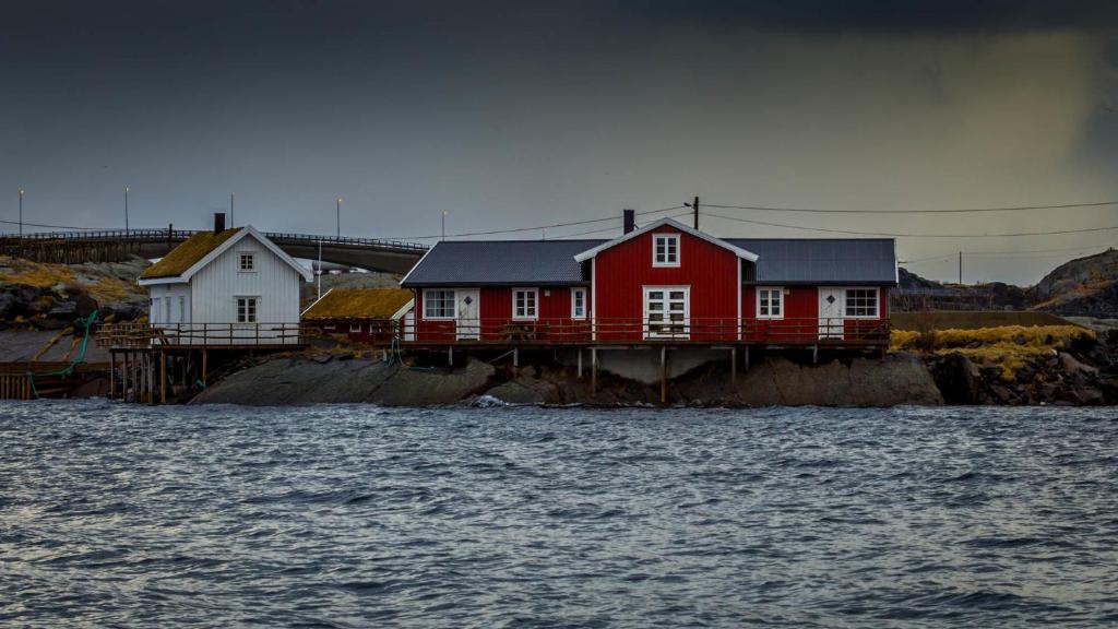

Early in the morning, you'll head to the village of Reine, from where you'll take a small local boat to a nearby islet with a beautiful and less touristy beach, Bunes. You'll return to Reine in the afternoon and immediately go to the iconic viewpoint of Reinebringen, probably the last climb of your Lofoten adventure.
From Reine you'll take the Reinefjorden ferry to Vindstad, from where you'll hike to Bunes beach. The ferry, at least outside of the peak season, cost 94 NOK for a return trip. During the summer months, this price will most likely be higher.
You don't need to buy tickets in advance; you can buy them directly on the boat. However, during the summer months, it's best to book them in advance because the boat is small and often crowded. You can book them online via the "Reis Nordland" app.

Vindstad is a small fishing village. Once you arrive in Vindstad, the hike to Bunes beach is relatively easy and suitable for families with children. It's a 3-kilometer walk that takes about 45 minutes. Most people can manage it, especially because it's short! The trail goes through picturesque terrain, a small village with houses, and offers breathtaking views of the fjord. When you arrive at the beach, you'll see that it's protected by cliffs and offers stunning views of the Arctic Ocean. The beach is also much larger than it looks.
The color of the ocean contrasting with the color of the mountains is breathtaking. I understand why people say that Bunes beach is one of the most beautiful beaches in Norway.
Bunes Beach is one of the most picturesque and least known corners of the Lofoten Islands, ideal for those seeking peace and natural beauty. It is located on the island of Moskenesøya and is only accessible on foot or by boat, which adds to its exclusivity.
Length: 6 km (round trip)
Time: 2 hours (depending on our pace and stops)
Elevation gain: only 80 meters, the route is more or less flat
Difficulty: easy

After returning to Reine, we'll ascend what I consider to be the most beautiful viewpoint in all of Lofoten. Above Reine rises the mountain Reinebringen, whose summit is reached via precisely 1978 steps. It's a steep climb, but the views are absolutely worth it. Plus, it's not that long; you'll be at the top within an hour.
Length: 3 km (round trip)
Time: 2 hours (depending on our pace and stops)
Elevation Gain: 500 meters (total 1978 steps)
Difficulty: rather difficult
The staircase begins on the west side of the Ramsvik tunnel, following the old road around the tunnel.
Take the first step, then another, until after 1978 steps you find yourself on the summit ridge. The beginning of the trail is relatively gentle, while the steps and exposure gradually increase as you approach the top. Due to high summer traffic, increased caution is needed to avoid slipping or falling.
The steps are on average quite high, and the climb can be quite demanding for those with shorter legs. There are several resting places along the route.
You reach the end of the ridge on the right via a steep, muddy path just before the summit. If it has rained recently, it will be slippery! Alternatively, once you reach the ridge, you can scramble up over the slightly elevated rocks to the right.

The village of Å Rorbuer is located at the very end of the Lofoten Islands, making it the furthest point of your journey.
On the last day, adjust your plans according to how much energy and motivation for sports you have. I have a little surprise for you.
A final treat for your stay - a kayak excursion on the local fjord. Don't worry, we'll be accompanied by an experienced guide throughout, who will ensure our safety, explain the what and how, and tell us more about life in this part of the Lofoten Islands.
Later, you'll have an almost 4-hour-long journey back to the airport, which you can make more pleasant with a stop in Svolvær. Those who want to can go on a hike to the iconic Djevelporten, while others can stay in town and buy souvenirs.
Quick stop at a viewpoint on Austnesfjorden.
Your flight back home will again have a stop in Oslo. Remember to be at the airport on time so you can arrange everything calmly.
The Lofoten Islands offered you more than just breathtaking scenery. Perhaps for the first time in your life you stood in silence on a mountaintop, watched the endless sea, or sat in a warm hat on the beach, sipping hot tea while the Northern Lights danced above you. Maybe you simply finally relaxed – without haste, without signal, just together. You're leaving with the feeling that this trip was worth it – and that you'll remember it for a long time.
Imagine a landscape where rugged fjords meet majestic mountains, where traditional fishing villages peek out from between rocky cliffs, and the bluish sea laps against white beaches. This is Lofoten – an archipelago that will enchant anyone who dares to enter its embrace. Lofoten is beautiful in every season. In summer, from June to the end of July, you will experience the midnight sun – days without darkness, where the sun lazily rolls along the horizon and night almost doesn't exist. But from the end of August, the landscape begins to change: autumn arrives, nature is painted in warm tones, it begins to get dark – and with the darkness comes the Northern Lights. Every night can thus turn into an unforgettable spectacle in the sky. One of the strongest experiences ever. A few hikes to iconic viewpoints await you, so get ready for a more active adventure holiday.
The first day will be mainly spent traveling. You will have one transfer in Oslo, where you will wait a few hours at the airport for your connecting flight to northern Norway. The expected arrival at your destination is usually in the late afternoon/evening.
Upon arrival, you'll pick up your car and head straight to a nearby hotel for a good night's sleep to save your energy for the following days. It's still a few hours' drive to the Lofoten Islands.
You'll get up early in the morning and drive further towards the Lofoten Islands. Stop on the way to buy food, and then you'll have your first hike of this trip.
The trip to Matmora starts in Delp at the northeast corner of Austvågøy.
From Svolvær, follow the E10 16 km east before turning left onto Fv888 to Laukvik. Follow this road for 17 km until you get closer to the coast and it splits in two directions. Turn right (east) towards Fiskebøl.
Continue for another 2 km until you see a parking lot on the right just before Delp. It is marked there towards Matmora. Park here.
Matmora is one of the most impressive trekking experiences in the Lofoten Islands, not only because of its breathtaking panoramas, but also because it lies off the beaten track. Even Norwegians claim it's the most beautiful hike in the entire Lofoten archipelago.
Length: approx. 13 km (return trip)
Time: 4 hours (depending on our pace and stops)
Ascent: 800 meters of elevation gain
Difficulty: Moderate to challenging, suitable for experienced hikers
The trail starts from the back of the parking lot. Go through the gate and continue along the well-trodden path towards the hill in front of you. The trail remains clearly visible as it winds up the wooded slope. At an altitude of around 300 meters, the trees begin to thin out as you reach a wide, flat plateau in Delpen/Gjersvollheia.
As the plateau flattens out, a number of possible trails spread across the heather landscape. In clear weather, you can see the large summit cairn of Matmora almost directly to the south, at the highest point of the ridge.
Keep to any of the trails and continue south across the plateau before heading slightly to the right (west) towards the first highest point at 529 m in the distance, marked by a cairn. You can skip the highest point and follow the trail along the left side of the ridge. From here you descend slightly as the ridge narrows. That's where the real hiking begins.
Once you reach this small pass, the main Matmora ridge rises before you. Continue along the well-trodden path. There are several side trails that bypass some of the high points, however, the most scenic route is to stick to the trail that runs along the ridge.
As you ascend the ridge, slightly narrow and airy sections appear. The trail is always well-trodden and easy to walk on. However, if you go hiking early in the summer, there may be snowdrifts that can make progress difficult or impossible.
As you approach the summit, the ridge flattens out and the ascent softens until suddenly, almost out of nowhere, the summit cairn appears a short distance away.
If you don't know how to return the same way, it is possible to continue along the trail over the mountain and down the opposite side into Rangeldalen and back to Fv888. From there it's a 6 km road back to your car in Delpu.
After returning from the hike, you will drive to the largest Lofoten town, Svolvaer, where, if you have any energy left, you can take a walk. Stop, among other places, at a nice bakery in the square, where they have excellent cinnamon buns!
In the morning, you'll pack your things again and set off deeper into the heart of Lofoten. You'll visit another fishing village, some very nice cafes, and then another hike offering completely different views. You'll spend the night near the town of Leknes, where you'll stay for 2 nights.
Henningsvær is a fishing village spread over several small islands. The most famous place here is probably the iconic football pitch, which was even featured in an official video for UEFA.
On your way back from the playground, stop for specialty coffee and cinnamon buns at arguably the best café in Lofoten.
In this location, you will also visit a peak that rises above Henningsvær and offers magnificent views of the surrounding area. It's a relatively short but steep climb, but it's worth it.
Length: approx. 3 km (total there and back)
Time: 1.5-2 hours (depending on our pace and stops)
Ascent: 500 vertical meters
Difficulty: Medium
From anywhere in the Lofoten Islands, head towards Henningsvær, located on the south side of Austvågøy. After getting off the E10 and driving towards Henningsvær, after 5 km of road, before several large buildings, turn sharply left. The first parking option is here. Or continue along the road for another few hundred meters and the road will turn sharply to the right. Immediately behind it, there will be a turn-off on the right where you can also park.
If you parked by the buildings, continue along the road towards the rocky slope behind the sharp right bend in front of you. If you parked at the second turn-off, return along the road. The trail starts with an ascent up the rocky slope on the mountain side of the turn-off to the right.
From the road you will see a clear and well-trodden path emerging from the bushes. Follow it.
To relax after the more demanding previous days, you will set out to explore the Arctic beaches. And those who want to can go for a view a short distance from the accommodation later in the afternoon. Ideally for the sunset.
Our first stop of the day will be at the famous surfing beach of Unstad, where, if you're lucky, you'll see surfers in the water. Surfing takes place here all year round, even in winter. For lovers of cinnamon buns, there's an opportunity to stop at Arctic Surf Unstad, which reportedly serves the World's Best Cinnamon Buns.
Next, you'll find the beaches of Haukland and Uttakleiv, which are very close to each other and resemble an Arctic Caribbean. In autumn and winter, they are also great spots for observing the Northern Lights, so feel free to head there in the evening as well!
Uttakleiv is, for me, one of the most beautiful beaches in Lofoten.
A short distance from your accommodation lies the hill Offersoykammen, where volunteers can climb to watch the sunset.
Length: approx. 3 km (round trip)
Time: 1.5-2 hours (depending on pace and stops)
Ascent: 400 meters of elevation
Difficulty: Easy-Medium
From Skreda, the original trail leads 600 meters east along the E10 road. You can either walk along the roadside or along the access road towards the red cabins before climbing back up the hill and crossing the E10 road.
In recent years, several newer trails closer to the Skreda parking lot have also been created, avoiding the longer walk along the road. They are clearly visible, but steeper than the original trail.
The original trail starts 600 m east of Skreda, roughly above 3 cabins down by the water. Look for the double power line just above the road, next to a small grove of fir trees.
The trail leads several hundred meters uphill through bushy birches before crossing the forest boundary. From here, the trail occasionally splits and passes small ledges, but keep climbing upwards.
The slope of the trail gradually decreases as you approach the summit. You will soon be on a relatively flat summit. Watch out for the cliffs on the north side. Enjoy the views.
In the morning, you'll pack your things and move almost to the end of the Lofoten Islands. On the way, stop at one of the oldest fishing villages in all of Norway, Nusfjord, and then you'll be able to visit perhaps the most famous Lofoten viewpoint.
This is one of the oldest fishing villages in all of Norway. The tour will take about 30 minutes, and then we'll go sit down for coffee and another delicious cinnamon bun at the local café. The entrance fee to the village is 200 NOK.
Hora Ryten and the beach of Kvalvika are among the most popular destinations in Lofoten. And it's no wonder, the views here are truly breathtaking. The hike is a bit longer, but a little less steep than in previous days. You will mainly need higher ankle boots, as the trails are often waterlogged.
Length: 8 km (total, there and back)
Time: 3 hours (depending on our pace and stops)
Elevation gain: 600 meters
Difficulty: Moderate
Drive along the E10 towards the village of Fredvang and cross two bridges. After crossing two bridges, turn left into Fredvang and continue along the road through the village. After about 3 km (from the turnoff), you will see a red boathouse on the left by the water. Right behind it is a paved parking lot large enough for 7-8 cars. Park here. Directly opposite the parking lot you will see a trail leading into the bushes and uphill. There are several entry points, but they all merge at a certain point. The beginning of the trail is slightly marshy, as it leads through a mountain birch forest and uphill. After 10-15 minutes you will mostly be out of the trees and heading towards the middle of the pass. The elevation gain here is moderate, as the path leads between two mountains.
After about 30-40 minutes you will reach the top of the pass and start descending to the beach. Here the trail becomes steep and rocky in places and quite slippery when wet. Continue down to the beach, if you have a view, or towards the sound of the waves, if you are in the clouds. About an hour after leaving the car park you should reach the flat, grassy dunes at the back of the beach.
On the right side of the beach you will see a small stream flowing from the hills. Right next to it is a trail leading uphill. Follow it. After a few hundred meters of ascent, the trail begins to flatten out and you will reach a small lake. Pass the lake and try to follow the trail leading to the left and up the slope of the mountain. You can get off the trail here, but that's okay. Continue up the mountain until you come across a larger, well-trodden trail. This trail will now lead you back to the ridge and gradually ascends. You will soon reach the ridge, where the trail continues to the summit.
On your way back, stop at the viewpoint overlooking the famous Fredvang bridges. It's an ideal location for drone flights, but there's also a beautiful view from the parking lot on the island.
After the hike, you can move straight to your accommodation, which also boasts the most famous view of the Lofoten Islands of the fishing village Hamnoy. Since it was featured in National Geographic, crowds of photographers have been flocking here. :)
Next door, there is also a stop at the fishing village of Sakrisoya, where these iconic yellow houses are located.
At the end of the day, check out the renowned Anita's Seafood, where they have the best salmon burgers and other goodies.
Early in the morning, you'll head to the village of Reine, from where you'll take a small local boat to a nearby islet with a beautiful and less touristy beach, Bunes. You'll return to Reine in the afternoon and immediately go to the iconic viewpoint of Reinebringen, probably the last climb of your Lofoten adventure.
From Reine you'll take the Reinefjorden ferry to Vindstad, from where you'll hike to Bunes beach. The ferry, at least outside of the peak season, cost 94 NOK for a return trip. During the summer months, this price will most likely be higher.
You don't need to buy tickets in advance; you can buy them directly on the boat. However, during the summer months, it's best to book them in advance because the boat is small and often crowded. You can book them online via the "Reis Nordland" app.
Vindstad is a small fishing village. Once you arrive in Vindstad, the hike to Bunes beach is relatively easy and suitable for families with children. It's a 3-kilometer walk that takes about 45 minutes. Most people can manage it, especially because it's short! The trail goes through picturesque terrain, a small village with houses, and offers breathtaking views of the fjord. When you arrive at the beach, you'll see that it's protected by cliffs and offers stunning views of the Arctic Ocean. The beach is also much larger than it looks.
The color of the ocean contrasting with the color of the mountains is breathtaking. I understand why people say that Bunes beach is one of the most beautiful beaches in Norway.
Bunes Beach is one of the most picturesque and least known corners of the Lofoten Islands, ideal for those seeking peace and natural beauty. It is located on the island of Moskenesøya and is only accessible on foot or by boat, which adds to its exclusivity.
Length: 6 km (round trip)
Time: 2 hours (depending on our pace and stops)
Elevation gain: only 80 meters, the route is more or less flat
Difficulty: easy
After returning to Reine, we'll ascend what I consider to be the most beautiful viewpoint in all of Lofoten. Above Reine rises the mountain Reinebringen, whose summit is reached via precisely 1978 steps. It's a steep climb, but the views are absolutely worth it. Plus, it's not that long; you'll be at the top within an hour.
Length: 3 km (round trip)
Time: 2 hours (depending on our pace and stops)
Elevation Gain: 500 meters (total 1978 steps)
Difficulty: rather difficult
The staircase begins on the west side of the Ramsvik tunnel, following the old road around the tunnel.
Take the first step, then another, until after 1978 steps you find yourself on the summit ridge. The beginning of the trail is relatively gentle, while the steps and exposure gradually increase as you approach the top. Due to high summer traffic, increased caution is needed to avoid slipping or falling.
The steps are on average quite high, and the climb can be quite demanding for those with shorter legs. There are several resting places along the route.
You reach the end of the ridge on the right via a steep, muddy path just before the summit. If it has rained recently, it will be slippery! Alternatively, once you reach the ridge, you can scramble up over the slightly elevated rocks to the right.
The village of Å Rorbuer is located at the very end of the Lofoten Islands, making it the furthest point of your journey.
On the last day, adjust your plans according to how much energy and motivation for sports you have. I have a little surprise for you.
A final treat for your stay - a kayak excursion on the local fjord. Don't worry, we'll be accompanied by an experienced guide throughout, who will ensure our safety, explain the what and how, and tell us more about life in this part of the Lofoten Islands.
Later, you'll have an almost 4-hour-long journey back to the airport, which you can make more pleasant with a stop in Svolvær. Those who want to can go on a hike to the iconic Djevelporten, while others can stay in town and buy souvenirs.
Quick stop at a viewpoint on Austnesfjorden.
Your flight back home will again have a stop in Oslo. Remember to be at the airport on time so you can arrange everything calmly.
The Lofoten Islands offered you more than just breathtaking scenery. Perhaps for the first time in your life you stood in silence on a mountaintop, watched the endless sea, or sat in a warm hat on the beach, sipping hot tea while the Northern Lights danced above you. Maybe you simply finally relaxed – without haste, without signal, just together. You're leaving with the feeling that this trip was worth it – and that you'll remember it for a long time.


itinerary by Teru Menclova
The adventure awaits
Imagine a landscape where rugged fjords meet majestic mountains, where traditional fishing villages peek out from between rocky cliffs, and the bluish sea laps against white beaches. This is Lofoten – an archipelago that will enchant anyone who dares to enter its embrace. Lofoten is beautiful in every season. In summer, from June to the end of July, you will experience the midnight sun – days without darkness, where the sun lazily rolls along the horizon and night almost doesn't exist. But from the end of August, the landscape begins to change: autumn arrives, nature is painted in warm tones, it begins to get dark – and with the darkness comes the Northern Lights. Every night can thus turn into an unforgettable spectacle in the sky. One of the strongest experiences ever. A few hikes to iconic viewpoints await you, so get ready for a more active adventure holiday.
The first day will be mainly spent traveling. You will have one transfer in Oslo, where you will wait a few hours at the airport for your connecting flight to northern Norway. The expected arrival at your destination is usually in the late afternoon/evening.
Upon arrival, you'll pick up your car and head straight to a nearby hotel for a good night's sleep to save your energy for the following days. It's still a few hours' drive to the Lofoten Islands.
You'll get up early in the morning and drive further towards the Lofoten Islands. Stop on the way to buy food, and then you'll have your first hike of this trip.
The trip to Matmora starts in Delp at the northeast corner of Austvågøy.
From Svolvær, follow the E10 16 km east before turning left onto Fv888 to Laukvik. Follow this road for 17 km until you get closer to the coast and it splits in two directions. Turn right (east) towards Fiskebøl.
Continue for another 2 km until you see a parking lot on the right just before Delp. It is marked there towards Matmora. Park here.
Matmora is one of the most impressive trekking experiences in the Lofoten Islands, not only because of its breathtaking panoramas, but also because it lies off the beaten track. Even Norwegians claim it's the most beautiful hike in the entire Lofoten archipelago.
Length: approx. 13 km (return trip)
Time: 4 hours (depending on our pace and stops)
Ascent: 800 meters of elevation gain
Difficulty: Moderate to challenging, suitable for experienced hikers
The trail starts from the back of the parking lot. Go through the gate and continue along the well-trodden path towards the hill in front of you. The trail remains clearly visible as it winds up the wooded slope. At an altitude of around 300 meters, the trees begin to thin out as you reach a wide, flat plateau in Delpen/Gjersvollheia.
As the plateau flattens out, a number of possible trails spread across the heather landscape. In clear weather, you can see the large summit cairn of Matmora almost directly to the south, at the highest point of the ridge.
Keep to any of the trails and continue south across the plateau before heading slightly to the right (west) towards the first highest point at 529 m in the distance, marked by a cairn. You can skip the highest point and follow the trail along the left side of the ridge. From here you descend slightly as the ridge narrows. That's where the real hiking begins.
Once you reach this small pass, the main Matmora ridge rises before you. Continue along the well-trodden path. There are several side trails that bypass some of the high points, however, the most scenic route is to stick to the trail that runs along the ridge.
As you ascend the ridge, slightly narrow and airy sections appear. The trail is always well-trodden and easy to walk on. However, if you go hiking early in the summer, there may be snowdrifts that can make progress difficult or impossible.
As you approach the summit, the ridge flattens out and the ascent softens until suddenly, almost out of nowhere, the summit cairn appears a short distance away.
If you don't know how to return the same way, it is possible to continue along the trail over the mountain and down the opposite side into Rangeldalen and back to Fv888. From there it's a 6 km road back to your car in Delpu.
After returning from the hike, you will drive to the largest Lofoten town, Svolvaer, where, if you have any energy left, you can take a walk. Stop, among other places, at a nice bakery in the square, where they have excellent cinnamon buns!
In the morning, you'll pack your things again and set off deeper into the heart of Lofoten. You'll visit another fishing village, some very nice cafes, and then another hike offering completely different views. You'll spend the night near the town of Leknes, where you'll stay for 2 nights.
Henningsvær is a fishing village spread over several small islands. The most famous place here is probably the iconic football pitch, which was even featured in an official video for UEFA.
On your way back from the playground, stop for specialty coffee and cinnamon buns at arguably the best café in Lofoten.
In this location, you will also visit a peak that rises above Henningsvær and offers magnificent views of the surrounding area. It's a relatively short but steep climb, but it's worth it.
Length: approx. 3 km (total there and back)
Time: 1.5-2 hours (depending on our pace and stops)
Ascent: 500 vertical meters
Difficulty: Medium
From anywhere in the Lofoten Islands, head towards Henningsvær, located on the south side of Austvågøy. After getting off the E10 and driving towards Henningsvær, after 5 km of road, before several large buildings, turn sharply left. The first parking option is here. Or continue along the road for another few hundred meters and the road will turn sharply to the right. Immediately behind it, there will be a turn-off on the right where you can also park.
If you parked by the buildings, continue along the road towards the rocky slope behind the sharp right bend in front of you. If you parked at the second turn-off, return along the road. The trail starts with an ascent up the rocky slope on the mountain side of the turn-off to the right.
From the road you will see a clear and well-trodden path emerging from the bushes. Follow it.
To relax after the more demanding previous days, you will set out to explore the Arctic beaches. And those who want to can go for a view a short distance from the accommodation later in the afternoon. Ideally for the sunset.
Our first stop of the day will be at the famous surfing beach of Unstad, where, if you're lucky, you'll see surfers in the water. Surfing takes place here all year round, even in winter. For lovers of cinnamon buns, there's an opportunity to stop at Arctic Surf Unstad, which reportedly serves the World's Best Cinnamon Buns.
Next, you'll find the beaches of Haukland and Uttakleiv, which are very close to each other and resemble an Arctic Caribbean. In autumn and winter, they are also great spots for observing the Northern Lights, so feel free to head there in the evening as well!
Uttakleiv is, for me, one of the most beautiful beaches in Lofoten.
A short distance from your accommodation lies the hill Offersoykammen, where volunteers can climb to watch the sunset.
Length: approx. 3 km (round trip)
Time: 1.5-2 hours (depending on pace and stops)
Ascent: 400 meters of elevation
Difficulty: Easy-Medium
From Skreda, the original trail leads 600 meters east along the E10 road. You can either walk along the roadside or along the access road towards the red cabins before climbing back up the hill and crossing the E10 road.
In recent years, several newer trails closer to the Skreda parking lot have also been created, avoiding the longer walk along the road. They are clearly visible, but steeper than the original trail.
The original trail starts 600 m east of Skreda, roughly above 3 cabins down by the water. Look for the double power line just above the road, next to a small grove of fir trees.
The trail leads several hundred meters uphill through bushy birches before crossing the forest boundary. From here, the trail occasionally splits and passes small ledges, but keep climbing upwards.
The slope of the trail gradually decreases as you approach the summit. You will soon be on a relatively flat summit. Watch out for the cliffs on the north side. Enjoy the views.
In the morning, you'll pack your things and move almost to the end of the Lofoten Islands. On the way, stop at one of the oldest fishing villages in all of Norway, Nusfjord, and then you'll be able to visit perhaps the most famous Lofoten viewpoint.
This is one of the oldest fishing villages in all of Norway. The tour will take about 30 minutes, and then we'll go sit down for coffee and another delicious cinnamon bun at the local café. The entrance fee to the village is 200 NOK.
Hora Ryten and the beach of Kvalvika are among the most popular destinations in Lofoten. And it's no wonder, the views here are truly breathtaking. The hike is a bit longer, but a little less steep than in previous days. You will mainly need higher ankle boots, as the trails are often waterlogged.
Length: 8 km (total, there and back)
Time: 3 hours (depending on our pace and stops)
Elevation gain: 600 meters
Difficulty: Moderate
Drive along the E10 towards the village of Fredvang and cross two bridges. After crossing two bridges, turn left into Fredvang and continue along the road through the village. After about 3 km (from the turnoff), you will see a red boathouse on the left by the water. Right behind it is a paved parking lot large enough for 7-8 cars. Park here. Directly opposite the parking lot you will see a trail leading into the bushes and uphill. There are several entry points, but they all merge at a certain point. The beginning of the trail is slightly marshy, as it leads through a mountain birch forest and uphill. After 10-15 minutes you will mostly be out of the trees and heading towards the middle of the pass. The elevation gain here is moderate, as the path leads between two mountains.
After about 30-40 minutes you will reach the top of the pass and start descending to the beach. Here the trail becomes steep and rocky in places and quite slippery when wet. Continue down to the beach, if you have a view, or towards the sound of the waves, if you are in the clouds. About an hour after leaving the car park you should reach the flat, grassy dunes at the back of the beach.
On the right side of the beach you will see a small stream flowing from the hills. Right next to it is a trail leading uphill. Follow it. After a few hundred meters of ascent, the trail begins to flatten out and you will reach a small lake. Pass the lake and try to follow the trail leading to the left and up the slope of the mountain. You can get off the trail here, but that's okay. Continue up the mountain until you come across a larger, well-trodden trail. This trail will now lead you back to the ridge and gradually ascends. You will soon reach the ridge, where the trail continues to the summit.
On your way back, stop at the viewpoint overlooking the famous Fredvang bridges. It's an ideal location for drone flights, but there's also a beautiful view from the parking lot on the island.
After the hike, you can move straight to your accommodation, which also boasts the most famous view of the Lofoten Islands of the fishing village Hamnoy. Since it was featured in National Geographic, crowds of photographers have been flocking here. :)
Next door, there is also a stop at the fishing village of Sakrisoya, where these iconic yellow houses are located.
At the end of the day, check out the renowned Anita's Seafood, where they have the best salmon burgers and other goodies.
Early in the morning, you'll head to the village of Reine, from where you'll take a small local boat to a nearby islet with a beautiful and less touristy beach, Bunes. You'll return to Reine in the afternoon and immediately go to the iconic viewpoint of Reinebringen, probably the last climb of your Lofoten adventure.
From Reine you'll take the Reinefjorden ferry to Vindstad, from where you'll hike to Bunes beach. The ferry, at least outside of the peak season, cost 94 NOK for a return trip. During the summer months, this price will most likely be higher.
You don't need to buy tickets in advance; you can buy them directly on the boat. However, during the summer months, it's best to book them in advance because the boat is small and often crowded. You can book them online via the "Reis Nordland" app.
Vindstad is a small fishing village. Once you arrive in Vindstad, the hike to Bunes beach is relatively easy and suitable for families with children. It's a 3-kilometer walk that takes about 45 minutes. Most people can manage it, especially because it's short! The trail goes through picturesque terrain, a small village with houses, and offers breathtaking views of the fjord. When you arrive at the beach, you'll see that it's protected by cliffs and offers stunning views of the Arctic Ocean. The beach is also much larger than it looks.
The color of the ocean contrasting with the color of the mountains is breathtaking. I understand why people say that Bunes beach is one of the most beautiful beaches in Norway.
Bunes Beach is one of the most picturesque and least known corners of the Lofoten Islands, ideal for those seeking peace and natural beauty. It is located on the island of Moskenesøya and is only accessible on foot or by boat, which adds to its exclusivity.
Length: 6 km (round trip)
Time: 2 hours (depending on our pace and stops)
Elevation gain: only 80 meters, the route is more or less flat
Difficulty: easy
After returning to Reine, we'll ascend what I consider to be the most beautiful viewpoint in all of Lofoten. Above Reine rises the mountain Reinebringen, whose summit is reached via precisely 1978 steps. It's a steep climb, but the views are absolutely worth it. Plus, it's not that long; you'll be at the top within an hour.
Length: 3 km (round trip)
Time: 2 hours (depending on our pace and stops)
Elevation Gain: 500 meters (total 1978 steps)
Difficulty: rather difficult
The staircase begins on the west side of the Ramsvik tunnel, following the old road around the tunnel.
Take the first step, then another, until after 1978 steps you find yourself on the summit ridge. The beginning of the trail is relatively gentle, while the steps and exposure gradually increase as you approach the top. Due to high summer traffic, increased caution is needed to avoid slipping or falling.
The steps are on average quite high, and the climb can be quite demanding for those with shorter legs. There are several resting places along the route.
You reach the end of the ridge on the right via a steep, muddy path just before the summit. If it has rained recently, it will be slippery! Alternatively, once you reach the ridge, you can scramble up over the slightly elevated rocks to the right.
The village of Å Rorbuer is located at the very end of the Lofoten Islands, making it the furthest point of your journey.
On the last day, adjust your plans according to how much energy and motivation for sports you have. I have a little surprise for you.
A final treat for your stay - a kayak excursion on the local fjord. Don't worry, we'll be accompanied by an experienced guide throughout, who will ensure our safety, explain the what and how, and tell us more about life in this part of the Lofoten Islands.
Later, you'll have an almost 4-hour-long journey back to the airport, which you can make more pleasant with a stop in Svolvær. Those who want to can go on a hike to the iconic Djevelporten, while others can stay in town and buy souvenirs.
Quick stop at a viewpoint on Austnesfjorden.
Your flight back home will again have a stop in Oslo. Remember to be at the airport on time so you can arrange everything calmly.
The Lofoten Islands offered you more than just breathtaking scenery. Perhaps for the first time in your life you stood in silence on a mountaintop, watched the endless sea, or sat in a warm hat on the beach, sipping hot tea while the Northern Lights danced above you. Maybe you simply finally relaxed – without haste, without signal, just together. You're leaving with the feeling that this trip was worth it – and that you'll remember it for a long time.
Imagine a landscape where rugged fjords meet majestic mountains, where traditional fishing villages peek out from between rocky cliffs, and the bluish sea laps against white beaches. This is Lofoten – an archipelago that will enchant anyone who dares to enter its embrace. Lofoten is beautiful in every season. In summer, from June to the end of July, you will experience the midnight sun – days without darkness, where the sun lazily rolls along the horizon and night almost doesn't exist. But from the end of August, the landscape begins to change: autumn arrives, nature is painted in warm tones, it begins to get dark – and with the darkness comes the Northern Lights. Every night can thus turn into an unforgettable spectacle in the sky. One of the strongest experiences ever. A few hikes to iconic viewpoints await you, so get ready for a more active adventure holiday.
The first day will be mainly spent traveling. You will have one transfer in Oslo, where you will wait a few hours at the airport for your connecting flight to northern Norway. The expected arrival at your destination is usually in the late afternoon/evening.
Upon arrival, you'll pick up your car and head straight to a nearby hotel for a good night's sleep to save your energy for the following days. It's still a few hours' drive to the Lofoten Islands.
You'll get up early in the morning and drive further towards the Lofoten Islands. Stop on the way to buy food, and then you'll have your first hike of this trip.
The trip to Matmora starts in Delp at the northeast corner of Austvågøy.
From Svolvær, follow the E10 16 km east before turning left onto Fv888 to Laukvik. Follow this road for 17 km until you get closer to the coast and it splits in two directions. Turn right (east) towards Fiskebøl.
Continue for another 2 km until you see a parking lot on the right just before Delp. It is marked there towards Matmora. Park here.
Matmora is one of the most impressive trekking experiences in the Lofoten Islands, not only because of its breathtaking panoramas, but also because it lies off the beaten track. Even Norwegians claim it's the most beautiful hike in the entire Lofoten archipelago.
Length: approx. 13 km (return trip)
Time: 4 hours (depending on our pace and stops)
Ascent: 800 meters of elevation gain
Difficulty: Moderate to challenging, suitable for experienced hikers
The trail starts from the back of the parking lot. Go through the gate and continue along the well-trodden path towards the hill in front of you. The trail remains clearly visible as it winds up the wooded slope. At an altitude of around 300 meters, the trees begin to thin out as you reach a wide, flat plateau in Delpen/Gjersvollheia.
As the plateau flattens out, a number of possible trails spread across the heather landscape. In clear weather, you can see the large summit cairn of Matmora almost directly to the south, at the highest point of the ridge.
Keep to any of the trails and continue south across the plateau before heading slightly to the right (west) towards the first highest point at 529 m in the distance, marked by a cairn. You can skip the highest point and follow the trail along the left side of the ridge. From here you descend slightly as the ridge narrows. That's where the real hiking begins.
Once you reach this small pass, the main Matmora ridge rises before you. Continue along the well-trodden path. There are several side trails that bypass some of the high points, however, the most scenic route is to stick to the trail that runs along the ridge.
As you ascend the ridge, slightly narrow and airy sections appear. The trail is always well-trodden and easy to walk on. However, if you go hiking early in the summer, there may be snowdrifts that can make progress difficult or impossible.
As you approach the summit, the ridge flattens out and the ascent softens until suddenly, almost out of nowhere, the summit cairn appears a short distance away.
If you don't know how to return the same way, it is possible to continue along the trail over the mountain and down the opposite side into Rangeldalen and back to Fv888. From there it's a 6 km road back to your car in Delpu.
After returning from the hike, you will drive to the largest Lofoten town, Svolvaer, where, if you have any energy left, you can take a walk. Stop, among other places, at a nice bakery in the square, where they have excellent cinnamon buns!
In the morning, you'll pack your things again and set off deeper into the heart of Lofoten. You'll visit another fishing village, some very nice cafes, and then another hike offering completely different views. You'll spend the night near the town of Leknes, where you'll stay for 2 nights.
Henningsvær is a fishing village spread over several small islands. The most famous place here is probably the iconic football pitch, which was even featured in an official video for UEFA.
On your way back from the playground, stop for specialty coffee and cinnamon buns at arguably the best café in Lofoten.
In this location, you will also visit a peak that rises above Henningsvær and offers magnificent views of the surrounding area. It's a relatively short but steep climb, but it's worth it.
Length: approx. 3 km (total there and back)
Time: 1.5-2 hours (depending on our pace and stops)
Ascent: 500 vertical meters
Difficulty: Medium
From anywhere in the Lofoten Islands, head towards Henningsvær, located on the south side of Austvågøy. After getting off the E10 and driving towards Henningsvær, after 5 km of road, before several large buildings, turn sharply left. The first parking option is here. Or continue along the road for another few hundred meters and the road will turn sharply to the right. Immediately behind it, there will be a turn-off on the right where you can also park.
If you parked by the buildings, continue along the road towards the rocky slope behind the sharp right bend in front of you. If you parked at the second turn-off, return along the road. The trail starts with an ascent up the rocky slope on the mountain side of the turn-off to the right.
From the road you will see a clear and well-trodden path emerging from the bushes. Follow it.
To relax after the more demanding previous days, you will set out to explore the Arctic beaches. And those who want to can go for a view a short distance from the accommodation later in the afternoon. Ideally for the sunset.
Our first stop of the day will be at the famous surfing beach of Unstad, where, if you're lucky, you'll see surfers in the water. Surfing takes place here all year round, even in winter. For lovers of cinnamon buns, there's an opportunity to stop at Arctic Surf Unstad, which reportedly serves the World's Best Cinnamon Buns.
Next, you'll find the beaches of Haukland and Uttakleiv, which are very close to each other and resemble an Arctic Caribbean. In autumn and winter, they are also great spots for observing the Northern Lights, so feel free to head there in the evening as well!
Uttakleiv is, for me, one of the most beautiful beaches in Lofoten.
A short distance from your accommodation lies the hill Offersoykammen, where volunteers can climb to watch the sunset.
Length: approx. 3 km (round trip)
Time: 1.5-2 hours (depending on pace and stops)
Ascent: 400 meters of elevation
Difficulty: Easy-Medium
From Skreda, the original trail leads 600 meters east along the E10 road. You can either walk along the roadside or along the access road towards the red cabins before climbing back up the hill and crossing the E10 road.
In recent years, several newer trails closer to the Skreda parking lot have also been created, avoiding the longer walk along the road. They are clearly visible, but steeper than the original trail.
The original trail starts 600 m east of Skreda, roughly above 3 cabins down by the water. Look for the double power line just above the road, next to a small grove of fir trees.
The trail leads several hundred meters uphill through bushy birches before crossing the forest boundary. From here, the trail occasionally splits and passes small ledges, but keep climbing upwards.
The slope of the trail gradually decreases as you approach the summit. You will soon be on a relatively flat summit. Watch out for the cliffs on the north side. Enjoy the views.
In the morning, you'll pack your things and move almost to the end of the Lofoten Islands. On the way, stop at one of the oldest fishing villages in all of Norway, Nusfjord, and then you'll be able to visit perhaps the most famous Lofoten viewpoint.
This is one of the oldest fishing villages in all of Norway. The tour will take about 30 minutes, and then we'll go sit down for coffee and another delicious cinnamon bun at the local café. The entrance fee to the village is 200 NOK.
Hora Ryten and the beach of Kvalvika are among the most popular destinations in Lofoten. And it's no wonder, the views here are truly breathtaking. The hike is a bit longer, but a little less steep than in previous days. You will mainly need higher ankle boots, as the trails are often waterlogged.
Length: 8 km (total, there and back)
Time: 3 hours (depending on our pace and stops)
Elevation gain: 600 meters
Difficulty: Moderate
Drive along the E10 towards the village of Fredvang and cross two bridges. After crossing two bridges, turn left into Fredvang and continue along the road through the village. After about 3 km (from the turnoff), you will see a red boathouse on the left by the water. Right behind it is a paved parking lot large enough for 7-8 cars. Park here. Directly opposite the parking lot you will see a trail leading into the bushes and uphill. There are several entry points, but they all merge at a certain point. The beginning of the trail is slightly marshy, as it leads through a mountain birch forest and uphill. After 10-15 minutes you will mostly be out of the trees and heading towards the middle of the pass. The elevation gain here is moderate, as the path leads between two mountains.
After about 30-40 minutes you will reach the top of the pass and start descending to the beach. Here the trail becomes steep and rocky in places and quite slippery when wet. Continue down to the beach, if you have a view, or towards the sound of the waves, if you are in the clouds. About an hour after leaving the car park you should reach the flat, grassy dunes at the back of the beach.
On the right side of the beach you will see a small stream flowing from the hills. Right next to it is a trail leading uphill. Follow it. After a few hundred meters of ascent, the trail begins to flatten out and you will reach a small lake. Pass the lake and try to follow the trail leading to the left and up the slope of the mountain. You can get off the trail here, but that's okay. Continue up the mountain until you come across a larger, well-trodden trail. This trail will now lead you back to the ridge and gradually ascends. You will soon reach the ridge, where the trail continues to the summit.
On your way back, stop at the viewpoint overlooking the famous Fredvang bridges. It's an ideal location for drone flights, but there's also a beautiful view from the parking lot on the island.
After the hike, you can move straight to your accommodation, which also boasts the most famous view of the Lofoten Islands of the fishing village Hamnoy. Since it was featured in National Geographic, crowds of photographers have been flocking here. :)
Next door, there is also a stop at the fishing village of Sakrisoya, where these iconic yellow houses are located.
At the end of the day, check out the renowned Anita's Seafood, where they have the best salmon burgers and other goodies.
Early in the morning, you'll head to the village of Reine, from where you'll take a small local boat to a nearby islet with a beautiful and less touristy beach, Bunes. You'll return to Reine in the afternoon and immediately go to the iconic viewpoint of Reinebringen, probably the last climb of your Lofoten adventure.
From Reine you'll take the Reinefjorden ferry to Vindstad, from where you'll hike to Bunes beach. The ferry, at least outside of the peak season, cost 94 NOK for a return trip. During the summer months, this price will most likely be higher.
You don't need to buy tickets in advance; you can buy them directly on the boat. However, during the summer months, it's best to book them in advance because the boat is small and often crowded. You can book them online via the "Reis Nordland" app.
Vindstad is a small fishing village. Once you arrive in Vindstad, the hike to Bunes beach is relatively easy and suitable for families with children. It's a 3-kilometer walk that takes about 45 minutes. Most people can manage it, especially because it's short! The trail goes through picturesque terrain, a small village with houses, and offers breathtaking views of the fjord. When you arrive at the beach, you'll see that it's protected by cliffs and offers stunning views of the Arctic Ocean. The beach is also much larger than it looks.
The color of the ocean contrasting with the color of the mountains is breathtaking. I understand why people say that Bunes beach is one of the most beautiful beaches in Norway.
Bunes Beach is one of the most picturesque and least known corners of the Lofoten Islands, ideal for those seeking peace and natural beauty. It is located on the island of Moskenesøya and is only accessible on foot or by boat, which adds to its exclusivity.
Length: 6 km (round trip)
Time: 2 hours (depending on our pace and stops)
Elevation gain: only 80 meters, the route is more or less flat
Difficulty: easy
After returning to Reine, we'll ascend what I consider to be the most beautiful viewpoint in all of Lofoten. Above Reine rises the mountain Reinebringen, whose summit is reached via precisely 1978 steps. It's a steep climb, but the views are absolutely worth it. Plus, it's not that long; you'll be at the top within an hour.
Length: 3 km (round trip)
Time: 2 hours (depending on our pace and stops)
Elevation Gain: 500 meters (total 1978 steps)
Difficulty: rather difficult
The staircase begins on the west side of the Ramsvik tunnel, following the old road around the tunnel.
Take the first step, then another, until after 1978 steps you find yourself on the summit ridge. The beginning of the trail is relatively gentle, while the steps and exposure gradually increase as you approach the top. Due to high summer traffic, increased caution is needed to avoid slipping or falling.
The steps are on average quite high, and the climb can be quite demanding for those with shorter legs. There are several resting places along the route.
You reach the end of the ridge on the right via a steep, muddy path just before the summit. If it has rained recently, it will be slippery! Alternatively, once you reach the ridge, you can scramble up over the slightly elevated rocks to the right.
The village of Å Rorbuer is located at the very end of the Lofoten Islands, making it the furthest point of your journey.
On the last day, adjust your plans according to how much energy and motivation for sports you have. I have a little surprise for you.
A final treat for your stay - a kayak excursion on the local fjord. Don't worry, we'll be accompanied by an experienced guide throughout, who will ensure our safety, explain the what and how, and tell us more about life in this part of the Lofoten Islands.
Later, you'll have an almost 4-hour-long journey back to the airport, which you can make more pleasant with a stop in Svolvær. Those who want to can go on a hike to the iconic Djevelporten, while others can stay in town and buy souvenirs.
Quick stop at a viewpoint on Austnesfjorden.
Your flight back home will again have a stop in Oslo. Remember to be at the airport on time so you can arrange everything calmly.
The Lofoten Islands offered you more than just breathtaking scenery. Perhaps for the first time in your life you stood in silence on a mountaintop, watched the endless sea, or sat in a warm hat on the beach, sipping hot tea while the Northern Lights danced above you. Maybe you simply finally relaxed – without haste, without signal, just together. You're leaving with the feeling that this trip was worth it – and that you'll remember it for a long time.